Ticker for September 1, 2005
MESONET TICKER ... MESONET TICKER ... MESONET TICKER ... MESONET TICKER ...
September 1, 2005  September 1, 2005  September 1, 2005  September 1, 2005


Fingerprints of Rain Show up in Atmosphere

The first two Tickers of the week described the prolonged dryness
in southeastern Oklahoma, and how this contributes to fire danger.
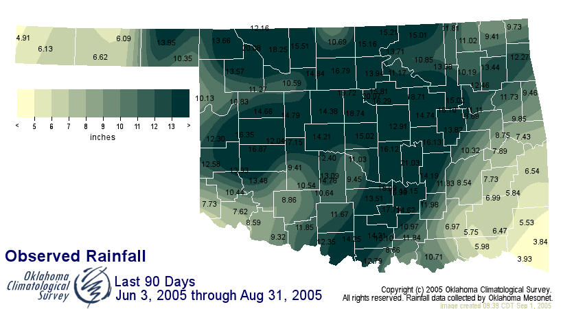
Well, the situation hasn't changed, as this map of rainfall in
the last 90 days shows:


We are all very familiar with the atmosphere's impact on surface
conditions. But this communication of energy and water molecules is
a two-way street. Through evaporation and plant transpiration,
collectively known as evapoptranspiration (ET), the surface transfers
water back to the atmosphere.

Of course, the amount of available soil water helps govern the rate
at which water is surrendered. And we can see the profound difference
that soil water content plays on calm, sunny days like yesterday.
The clear, high, summer sun provides plenty of energy to prod ET
processes along, and, when the atmosphere relaxes its large-scale
patterns, local impacts become much more obvious.

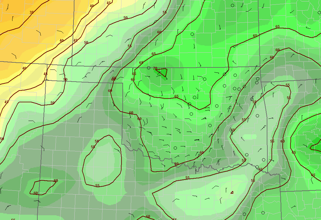
What we are left with is this afternoon dew point map:


Notice how, in the drought-plagued areas of the southeast, dew points
were relatively low, but for the rest of the state, they shot up to
near 70! The demand for ET was about the same, but the dry southeast
was unable to supply the atmosphere with water at nearly the same rate
as the rest of the state.

The difference between the two regimes - in terms of potential energy -
cannot be understated.  The 15-degree difference in dewpoint represents
tons and tons of water vapor in the over patches of earth as small as a
baseball field.

Better understanding these and related land-atmosphere processes are
one key to more accurate conceptual models of the atmosphere, which
is one key to more accurate forecast models, which is one key to more
accurate forecasts.
September 1 in Mesonet History
| Record | Value | Station | Year |
|---|---|---|---|
| Maximum Temperature | 110°F | WAUR | 2000 |
| Minimum Temperature | 49°F | GOOD | 2024 |
| Maximum Rainfall | 7.50 inches | BYAR | 2020 |
Mesonet records begin in 1994.
Search by Date
If you're a bit off, don't worry, because just like horseshoes, “almost” counts on the Ticker website!