Ticker for July 13, 2005
MESONET TICKER ... MESONET TICKER ... MESONET TICKER ... MESONET TICKER ...
July 13, 2005 July 13, 2005 July 13, 2005 July 13, 2005
Know Your Boundaries
When showers and thunderstorms occur in a relaxed synoptic environment
(and often when they don't), they can spit out some entertaining and
delightfully refreshing outflow for miles around.
That was the case yesterday across much of the state. Here's a radar
image (OKC plus Tulsa radars) of convection and associated outflow
near the Tulsa area early yesterday afternoon:
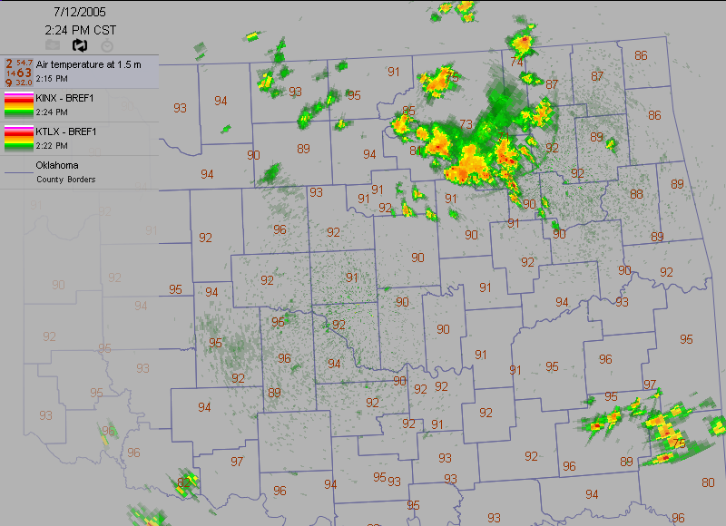
Notice a few things. First, the temperatures north and west of Tulsa
were in the 70s, while everybody else in the region hovered around 90.
Second, notice the thin line that delineates this dichotomy (an arc
running from about Nowata bending southwest over Tulsa then west
to Sapulpa).
That, of course, is the boundary between fresh, rain-cooled air and
the soupy, warm air of the surrounding environs. The cooler air
surging out from the base of the storms is denser than the warm air.
The radar can "see" this outflow boundary because it is the interface
between two fluids of different densities. Our eyeballs and brain do
the same thing with visible light when we detect the line between the
oil and the vinegar - two fluids with different densities.
Now, notice a third thing. Take a look at the exact same frame, but
using only the OKC radar - we removed the Tulsa radar image:
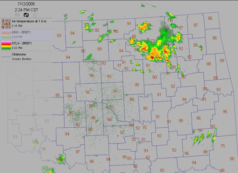
The boundary is gone! Why can the Tulsa radar "see" the boundary,
but the OKC radar can't? That's because a radar beam gets higher off
the ground with distance. Two factors come into play here:
A) The radar beam is tilted slightly above the horizontal
B) The earth is curved but the radar beam is straight!
Because the boundary is a near-surface feature, only the nearby Tulsa
radar could pick it up.
Okay, now here's an image (both radars) from about an hour later:
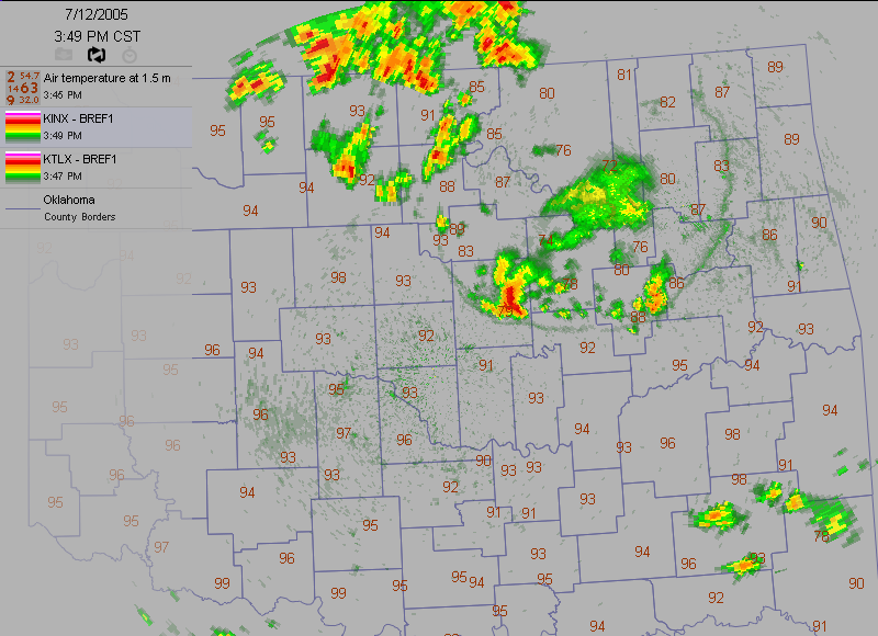
The outflow boundary is even more dramatic in this one! But when we
break them down into individual radars, you can see again that
near-surface features are usually only resolved near the radar.
OKC picks up the western half:
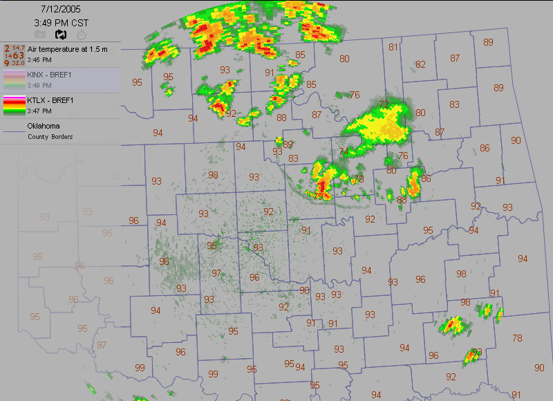
Tulsa picks up the eastern half:
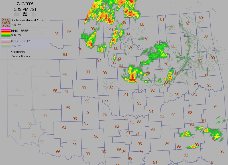
Several hours later, a new round of storms laid down a new boundary,
oriented east-west across the OKC metro area. There's nothing sacred
about an old boundary, and as the newer outflow plowed through, it
scrubbed the old one from the surface, leaving this interesting "Tau"
shape:
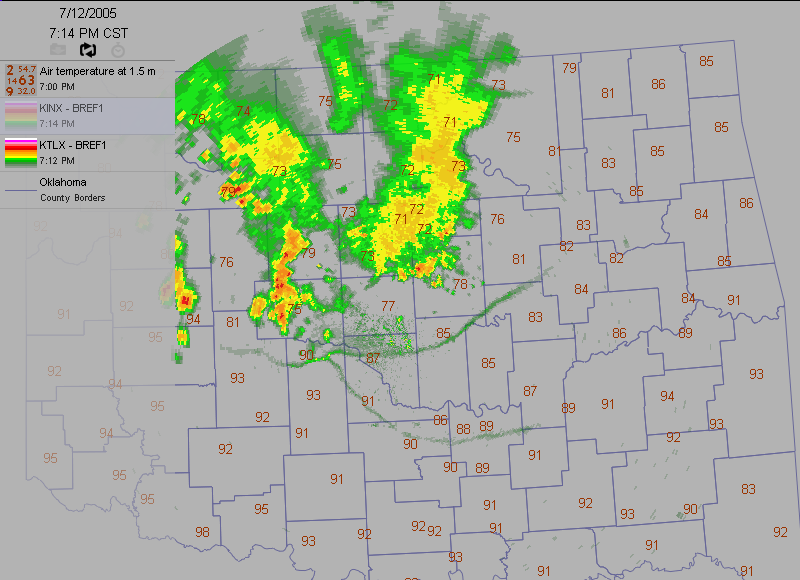
Again, notice that the portions of the boundary that are closest
to the radar are best "seen" by the radar!
July 13 in Mesonet History
| Record | Value | Station | Year |
|---|---|---|---|
| Maximum Temperature | 109°F | LAHO | 2003 |
| Minimum Temperature | 52°F | BOIS | 2008 |
| Maximum Rainfall | 4.29″ | CLAY | 2025 |
Mesonet records begin in 1994.
Search by Date
If you're a bit off, don't worry, because just like horseshoes, “almost” counts on the Ticker website!