Ticker for June 29, 2005
MESONET TICKER ... MESONET TICKER ... MESONET TICKER ... MESONET TICKER ...
June 29, 2005      June 29, 2005      June 29, 2005      June 29, 2005


Winter Wheat Belt = Summer Heat Dealt

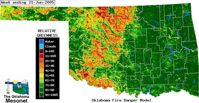
Yesterday's Ticker featured the impact of Oklahoma's winter wheat
belt on satellite observations and the fire danger model.  It also
has a very direct effect on local weather conditions ("microclimate"
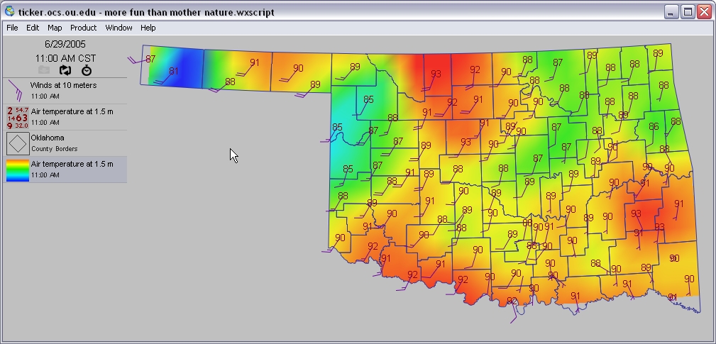
being the appropos buzzword).  Take a look at the wheatbelt, as seen
from satellite, and compare it to a Mesonet map from this morning:


The first stations to crack the 90s west of I-35?  You guessed it:
wheatbelt stations.  In these areas, sunlight pounds the surface
unabated by grasses or other vegetation. And because so little of
the sun's energy is invested in evaporating water (or helping plants
transpire it), the energy goes almost completely into heating the
surface. The end result within the wheatbelt on many summer days:
warmer, drier, gustier, earlier.

Notice also that this morning's winds were out of the south-southwest,
very nicely aligned with the wheatbelt. After a few hundred miles
of travel directly over plowed wheat fields, air parcels pick up
some of that heat. The heat can "pile up", for lack of a better term,
on the downwind side of this fetch, causing noticably higher temps
in the north.
June 29 in Mesonet History
| Record | Value | Station | Year |
|---|---|---|---|
| Maximum Temperature | 111°F | HOOK | 1998 |
| Minimum Temperature | 47°F | GOOD | 2007 |
| Maximum Rainfall | 4.34″ | CLAR | 1995 |
Mesonet records begin in 1994.
Search by Date
If you're a bit off, don't worry, because just like horseshoes, “almost” counts on the Ticker website!