Ticker for May 3, 2005
MESONET TICKER ... MESONET TICKER ... MESONET TICKER ... MESONET TICKER ...
May 3, 2005 May 3, 2005 May 3, 2005 May 3, 2005
Mother Nature Strikes Back, And She Brought October With Her!
The rainfall over the last few days is certainly welcomed by those
fortunate enough to receive it. In fact, for some locations in
south-central Oklahoma, the first sixty-one hours of May delivered
more rainfall than the entire sixty-one *days* of March and April:
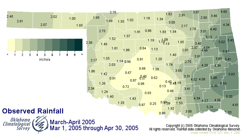
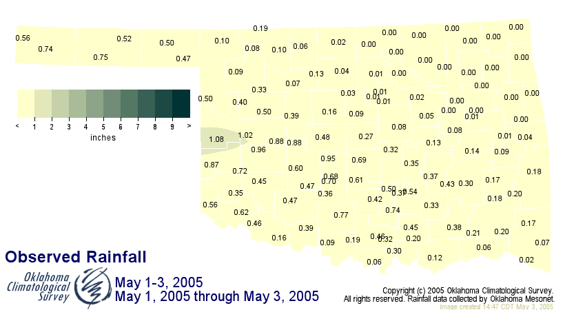
(focus on Grady and Garvin Counties)
But, alas, the rainfall has come at the expense of temperature. This
week's atmospheric configuration is more evocative of fall's flatness
than May's majesty. In fact, this pattern - stratiform rainfall with
a stalled front to our south - is how we get many of our autumn
flood events.
Yesterday morning's temperatures bottomed out between the mid-30s and
mid-40s across most of the state:

These are unseasonably cool, indeed! In fact, we haven't a May 2nd
this cold since, well ... since ... uh ... last year:
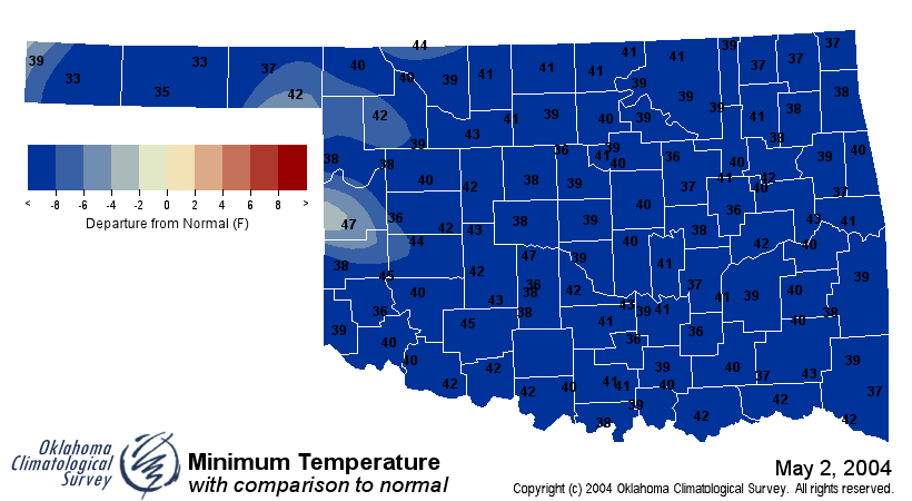
( for what it's worth, last year's May 2nd temps recovered quite nicely,
something 2005 cannot claim:
2004: 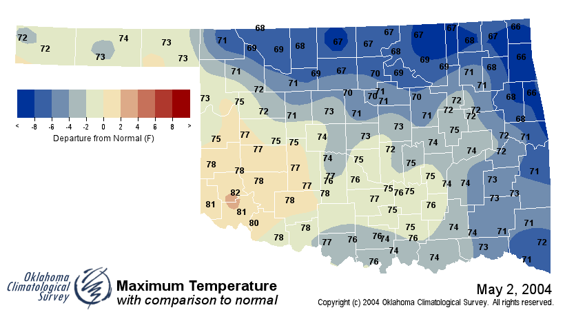
2005: 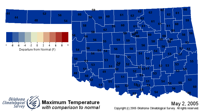 )
)
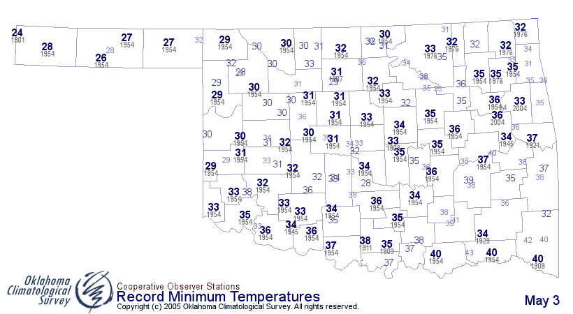
So, temperatures like these are below the so-called "normals" for
early May, but they are certainly not unheard of. In fact, if you want
to see how cold it can get this time of year, here's a map:
May 3 in Mesonet History
| Record | Value | Station | Year |
|---|---|---|---|
| Maximum Temperature | 101°F | ALTU | 2012 |
| Minimum Temperature | 22°F | BOIS | 2013 |
| Maximum Rainfall | 3.14″ | MCAL | 2021 |
Mesonet records begin in 1994.
Search by Date
If you're a bit off, don't worry, because just like horseshoes, “almost” counts on the Ticker website!