Ticker for March 15, 2005
MESONET TICKER ... MESONET TICKER ... MESONET TICKER ... MESONET TICKER ...
March 15, 2005     March 15, 2005     March 15, 2005     March 15, 2005


Heavy Snow in Western Oklahoma

Longtime Cheyenne resident and friend-of-the-Mesonet Pete Thurmond
reports up to 10 inches of snow so far at his place. That jives
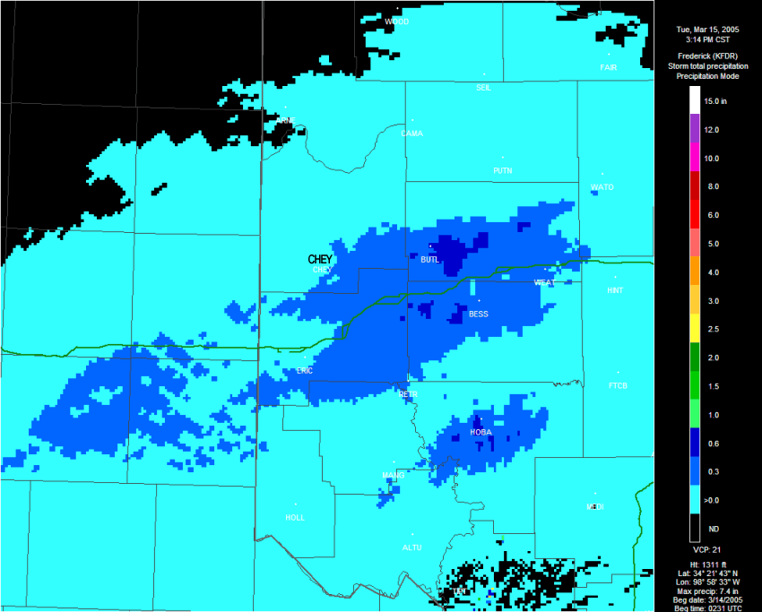
with other reports from the region. Curiously, radar-estimated
precipitation in the region suggests that 0.0-0.3" has fallen in
the Cheyenne vicinity:


Why is the number so far off?

Now, radar is a marvel of engineering technology. The fact that it
works as well as it does makes the Ticker staff marvel at what magic
was used.  Nonetheless, like with all engineering projects, there
were some critical assumptions that needed to be made.

One major assumption is that every hydrometeor the radar sees is
water - liquid water. This has major implications in two areas:

1. The radar is actually estimating the liquid-equivalent (we prefer
the term "hydrologically representative, thankyouverymuch) content
of the snow.

Now, given that the snow-to-water ratio is roughly - and we mean
roughly - ten-to-one, that still pegs an estimated snow cover of
up to about 3".  That's a major difference! In fact, even if this
snow-to-water ratio was correctly known, the radar would still
underestimate the snowfall. What else is going on?

2. That same assumption (all precip is liquid water) comes into play
when the radar samples snow. Snow is arranged in crystals, not
droplets, and its scattering characteristics are vastly different
that those for which the radar has been calibrated. It turns out
that dull crystals return much less energy than an equivalent
amount of relatively shiny droplets.

The combination of these two effects makes radar estimates of snowfall,
even liquid-equivalent values, really lousy.

In this age of wireless e-mail and retinal scanning technology and
coke machines that thank you by name (scary!) ... what's the best
measurer of snow?  A trained human with a ruler, like our friend Pete.


What's the Opposite of Freezing Rain?

In Oklahoma, we are often subjected to ice storms: rain that freezes
upon contact with the ground.  Today, in central Oklahoma, we may be
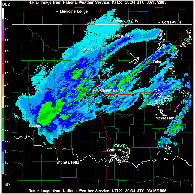
experiencing the opposite of that. Here's a radar image ripped off
from the NWS web site:


The banded structure and smoothed appearance suggest that the stuff
coming out of the clouds is snow (the ten-inch snow reports from
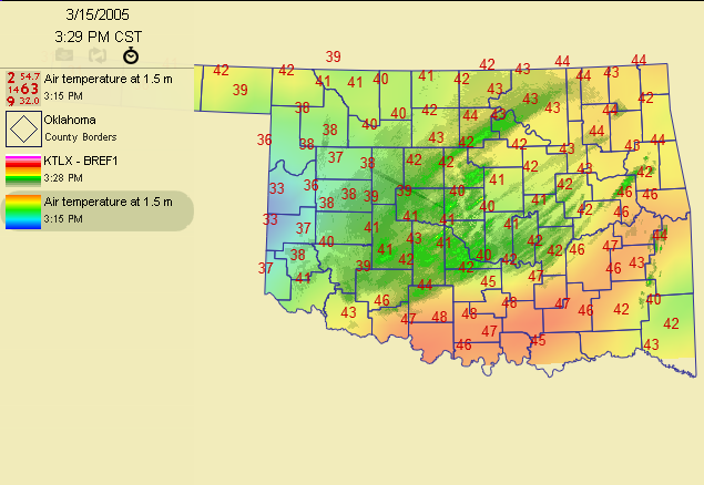
western Oklahoma don't hurt, either).  However, surface temps here
are well above freezing:


So that snow is melting well before it hits the ground - in this part
of the state!


How'd Ten-inches of Snow Land Out There, Anyway?

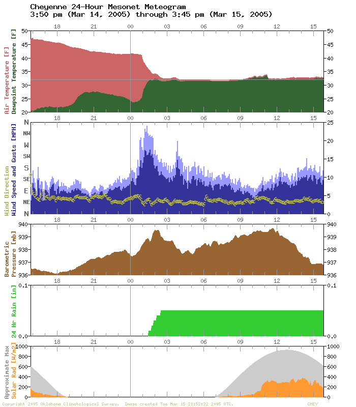
One more thing: notice the surface temps out in Pete's part of the
world.  Very, very near freezing!  Those temps came crashing down as
a result of a wet-bulbing phenomenon:


The temperature and dewpoint came together as persistent precip fell
into dry-ish air at the surface. The temp came down enough to support
the accumulation of snoww - lots of snow.
March 15 in Mesonet History
| Record | Value | Station | Year |
|---|---|---|---|
| Maximum Temperature | 88°F | ALV2 | 2013 |
| Minimum Temperature | 14°F | SLAP | 1997 |
| Maximum Rainfall | 3.96″ | WILB | 2014 |
Mesonet records begin in 1994.
Search by Date
If you're a bit off, don't worry, because just like horseshoes, “almost” counts on the Ticker website!