Ticker for September 29, 2004
MESONET TICKER ... MESONET TICKER ... MESONET TICKER ... MESONET TICKER ...
September 29, 2004 September 29, 2004 September 29, 2004 September 29, 2004
It's Good To Know When They Get It Right
Not much going on Ticker-wise today, except some reassuring evidence
that the physics behind atmospheric motion might be valid after all.
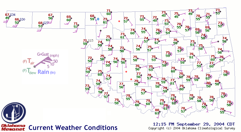
Today's surface weather map from the Mesonet indicates very light
winds across most of the state, save for some stronger southerlies
in the panhandle:
Those stronger winds are a response to a north-south surface trough
developing in, and approaching from, the high plains of Colorado,
New Mexico and Wyoming. The pressure falls associated with the trough
show up nicely in a three-hour change map from Mesonet barometers:
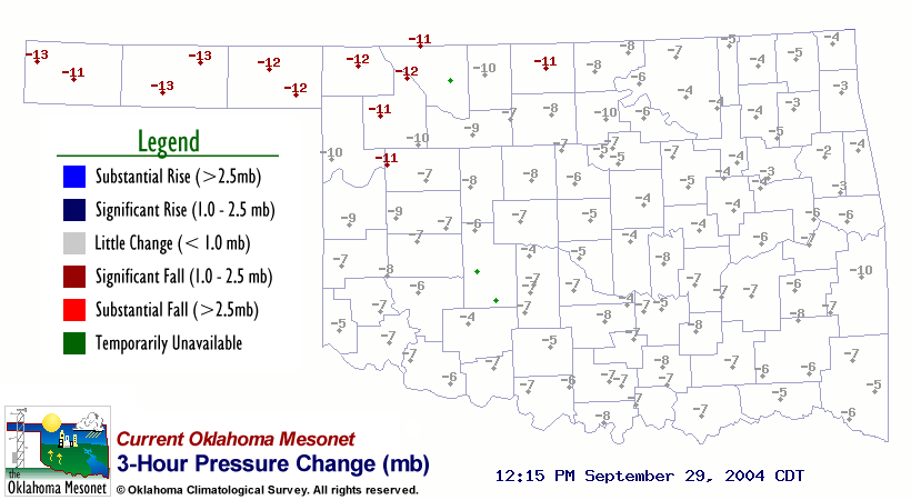
Those pressure falls of just over a millibar in three hours aren't
colossal by any means, but they are enough to excite some enhanced
southerly flow as the pressure gradient tightens.
The Kenton meteogram tells the story of the phenomenon's local
impact quite well (as meteograms often do):
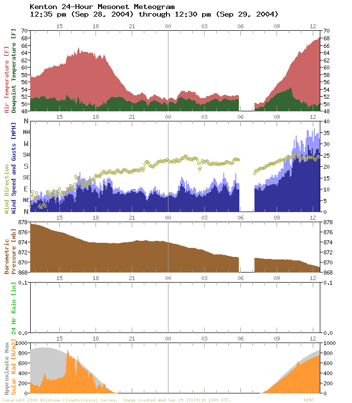
As the pressure falls accelerated between 10 and 11 am, the local
wind speeds accelerated with them.
Thanks, Atmosphere - for playing by the rules and helping us write a
Ticker!
September 29 in Mesonet History
| Record | Value | Station | Year |
|---|---|---|---|
| Maximum Temperature | 102°F | BURN | 2011 |
| Minimum Temperature | 31°F | KENT | 1999 |
| Maximum Rainfall | 4.93 inches | STIG | 2012 |
Mesonet records begin in 1994.
Search by Date
If you're a bit off, don't worry, because just like horseshoes, “almost” counts on the Ticker website!