Ticker for June 16, 2004
MESONET TICKER ... MESONET TICKER ... MESONET TICKER ... MESONET TICKER ...
June 16, 2004 June 16, 2004 June 16, 2004 June 16, 2004
Some Old, But Nonetheless Exciting, Business
Today's Ticker will look back in time a bit and erase one of the items
on our "To Do" ledger.
There was a very interesting downburst event several weeks ago in the
panhandle. The collapsing thunderstorms that were responsible for the
event delivered very strong winds - and zero rainfall - to several
towns in the panhandle.
Here are some meteograms, in order of occurrence as the feature moved
from southwest to northeast:

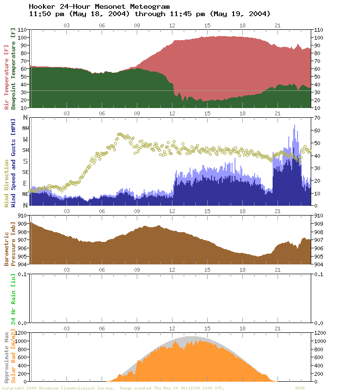
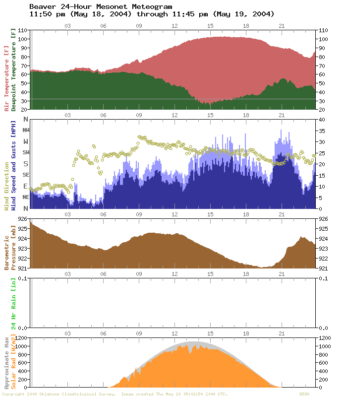
The pressure spike at Goodwell is very impressive! All of that air
slamming down on the surface can certainly wake up a barometer!
The duration of the event is impressive as well. Winds spent close
to three hours above the environmental baseline at the three stations.
Finally, here's a great movie from the Dodge City, Kansas radar:
https://content.mesonet.org/ticker/archive/20040616/ddc.mov
(you'll need a quicktime movie player to see it)
The final stage's of the storm's (shower's) collapse is quite evident
over Texas County from 10:00-10:30pm. WHUMP! As the downburst hit
the ground, it blasted north-northeastward far into Kansas (a boundary
is still visible near I-70 in central KS at the end of the movie).
Another cool feature in the movie: check out the retreating dryline
in the first few frames (it passes over the radar site from SE to NW).
If you look closely, you can even see it the dryline interact with
a short-lived cell as it (the cell) crosses the border from OK to KS.
Bravo, Mother Nature ... Bravo!
June 16 in Mesonet History
| Record | Value | Station | Year |
|---|---|---|---|
| Maximum Temperature | 108°F | ALTU | 2011 |
| Minimum Temperature | 45°F | KENT | 1998 |
| Maximum Rainfall | 3.93 inches | BLAC | 1997 |
Mesonet records begin in 1994.
Search by Date
If you're a bit off, don't worry, because just like horseshoes, “almost” counts on the Ticker website!