Ticker for October 7, 2003
MESONET TICKER ... MESONET TICKER ... MESONET TICKER ... MESONET TICKER ...
October 7, 2003 October 7, 2003 October 7, 2003 October 7, 2003
What's This? A Warm Day?
Today's high temperatures are around 80 across most of the state, which
is slightly above normal:
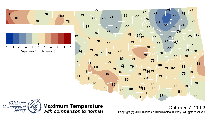
Being warmer than normal is the exception to the last 40 days or so,
which have been dominated by cooler air:
https://content.mesonet.org/ticker/archive/20031007/tmaxdifs.html
(click on any map for the full-scale version)
In fact, September was Oklahoma's 8th-coolest September since modern
records began in 1892 (a fact detailed in the new OCS Monthly Climate
Summary, but more on that tomorrow!).
Satellite Confirmation
There's an interesting feature in this afternoon's visible satellite
imagery:
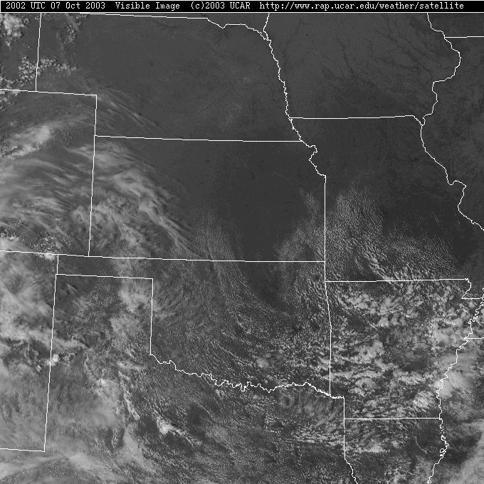
The little nose of cooler air around Bartlesville (as seen in the first
temperature map above) shows up quite noticeably as an area of suppressed
cumiliform development in north-central Oklahoma.
October 7 in Mesonet History
| Record | Value | Station | Year |
|---|---|---|---|
| Maximum Temperature | 99°F | WAUR | 2014 |
| Minimum Temperature | 26°F | SEIL | 2012 |
| Maximum Rainfall | 5.79 inches | HOBA | 2018 |
Mesonet records begin in 1994.
Search by Date
If you're a bit off, don't worry, because just like horseshoes, “almost” counts on the Ticker website!