Ticker for May 1, 2003
MESONET TICKER ... MESONET TICKER ... MESONET TICKER ... MESONET TICKER ...
May 1, 2003 May 1, 2003 May 1, 2003 May 1, 2003
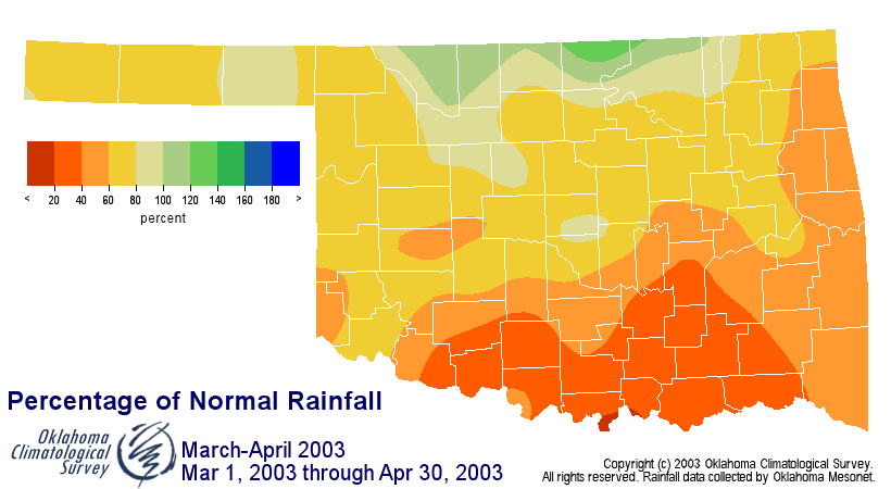
March-April Driest in 83 Years in South-Central Oklahoma
The preliminary stats are in, and they indicate that March and April
2003 were quite dry across the state. In fact, the Mar-Apr period was
the driest of the last 83 years in south-central Oklahoma, and the
second-driest in the southeast (eclipsed only by the brutal Dust Bowl
year of 1936). Here are the vital statistics:
https://content.mesonet.org/ticker/archive/20030501/ma2003.html
Maps of the departure from normal show that only the northernmost
counties escaped rainfall deficits:
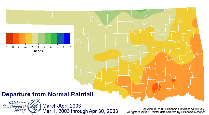
And these numbers are a bit misleading for the northern counties.
Because a Mesonet station runs on the average power consumption of
a nightlight, there aren't enough watts in the station's energy
budget to heat the rain gauge. Therefore, Mesonet stations only
measure frozen precipitation upon melting (we prefer the term
"hydrologically representative sampling"). So, the listed
precipitation for the northern counties include an inch or more
that's actually melt from a large snowfall event in late February.
May 1 in Mesonet History
| Record | Value | Station | Year |
|---|---|---|---|
| Maximum Temperature | 101°F | ALTU | 2002 |
| Minimum Temperature | 28°F | BOIS | 2011 |
| Maximum Rainfall | 7.70 inches | PRYO | 2009 |
Mesonet records begin in 1994.
Search by Date
If you're a bit off, don't worry, because just like horseshoes, “almost” counts on the Ticker website!