Ticker for January 28, 2003
MESONET TICKER ... MESONET TICKER ... MESONET TICKER ... MESONET TICKER ...
January 28, 2003   January 28, 2003   January 28, 2003   January 28, 2003


This Ticker's All Wet

Heavy, HEAVY dew rolled down driveways across much of Oklahoma this
morning, and we have last week's cold snap and today's stiff southerly
breeze to thank.

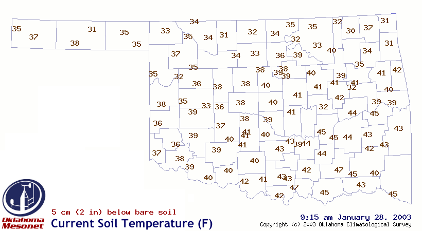
Thanks to several very cold days in a row, ground temperatures are
quite low, as evidenced by a 9:15 am edition of the Mesonet soil
temperature map:


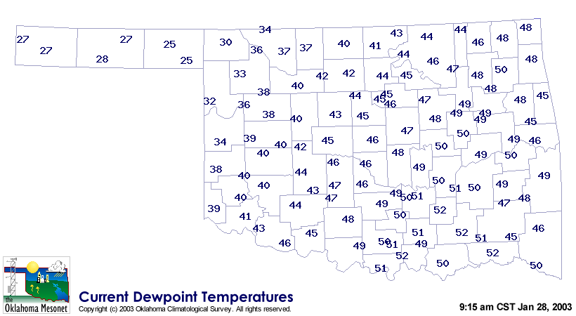
Southerly flow continues to bring relatively moist air into the state,
as shown on this dew point map from 9:15 am:


Looking at the numbers on these two maps, you can see that the dew point
temperature is significantly greater than the soil temperature at most
Mesonet stations.  So, like a cool mirror during your hot shower, the
cool ground represents a prime condensation surface.

Also, you may have noticed heavier condensation on pavement than on
the lawn.  This occurs for much the same reason that concrete usually
*doesn't* get heavier dew in the warm season: it takes longer for the
atmosphere to change the temperature of concrete than blades of grass.
The difference here is that the atmosphere moistened beyond the
surface temperature, rather than the surface cooling to the dew point.

A few more items: we hope you didn't slip on your wet patio today,
please don't ask us how we got today's idea, and can someone pass
the ibuprofen?
January 28 in Mesonet History
| Record | Value | Station | Year |
|---|---|---|---|
| Maximum Temperature | 83°F | MANG | 2015 |
| Minimum Temperature | -1°F | BUFF | 2009 |
| Maximum Rainfall | 2.87″ | TIPT | 2010 |
Mesonet records begin in 1994.
Search by Date
If you're a bit off, don't worry, because just like horseshoes, “almost” counts on the Ticker website!