Ticker for December 4, 2002
MESONET TICKER ... MESONET TICKER ... MESONET TICKER ... MESONET TICKER ...
December 4, 2002   December 4, 2002   December 4, 2002   December 4, 2002


Deja Vu, All Over Again

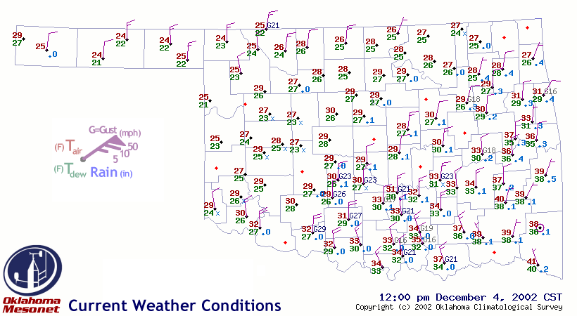
Today's wind sensor casualties reveal a swath of icing that is
eerily similar to the major ice storm of January 2002.  The
iced-up prop-vanes lay in a belt from west-central Oklahoma
to northeast Oklahoma, and are visible as non-reports in the
following graphic (our diligent QA manager has already flagged
the data):


Thankfully, the magnitude of precipitation is much less than the
January storm!

Meteograms demonstrate the very fine line between freezing and
not-freezing, and just how close to the ground that battle line
can be drawn.  Keep in mind that Mesonet observations are taken
at the World Meteorological Organization's prescribed heights:
Wind speed and Wind Direction: 10.0 meters (about 33 ft)
Air Temp and Rel Humidity:      1.5 meters (about 5 ft)
Rainfall is measured by a gauge that sits six inches or so above
the ground.

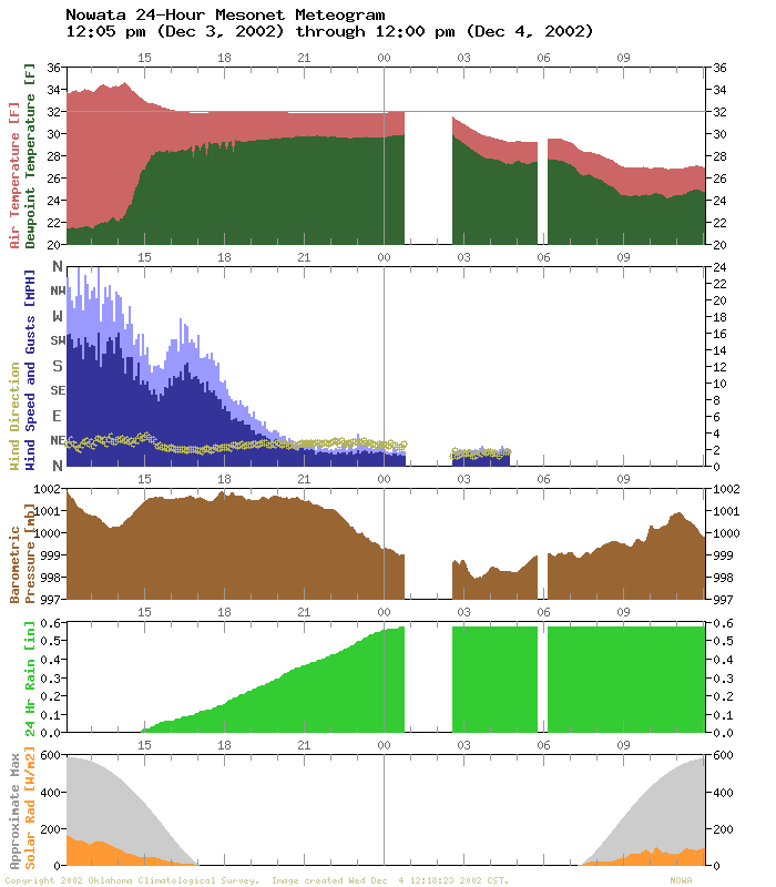
At Nowata,

precipitation started about 3:00 pm yesterday, and the
"wet-bulbing" effect brought the temperature exactly to 32 F, at
1.5 meters anyway.  However, at 10 meters, the wind monitor began to
ice up within a few hours, as indicated by the gradual decline in
wind speed.  But precipitation kept accumulating until after
midnight!

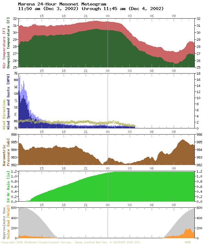
At Marena,

a similar occurrence.  The wind monitor iced up shortly
after noon.  However, even though the 1.5-meter temperature was
also below freezing, that didn't stop 1.2 inches of liquid precip
from flowing through the gauge over the next ten hours.

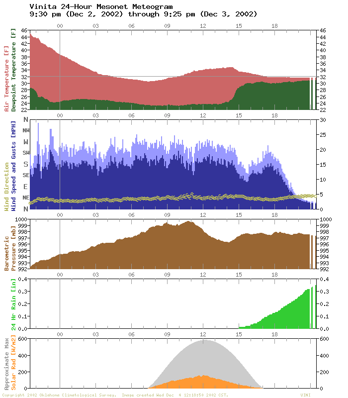
At Vinita,

the meteogram shows the same process just beginning,
as of 9:25 am anyway.


Freeze Map Discontinued

Every Mesonet station has now recorded a hard freeze this autumn,
so the special freeze duration map on the Ticker home page has been
put back on the shelf until October 2003.
December 4 in Mesonet History
| Record | Value | Station | Year |
|---|---|---|---|
| Maximum Temperature | 83°F | BURN | 2017 |
| Minimum Temperature | -2°F | NOWA | 2006 |
| Maximum Rainfall | 2.44″ | MIAM | 1999 |
Mesonet records begin in 1994.
Search by Date
If you're a bit off, don't worry, because just like horseshoes, “almost” counts on the Ticker website!