Ticker for May 24, 2002
MESONET TICKER ... MESONET TICKER ... MESONET TICKER ... MESONET TICKER ...
May 24, 2002       May 24, 2002       May 24, 2002       May 24, 2002


Sharp Temperature Contrast Evident in Western Oklahoma

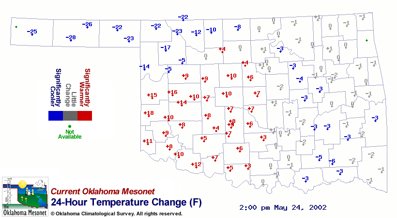
A quick look at the 24-hour change in Mesonet temperatures shows the
signature of strong heating to the south of a significant cold front:


(by the way, this product is updated every 15 minutes in the
"Weather Trends" section of the Mesonet subscriber pages)

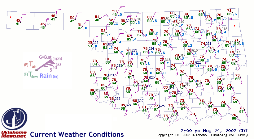
The strong temperature gradient in west-central Oklahoma is one to
appreciate, especially as we plod on toward summer when these
features become infrequent:


Clear to partly cloudy skies south of the surface front plus cloud
cover north of the surface front amplified the gradient.  At 2:00 pm,
the Mesonet stations at Cheyenne and Arnett measured temperatures of
79 F and 55 F, respectively.  That's a 24 F difference between stations
just 37 miles apart!
May 24 in Mesonet History
| Record | Value | Station | Year |
|---|---|---|---|
| Maximum Temperature | 111°F | TIPT | 2000 |
| Minimum Temperature | 36°F | EVAX | 2017 |
| Maximum Rainfall | 6.54″ | MCAL | 2015 |
Mesonet records begin in 1994.
Search by Date
If you're a bit off, don't worry, because just like horseshoes, “almost” counts on the Ticker website!