Ticker for February 27, 2002
MESONET TICKER ... MESONET TICKER ... MESONET TICKER ... MESONET TICKER ...
February 27, 2002 February 27, 2002 February 27, 2002 February 27, 2002
Traveling Wave Roams Across Oklahoma This Morning
If you're a fan of the surface reflection of gravity waves (and,
honestly, who isn't?) then wintertime is a fun time to watch early
morning Mesonet data. That's right - when we get a shallow and very
stable layer of air at the surface, it's a great time to pick up on
their sloshing, oscillating or travelling effects.
This morning, while most of us were in bed, an entertaining little
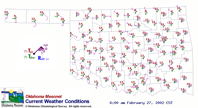
wave travelled west-to-east across Oklahoma. The following maps
represent 30-minute intervals from 2:30 am through 6:00 pm. For each
map time, a few Mesonet stations have winds out of the northeast, in
contrast to the predominant light westerly flow at the surface.
We've listed the a few of the stations with the "wrong way" winds
for each map time.
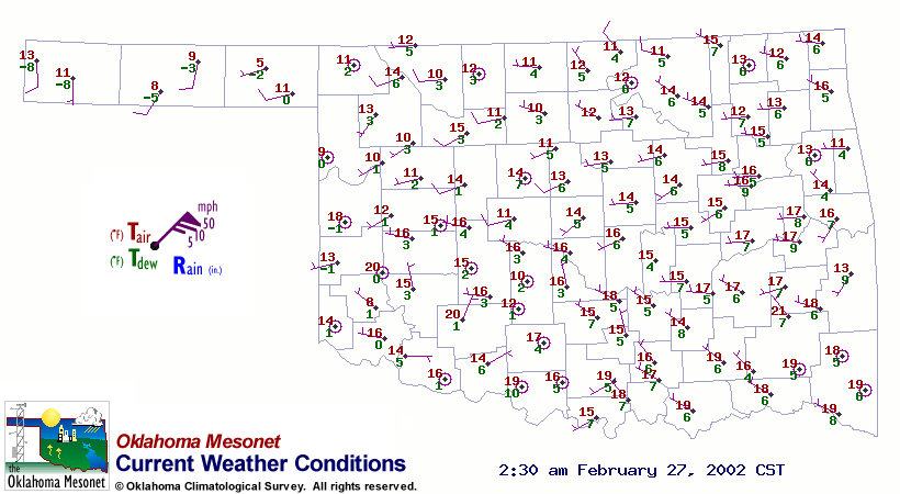 MEDI WALT
 BUTL WEAT FTCB
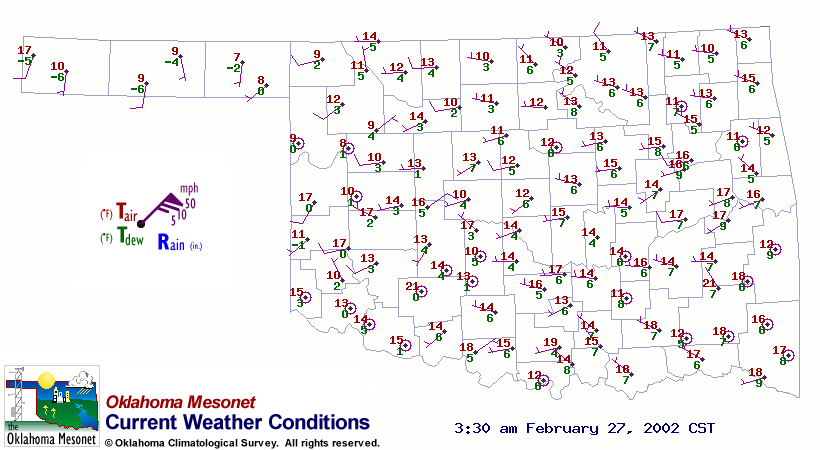 HINT
HINT
 CHIC KETC RING
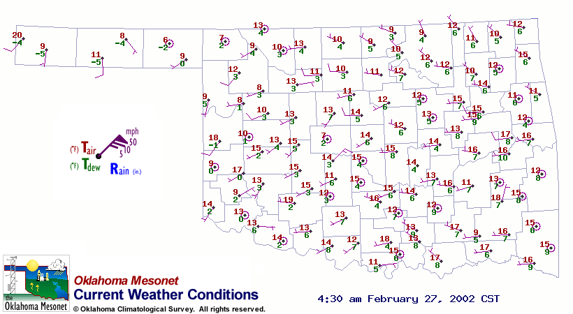 FAIR HINT BURN
 WASH ARDM MADI
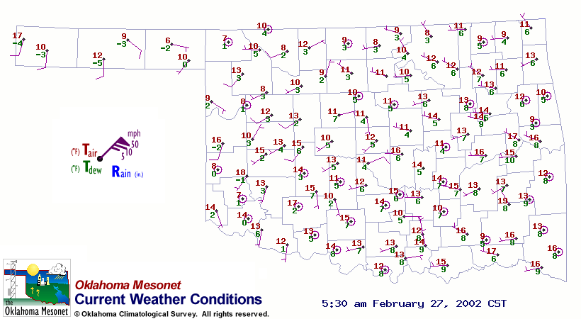 KING NORM PAUL
 MARS BYAR TISH
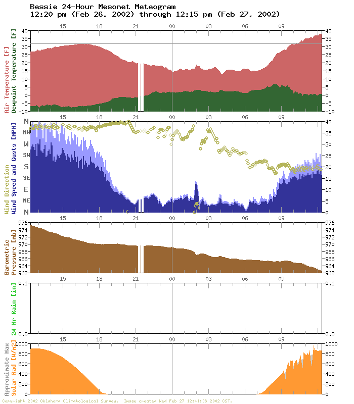
The wave showed up in meteograms, too. For example, the Bessie and
Norman meteograms show the abrupt change to NE'ly winds coincident with
a temporal minimum in pressure and some activity in the temperature and
dew point traces:
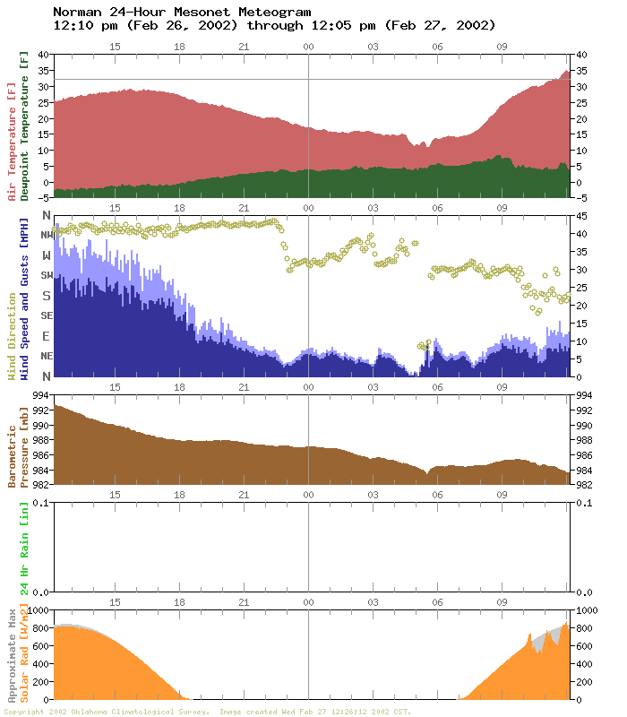
This feature showed up on several dozen Mesonet meteograms this morning.
It should be noted that northeasterly winds weren't observed at any
level of the Norman sounding this morning.
The Ticker thanks Mesonet Lead Operator (and resident night owl) David
Demko for catching this event in real time.
Speaking of the Shallow, Very Stable Layer ...
Record low temperatures occurred at several locations in the region,
including OKC and Wichita Falls. Here are the Mesonet's Top 15 (or
Bottom 15?) minimum temperatures from this morning:
1 Beaver 4 F 2:10 a
2 Buffalo 5 F 6:25 a
3 Camargo 6 F 6:05 a
4 Blackwell 6 F 7:10 a
5 Mangum 6 F 5:10 a
6 Breckinridge 6 F 7:00 a
7 Burbank 6 F 6:05 a
8 El Reno 6 F 4:40 a
9 Arnett 6 F 4:55 a
10 Antlers 7 F 6:55 a
11 Butler 7 F 7:15 a
12 Oilton 7 F 7:15 a
13 Boise City 7 F 7:25 a
14 Hooker 7 F 12:05 a
15 Medford 7 F 6:40 a
February 27 in Mesonet History
| Record | Value | Station | Year |
|---|---|---|---|
| Maximum Temperature | 90°F | WALT | 2011 |
| Minimum Temperature | 4°F | BEAV | 2002 |
| Maximum Rainfall | 1.82″ | CLOU | 2018 |
Mesonet records begin in 1994.
Search by Date
If you're a bit off, don't worry, because just like horseshoes, “almost” counts on the Ticker website!