Ticker for January 28, 2002
MESONET TICKER ... MESONET TICKER ... MESONET TICKER ... MESONET TICKER ...
January 28, 2002   January 28, 2002   January 28, 2002   January 28, 2002


Cold Front Creeps Across Oklahoma

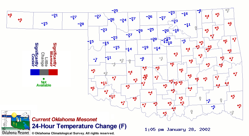
A sharp contrast in temperature exists across Oklahoma today as a
strong cold front drapes the state.  The front's southward progress
has slowed in recent hours, but the temperature change has been
significant:


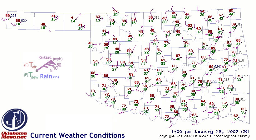
A nice feature in the Oklahoma Mesonet today is the reflection of the
state's terrain in surface conditions.  The cold front is a shallow
layer of cold air oozing (the Ticker's word, not science's) southward.
How shallow?  Shallow enough that, as of 1:15, the cold air hasn't yet
reached the lofty elevations in the western panhandle:


The Boise City and Kenton stations, both 4000+ feet above sea level,
still show warm, southerly flow.  Just down the road at Goodwell (and
downslope - elev: 3300 ft), the cold air is observed.
January 28 in Mesonet History
| Record | Value | Station | Year |
|---|---|---|---|
| Maximum Temperature | 83°F | MANG | 2015 |
| Minimum Temperature | -1°F | BUFF | 2009 |
| Maximum Rainfall | 2.87″ | TIPT | 2010 |
Mesonet records begin in 1994.
Search by Date
If you're a bit off, don't worry, because just like horseshoes, “almost” counts on the Ticker website!