Ticker for October 23, 2001
MESONET TICKER ... MESONET TICKER ... MESONET TICKER ... MESONET TICKER ...
October 23, 2001   October 23, 2001   October 23, 2001   October 23, 2001


Rainfall Deficit Continues Across Much of Oklahoma

During recent weeks, much of central, eastern and southern Oklahoma
received substantial relief from the mid-summer dry spell.  However,
large portions of the remainder of the state are still experiencing
significant a rainfall deficit for the summer and early autumn months.

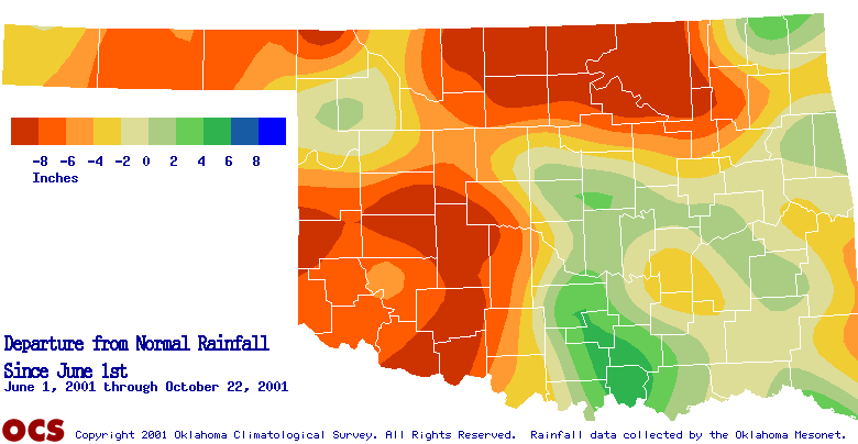
The following map shows rainfall relative to normal since June 1.


Yellows and reds indicate below-normal precip, while greens and blues
indicate above-normal precip.  The map shows that, despite some relief
in August, much of north-central and southwest Oklahoma remain well
below normal rainfall since early summer.  Moreover, rainfall deficits
have emerged in portions of the panhandle.

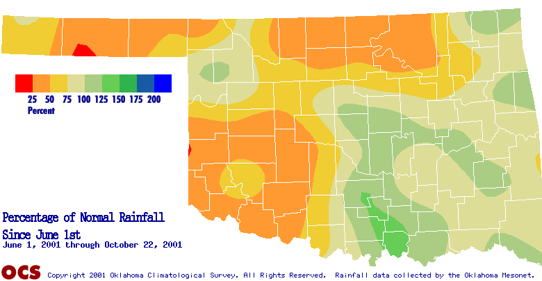
Subsets of these regions have observed less than one-half of their
normal rainfall for the period:


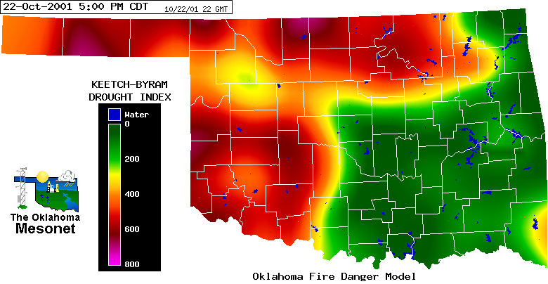
The signature can be seen in the latest Keetch-Byram Drought Index,
which estimates soil moisture conditions in the uppermost eight inches
of the soil:


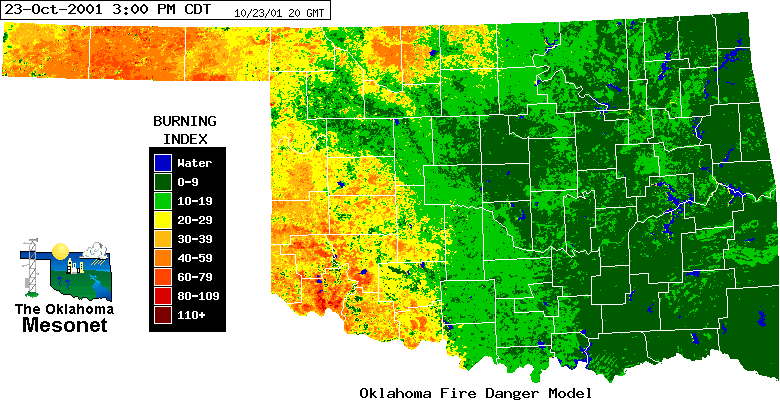
This afternoon's burning index from the Oklahoma Fire Danger Model also
reflects the rainfall signature:

October 23 in Mesonet History
| Record | Value | Station | Year |
|---|---|---|---|
| Maximum Temperature | 96°F | WAUR | 2024 |
| Minimum Temperature | 21°F | EVAX | 2020 |
| Maximum Rainfall | 4.31″ | BROK | 2015 |
Mesonet records begin in 1994.
Search by Date
If you're a bit off, don't worry, because just like horseshoes, “almost” counts on the Ticker website!