Ticker for January 19, 2000
MESONET TICKER ... MESONET TICKER ... MESONET TICKER ... MESONET TICKER ...
January 19, 2000 January 19, 2000 January 19, 2000 January 19, 2000
Strong Northerly Winds Exacerbate Fire Danger Conditions
This afternoon's weather map features strong gusty northerly winds
behind a surface trough (yes, the cold air is coming, too):
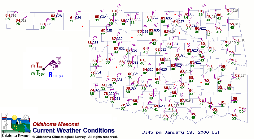
These high winds and low dew points have aggravated already-significant
fire danger conditions in western Oklahoma. Here are some images of
Oklahoma Fire Danger Model output to illustrate the situation:
Burning Index: 
Spread Component: 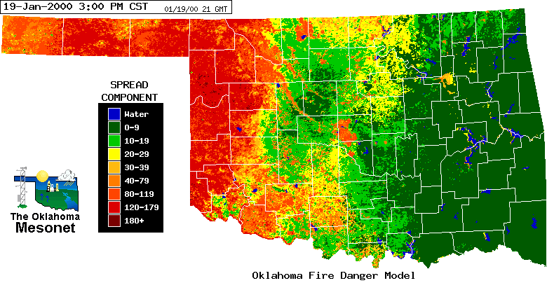
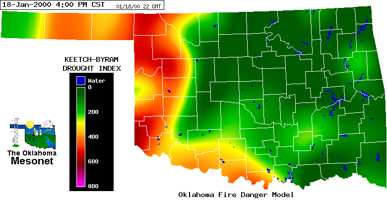
Since October 1, 1999, much of western Oklahoma has received less than
half of its normal rainfall:

This is also reflected in the Keetch-Byram Drought Index values in the
region:
In Tomorrow's Ticker ...
Some information regarding tomorrow night's total eclipse of the moon!
January 19 in Mesonet History
| Record | Value | Station | Year |
|---|---|---|---|
| Maximum Temperature | 77°F | BURN | 1999 |
| Minimum Temperature | -4°F | BOIS | 2025 |
| Maximum Rainfall | 0.66 inches | COOK | 2019 |
Mesonet records begin in 1994.
Search by Date
If you're a bit off, don't worry, because just like horseshoes, “almost” counts on the Ticker website!