Ticker for January 12, 2000
MESONET TICKER ... MESONET TICKER ... MESONET TICKER ... MESONET TICKER ...
January 12, 2000 January 12, 2000 January 12, 2000 January 12, 2000
January "Cold" Front Advances
It's the middlie of January and winds are gusting to more than 30 mph
across western Oklahoma. That's right: it's a cold front. And temps
are plunging into the ... sixties?
Strangely enough, that's the case today. A cold front packing gusty
winds and wimpy mild temperatures is diving southward today:
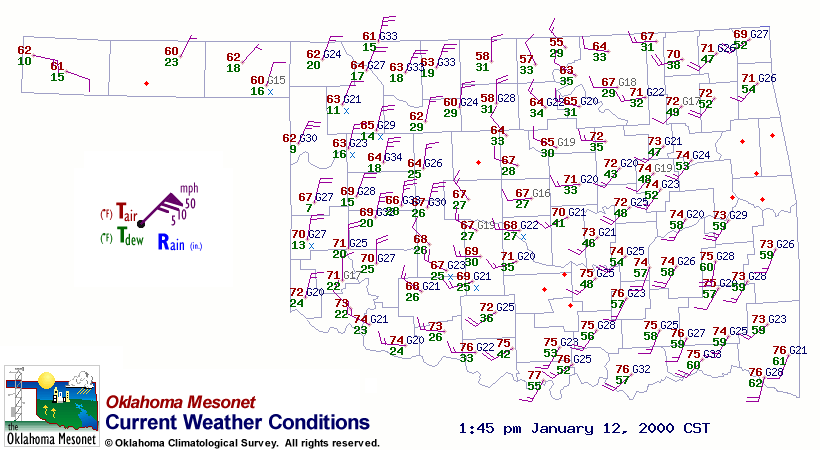
Temperatures behind the front are in the 60s, which is a far cry from
a typical January cold front in Oklahoma. This just underscores how
warm the first two weeks of the new year have been.
One significant change associated with this front are much lower
dew points. This dry air, along with the gusty winds, will exacerbate
the already-significant fire danger conditions throughout the state.
January 12 in Mesonet History
| Record | Value | Station | Year |
|---|---|---|---|
| Maximum Temperature | 80°F | BURN | 2000 |
| Minimum Temperature | -1°F | NEWK | 2011 |
| Maximum Rainfall | 2.10 inches | DURA | 2007 |
Mesonet records begin in 1994.
Search by Date
If you're a bit off, don't worry, because just like horseshoes, “almost” counts on the Ticker website!