Ticker for December 8, 1999
MESONET TICKER ... MESONET TICKER ... MESONET TICKER ... MESONET TICKER ...
December 8, 1999 December 8, 1999 December 8, 1999 December 8, 1999
A Tale of Two Regimes
Today's slowly advancing cold front is evident (well, sort of) in the
three-hour air temperature change map, indelibly frozen at 3:20 pm at:
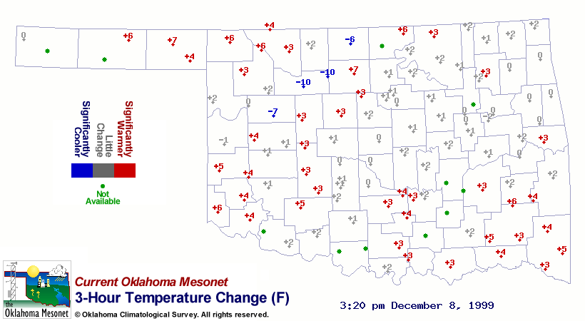
The significant temperature drops at Lahoma and Fairview are
understandable, because it's a reasonably strong cold front. But
where are the temperature drops one would expect at, say, Seiling,
Woodward, or Cherokee?
The answer lies in a visible satellite image from yesterday afternoon:
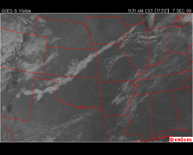
That long white strip from eastern New Mexico to west of Chicago isn't
cloud cover, it's snow cover. The long snow track reflects the
path of the low which blanketed some of the region with up to a foot
of snow a few days ago.
So, the reason the temperature hasn't dropped significantly behind the
front the aforementioned locations is because they never climbed very
high to begin with, because of the high albedo and latent heat flux
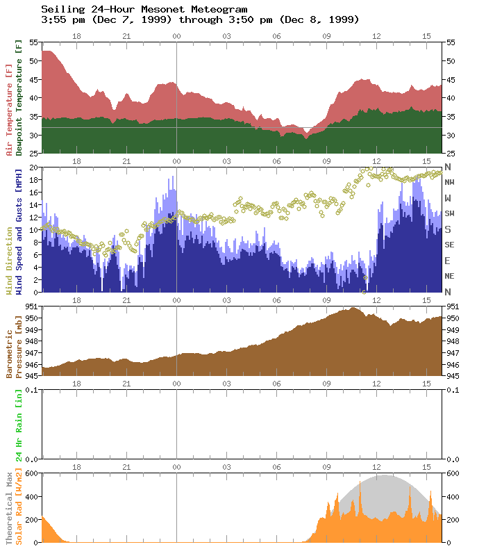
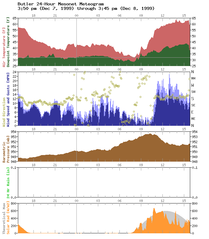
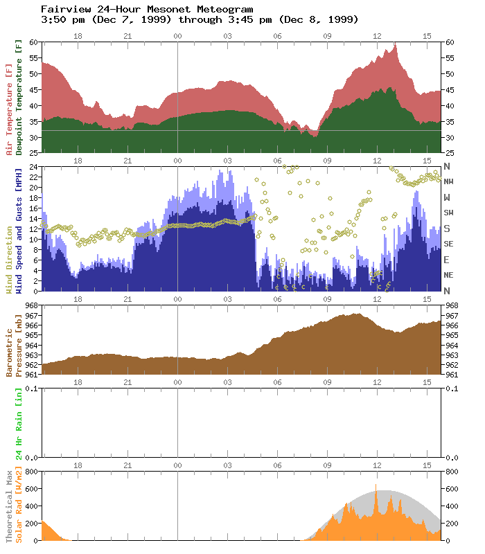
associated with the snow cover. Here are three meteograms for each
regime (snow and bare) to illustrate. Notice the stifling of the
afternoon temps at snowy locations.
SNOWY:


BARE:

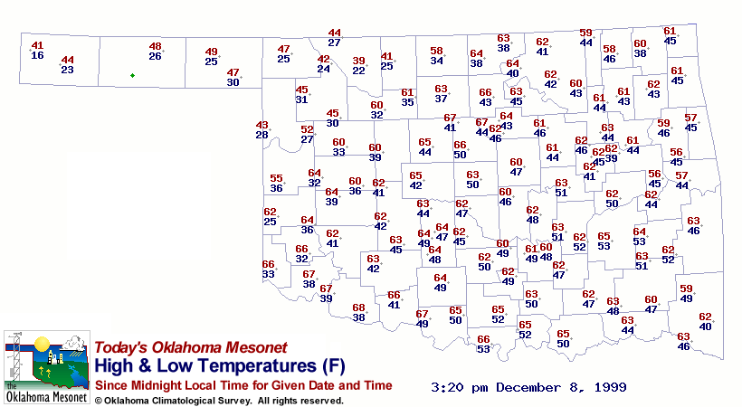
Finally, here's the daily hi/lo temperature map to beat this topic
to death:
December 8 in Mesonet History
| Record | Value | Station | Year |
|---|---|---|---|
| Maximum Temperature | 80°F | BURN | 2023 |
| Minimum Temperature | -15°F | KENT | 2005 |
| Maximum Rainfall | 2.35 inches | MTHE | 1994 |
Mesonet records begin in 1994.
Search by Date
If you're a bit off, don't worry, because just like horseshoes, “almost” counts on the Ticker website!