Ticker for August 26, 1999
MESONET TICKER ... MESONET TICKER ... MESONET TICKER ... MESONET TICKER ...
August 26, 1999    August 26, 1999    August 26, 1999    August 26, 1999


Do Not Adjust Your Set ... Part Two!

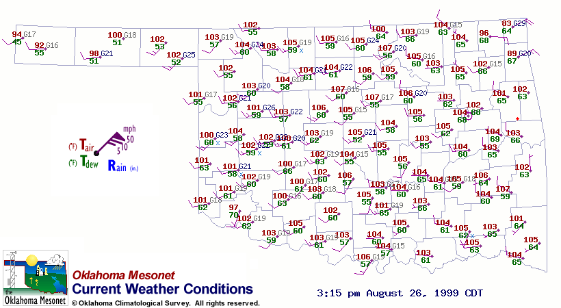
A look at today's afternoon weather conditions reveals that Altus
is cooler and more moist, relative to its Mesonet neighbors:


Is this poor performance by a Mesonet sensor?  Actually, no.
Altus is in the heart of cotton country, and a quick call to the
Extension agent in Jackson County verified that irrigation efforts
are in full swing.


Overnight Turbulent "Heating"

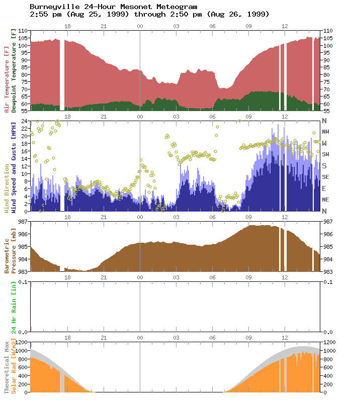
The second Ticker item refers to today's Burneyville meteogram:


Look at the hours between 3:00 and 6:00 am, particularly the
temperature, dew point, and wind speed.  When the wind stiffened
shortly after 3:00 the temperature rose ten degrees!  The dew point
dropped noticably as well.

This is undoubtedly the turbulent mixing of surface air with the
layer(s) above.  And, once again, meteograms pack a lot of
meteorology into one image.
August 26 in Mesonet History
| Record | Value | Station | Year |
|---|---|---|---|
| Maximum Temperature | 110°F | WAUR | 2023 |
| Minimum Temperature | 46°F | SEIL | 2010 |
| Maximum Rainfall | 5.24″ | BROK | 2020 |
Mesonet records begin in 1994.
Search by Date
If you're a bit off, don't worry, because just like horseshoes, “almost” counts on the Ticker website!