Ticker for June 10, 1999
MESONET TICKER ... MESONET TICKER ... MESONET TICKER ... MESONET TICKER ...
June 10, 1999      June 10, 1999      June 10, 1999      June 10, 1999


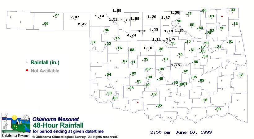
Heavy Rain Pounds Wheat Belt

Just a week after disrupting the harvest in southwestern Oklahoma, heavy
rains have followed the crews into the northern half of Oklahoma's
wheat belt.  The following list contains Mesonet stations which have
recorded an inch or more precip since sunrise Tuesday (as of 2:30 pm
today).  A more detailed map will be updated tonight at


Breckinridge  4.55"
Fairview      4.24"
Lahoma        3.12"
Beaver        2.87"
Slapout       2.42"
Buffalo       2.14"
Cherokee      1.98"
Marena        1.87"
Shawnee       1.74"
Alva          1.73"
May Ranch     1.68"
Blackwell     1.67"
Freedom       1.52"
Newkirk       1.31"
Medford       1.29"
Red Rock      1.19"
Pawnee        1.15"
Marshall      1.11"
Kingfisher    1.10"
Stillwater    1.05"


Mesonet Shows Convergence Just Before Yesterday's Convection

Just before 2:00 pm yesterday afternoon thunderstorms developed along
a remnant outflow boundary.  Observations from the Oklahoma Mesonet
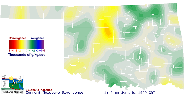
painted a clear picture of convergence in the area of initiation.

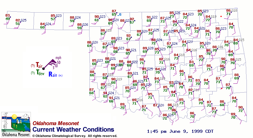
The wind observations in the 1:45 pm Mesonet weather map show a definite
confluence pattern in the storm initiation region (Kingfisher to Enid to
Medford).  The accompanying color-filled moisture convergence image
gives an even better depiction:


June 10 in Mesonet History
| Record | Value | Station | Year |
|---|---|---|---|
| Maximum Temperature | 109°F | ALTU | 2012 |
| Minimum Temperature | 40°F | EVAX | 2019 |
| Maximum Rainfall | 6.74″ | WALT | 1995 |
Mesonet records begin in 1994.
Search by Date
If you're a bit off, don't worry, because just like horseshoes, “almost” counts on the Ticker website!