Ticker for September 18, 2003
MESONET TICKER ... MESONET TICKER ... MESONET TICKER ... MESONET TICKER ...
September 18, 2003 September 18, 2003 September 18, 2003 September 18, 2003
Cold Front Brings Sharp Contrast to Sooner State
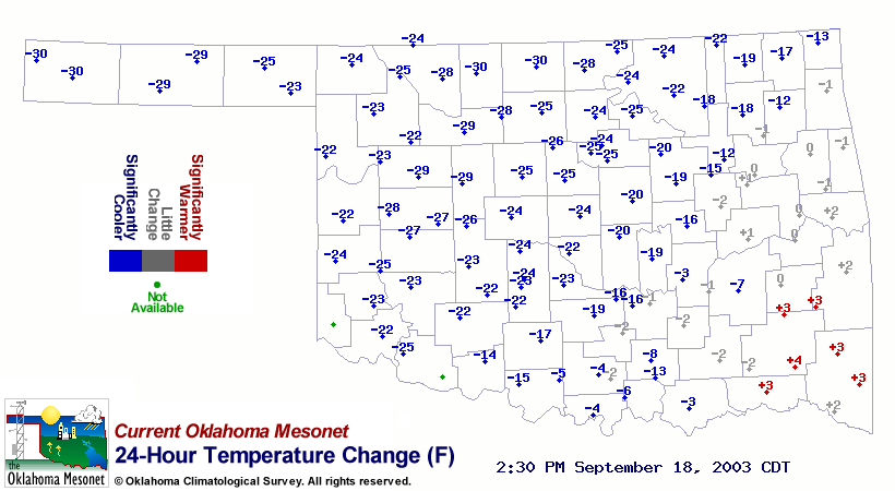
A significant cold front has beaten afternoon temperatures down into
the 60s across the northwestern two-thrids of the state so far today.
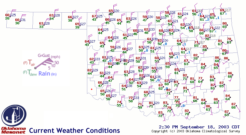
Strong northerly winds and much cooler air have replaced sticky
conditions behind the front:
The insurgence of cooler air is plainly visible on the Mesonet 24-hour
temperature change map:
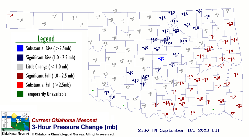
However, clearing skies 100 miles or so behind the front have allowed
afternoon temps to climb a bit in the northwest:

Finally, the 3-hour pressure change map shows the charateristic
fall-rise couplet pattern associated with the cold front:
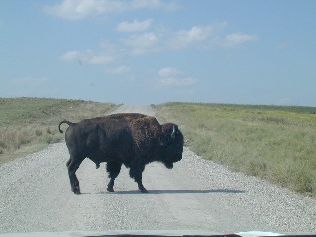
Snapshots From the Field
Mesonet Technician Ken Meyers provides a couple shots from his latest
trips out into the field. The first provides a beautiful glimpse of
the oncoming autumn season near Broken Bow, and the second shows an
all-too-familiar road hazard near the Foraker site:

September 18 in Mesonet History
| Record | Value | Station | Year |
|---|---|---|---|
| Maximum Temperature | 107°F | BUFF | 1997 |
| Minimum Temperature | 40°F | BOIS | 2012 |
| Maximum Rainfall | 3.61 inches | OILT | 2015 |
Mesonet records begin in 1994.
Search by Date
If you're a bit off, don't worry, because just like horseshoes, “almost” counts on the Ticker website!