MESONET TICKER ... MESONET TICKER ... MESONET TICKER ... MESONET TICKER ...
December 18, 2017 December 18, 2017 December 18, 2017 December 18, 2017
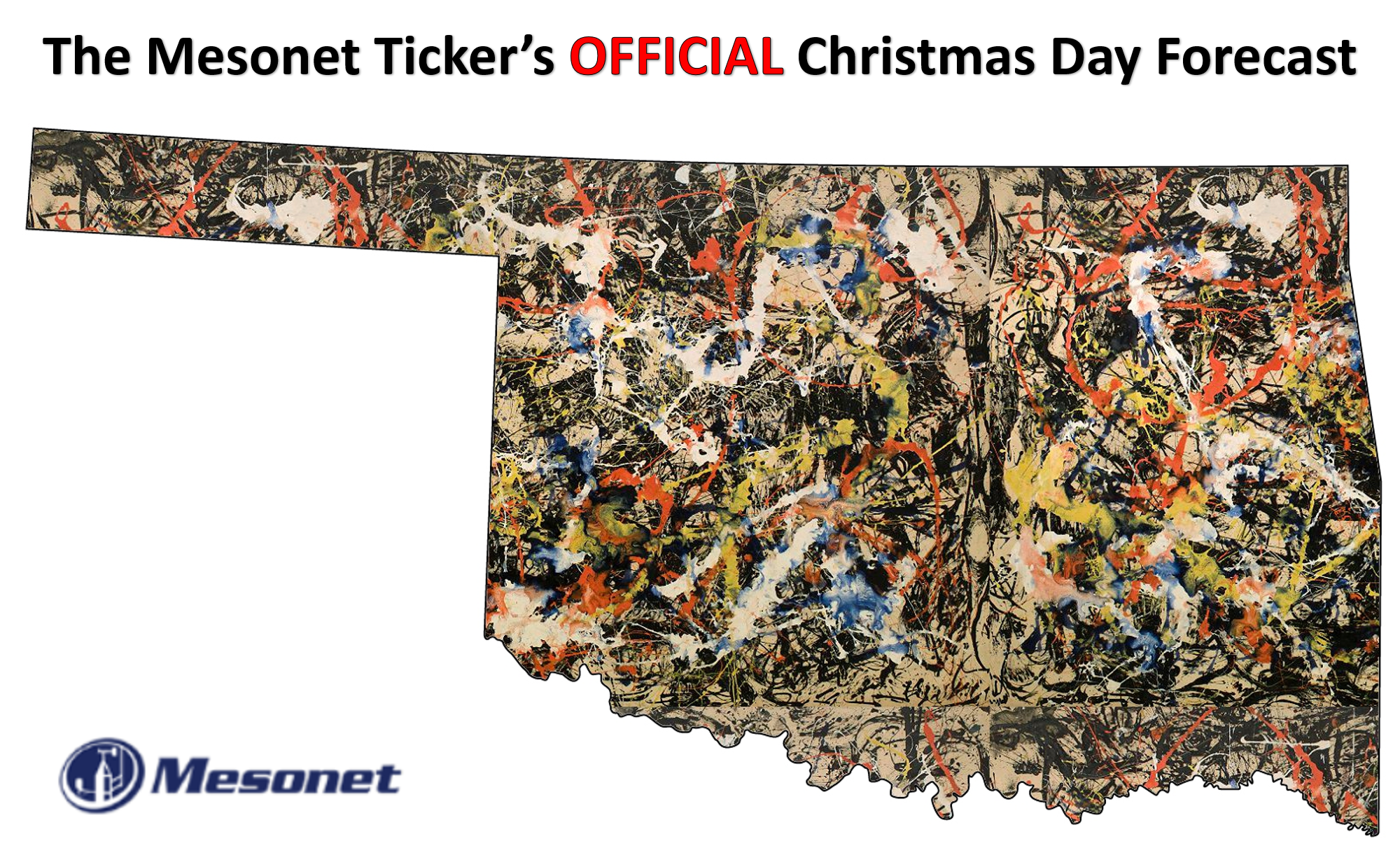
Snow? Who S-no-ws!
http://ticker.mesonet.org/archive/20171218/Chrstmas-forecast.png
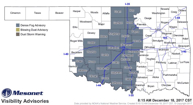
Clear as the visibility in Oklahoma right now, eh?
http://ticker.mesonet.org/archive/20171218/latest.oklahoma.visibility.gif
Well, of course we jest. No doubt by now you've been inundated with numerous tales
of anywhere from a dusting to 2 feet of snow by now, correct? With some caution,
with some certainty, and even with the dreaded meteorological anathema, "locked
in." Many a forecaster has crashed upon the rocks of their readers/viewers/
listeners confidence after uttering those fateful words, especially more than a
week out.
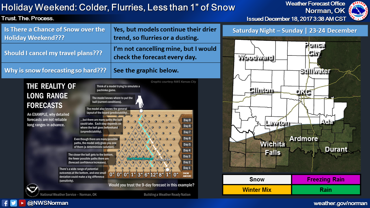
Here's something of an explanation from the NWS office in Norman, using the old
pachinko game (Price of Right fans...think Plinko).
http://ticker.mesonet.org/archive/20171218/nws-norman-uncertainty.png
Does that help you? Of course it does(n't). It helps you understand the
uncertainty of the forecast, but it also doesn't give you certainty in its
forecast. Say whaaaaatttt?
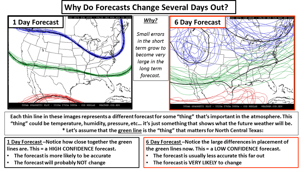
Yes, it's so simply complex that even a genius couldn't understand, but you're
common everyday dullard like me (I HEARD THAT!!) sorta gets it. Here's another
couple of graphics to not only understand how the uncertainly in forecast
models decreases with time, but why forecasting wintry weather is even
more difficult.
http://ticker.mesonet.org/archive/20151123/forecasting-chaos.png
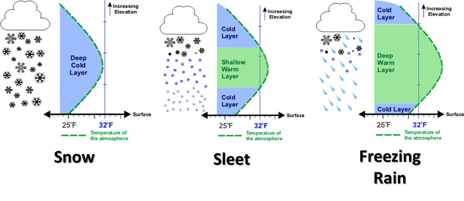
http://ticker.mesonet.org/archive/20131125/winter-precip-types.png
Okay, enough about uncertainty. I've already told you all I know about what we
don't know. One thing that is almost a certainty (dare I say "LOCKED IN") is
that it is going to get cold. And I mean "wow, it hasn't been this cold in a
long time" cold. The forecasts right now call for a front to come through
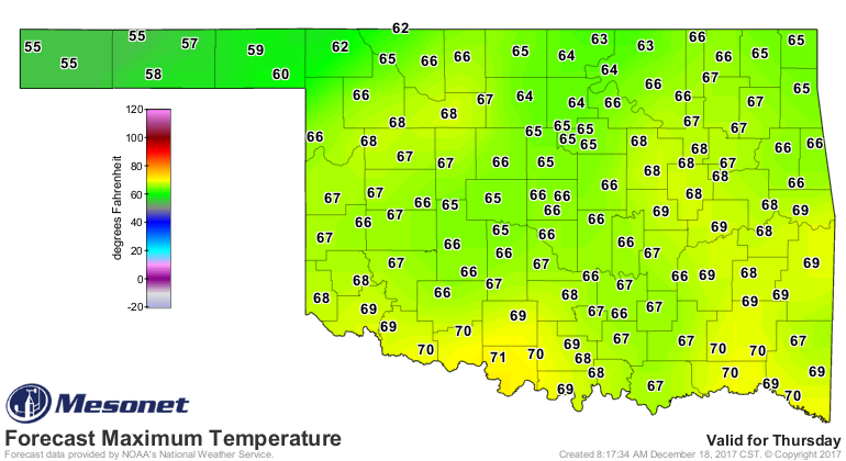
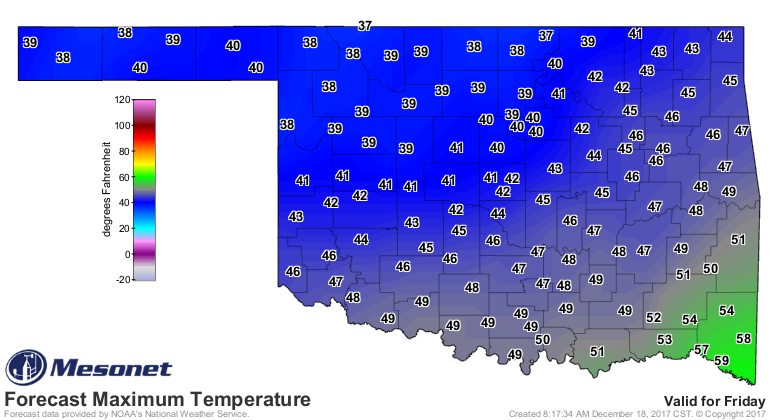
Thursday-ish, then a reinforcing shot of cold air over the weekend. We will go
from highs in the 60s and maybe a few 70s on Thursday, to down into the 20s by
that night. And then highs in the 30s and 40s on Friday. There will be a chance
of rain with that frontal passage on Thursday and Friday as well.
http://ticker.mesonet.org/archive/20171218/thursday-highs.png
http://ticker.mesonet.org/archive/20171218/friday-highs.png
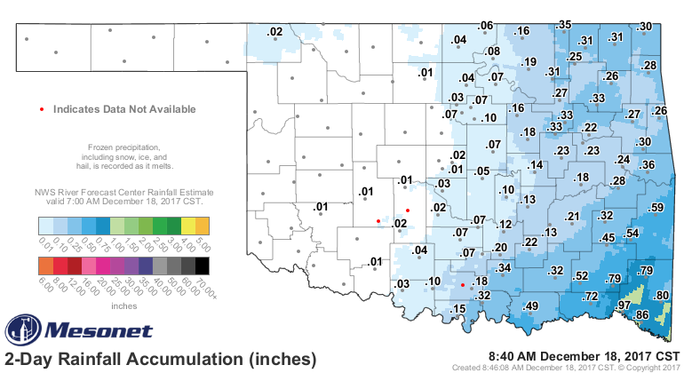
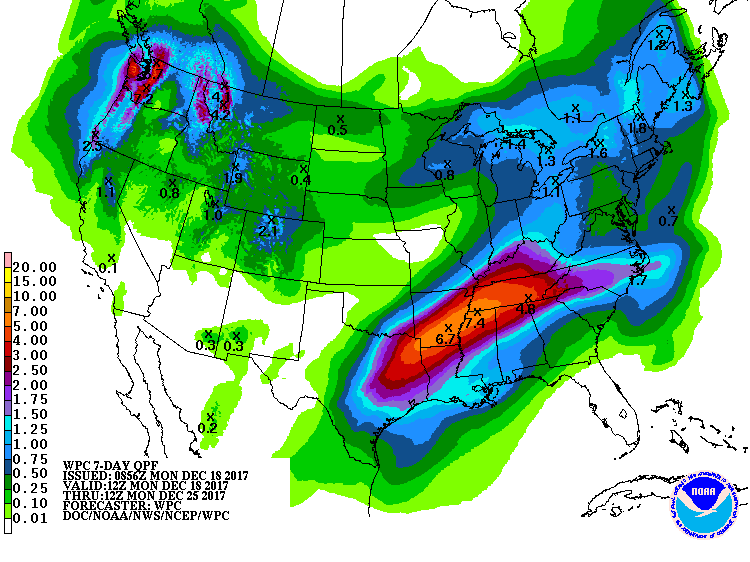
But again, the best news is that the drought area down across SE OK should get
a good shot of rain, to go along with the rain we just had.
http://ticker.mesonet.org/archive/20171218/2day-rain-totals.png
http://ticker.mesonet.org/archive/20171218/7day-rain-forecast.gif
I don't believe we've received enough rain down in the SE to improve the drought
conditions much, but perhaps we've forestalled any intensification for now. And
the rain chances coming up for a bit more hefty totals could create actual
improvements.
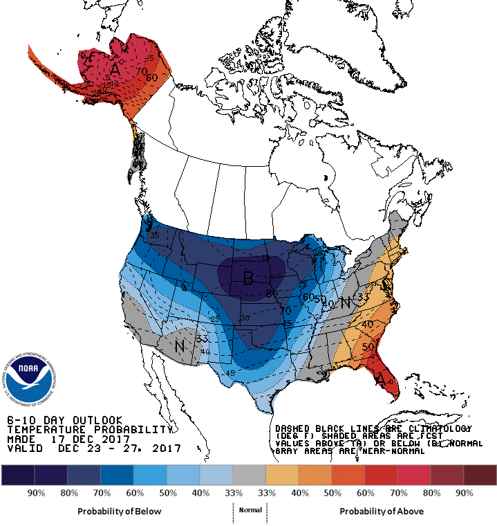
But again, to be as certain as I can about how uncertain I am, the one true
thing we're probably going to see, maybe, is COLD.
http://ticker.mesonet.org/archive/20171218/dec23-27-temp-outlook.gif
Gary McManus
State Climatologist
Oklahoma Mesonet
Oklahoma Climatological Survey
(405) 325-2253
gmcmanus@mesonet.org
==================================================
The OCS/Mesonet Ticker
https://ticker.mesonet.org/
To subscribe or unsubscribe from the Ticker
or for questions about the Ticker or its content
Phone or Email the Ticker Manager at OCS
Phone: 405-325-2253 Email: ticker@mesonet.org
---------------------------------------------------
-C- Copyright 2024 Oklahoma Climatological Survey
===================================================
|


 Tweet
Tweet