MESONET TICKER ... MESONET TICKER ... MESONET TICKER ... MESONET TICKER ...
December 18, 2014 December 18, 2014 December 18, 2014 December 18, 2014
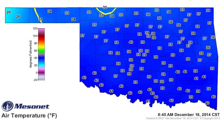
The weather outside is frightful
Okay, not in the sense of the old Christmas song, but to me, temps in the 30s
with drizzle is downright scary. Ugh, enough.
http://ticker.mesonet.org/archive/20141218/current-temps.png
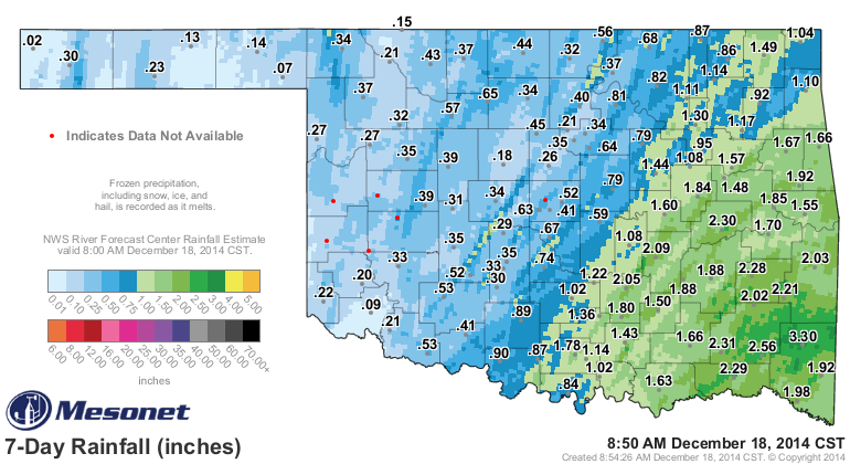
http://ticker.mesonet.org/archive/20141218/rain-since-midnight.png
I mean, really, do all those hundredths really help anything except make us
miserable (those of us that are sane...some people of questionable state of mind
actually like this weather). Welllll, I'll give in. I guess it keeps the fire
danger down, and we can use moisture of any kind. Speaking of moisture, the
recent rains did bring changes in the U.S. Drought Monitor map. They weren't
major, but they were there nonetheless. Most of the changes came across far SE
Oklahoma where a good 2-3 inches fell.
http://ticker.mesonet.org/archive/20141218/rainrfc.168hr.png
http://ticker.mesonet.org/archive/20141218/20141216_OK_trd.png
As per usual, most of the western half of the state was left low and slightly wet
(as opposed to high and dry...that's usually reserved for the Panhandle).
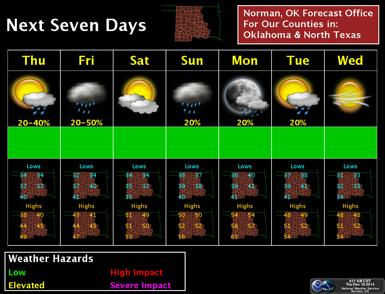
Don' expect much in the change in dreary weather over the next several days.
It would appear we'll stay with chances of rain (and clouds) for today and
tomorrow. A bit of respite on Saturday before more clouds (and rain chances)
on Sunday and Monday. This graphic from NWS-Norman doesn't cover the entire
state...but you get the picture. No, really, you do. I'm showing it to you in
this link!
http://ticker.mesonet.org/archive/20141218/nws-norman-7dayplanner.jpg
You can also see from that graphic that we'll see temperatures start to jump
up again as we approach the weekend with lots of 50s around, and lows staying
mostly above freezing.
Tulsa's graphic is very gray looking, and for good reason, detailing the lowered
skies and drizzle in store through today.
http://ticker.mesonet.org/archive/20141218/nws-tulsa.png
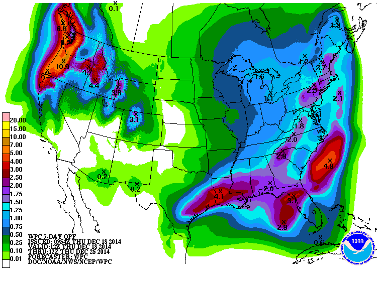
Let's gaze into the future. What is all this gray, drizzly/rainy weather supposed
to bring us? Well, probably not much (hello, it's drizzle!).
http://ticker.mesonet.org/archive/20141218/7day-moisture-forecast.gif
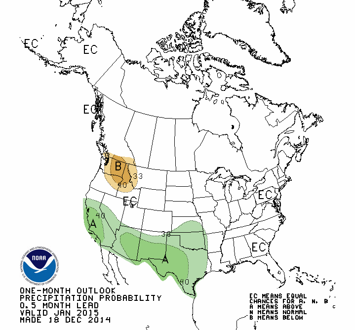
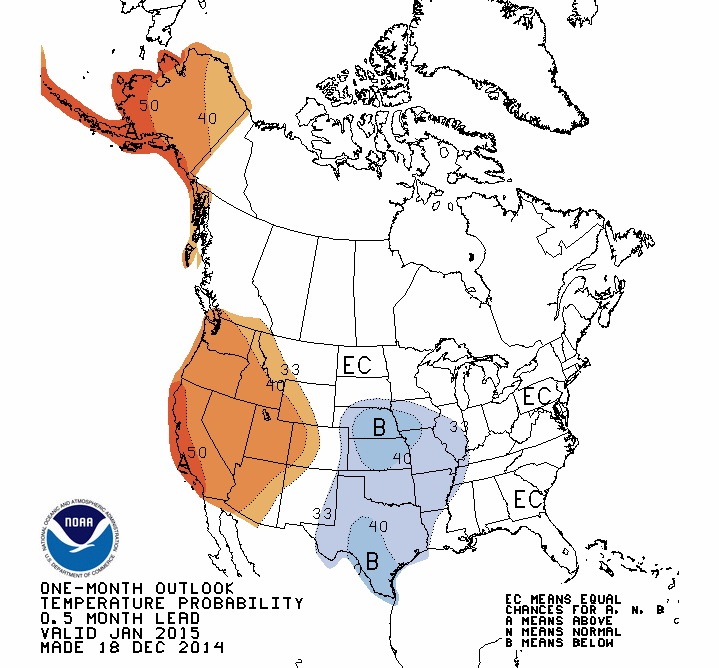
Here's some good news, the CPC outlooks for January call for increased odds of
below normal temperatures and above normal precip.
WARNING WARNING, DR. SMITH!! THAT DOES NOT AUTOMATICALLY EQUATE TO GOBS OF SNOW/
SLEET/ICE! What if temps are below normal but it's mostly on the high temperature
side? What if the cool periods don't intersect with the wet portions? See where
I'm going here? What if the outlooks are totally wrong? In that case, blame
somebody else!
http://ticker.mesonet.org/archive/20141218/jan-precip-outlook.gif
http://ticker.mesonet.org/archive/20141218/jan-temp-outlook.gif
I will say after reading the text discussion from the forecaster that this
January outlook came with a lot of uncertainty, based mainly on model outlooks
and "if this were to happen." Just a bit of transparency there.
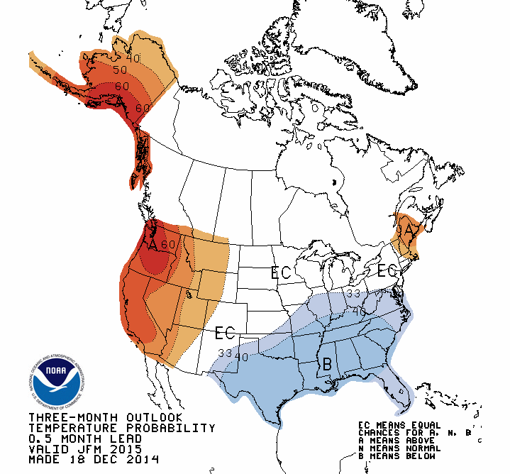
Sort of the same picture for the January-March period (the same warnings apply,
please do not try and forecast precipitation type from these outlooks).
http://ticker.mesonet.org/archive/20141218/jan-march-precip-outlook.gif
http://ticker.mesonet.org/archive/20141218/jan-march-temp-outlook.gif
The other cautions also apply here, with uncertainties being a bit high for
these outlooks.
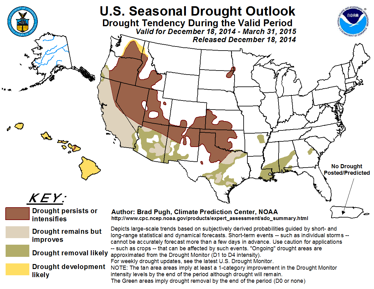
The bad news is that CPC expects drought to persist or intensify through March
2015, at least where it already exists across Oklahoma. At least no development
is indicated.
http://ticker.mesonet.org/archive/20141218/season_drought.png
This comes despite the call for increased odds of above normal temperatures.
The reason is simple: it's the driest time of the year, so above normal precip
doesn't necessarily mean drought-busting precip (as aptly put by the forecaster):
"Varying intensity of drought persists across the central and
southern Great Plains with exceptional drought centered over
southwest Oklahoma and northwest Texas. Although a tilt in the
odds towards above-median precipitation during JFM is forecast
for the central and southern Great Plains, a relatively dry
climatology favors persistence on a broad scale. Historically,
only 10 to 15 percent of the annual precipitation occurs during
this outlook period across Kansas, western Oklahoma, and northwest
Texas."
Give us those increased odds during May and June. Then we're talking.
Enjoy your gray.
Gary McManus
State Climatologist
Oklahoma Mesonet
Oklahoma Climatological Survey
(405) 325-2253
gmcmanus@mesonet.org
==================================================
The OCS/Mesonet Ticker
https://ticker.mesonet.org/
To subscribe or unsubscribe from the Ticker
or for questions about the Ticker or its content
Phone or Email the Ticker Manager at OCS
Phone: 405-325-2253 Email: ticker@mesonet.org
---------------------------------------------------
-C- Copyright 2024 Oklahoma Climatological Survey
===================================================
|


 Tweet
Tweet