MESONET TICKER ... MESONET TICKER ... MESONET TICKER ... MESONET TICKER ...
November 30, 2015 November 30, 2015 November 30, 2015 November 30, 2015
So, what's new?
http://ticker.mesonet.org/archive/20151130/winter.jpg
Well, some folks wanted winter and they got more than they bargained for. In fact,
judging by the, uh, fact, that Governor Fallin declared a state of emergency for
all 77 counties, I'd say we all did. If you're one of the lucky 100,000 or so that
got your power back (or never lost it), you've seen all the ice pictures you can
handle, so I won't add to the misery. Ice thicknesses from what I've seen peaked
out over in Caddo, Canadian and west Oklahoma counties from 0.75" or so, with
a few reports bigger than that.
Simply put, this was one of the most powerful, juicy storm systems to ever hit the
state during November with floods in the southeastern half of the state and
massive ice across the NW half. The ice sort of overshadowed the flooding across
the SE, but at one point nearly the entire eastern half of the state was under
some sort of flood advisory. Hugo led the state during this storm with nearly
10 inches of rain, but amounts from 4-8 inches were widespread across that SE
half of the state.
http://ticker.mesonet.org/archive/20151130/4day-rainfall-totals.png
Keep in mind that some of those gauges across the NW half of the state were
coated in over a half-inch of ice, and while much of that area has been above
freezing, it will take some time for that ice to melt and register in our
un-heated tipping bucket gauges. So the totals you see there are probably a bit
of an underestimate. With that understood, we are frighteningly close to having
had our wettest November on record, and also right in the range of finally
eclipsing 1957 as the wettest YEAR on record. Here are the current estimates
for November (with some melting to go).
http://ticker.mesonet.org/archive/20151130/november-totals.png
http://ticker.mesonet.org/archive/20151130/nov-depart-normal.png
http://ticker.mesonet.org/archive/20151130/nov-pct-normal.png
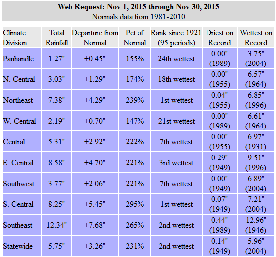
http://ticker.mesonet.org/archive/20151130/november-stats.png
Oh so close, just 0.21" away from 2004's 5.96". One thing to remember when we
talk about these records is that they are UNOFFICIAL until NCEI (formerly NCDC)
releases the official datasets in about a week or so, but our Mesonet numbers
are usually fairly close. I think we can safely say that both NE and SC OK
easily beat their records for wettest November on record.
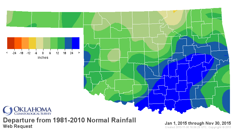
As for the year thus far, we now stand at 47.38", again, tantalizingly close to
1957's January-December (so we have a month to go still) statewide total of
47.88". Another 1.5 inches and yet another record will fall.
http://ticker.mesonet.org/archive/20151130/jan1-nov30-totals.png
http://ticker.mesonet.org/archive/20151130/jan1-nov30-depart.png
http://ticker.mesonet.org/archive/20151130/jan1-nov30-pct.png
If you look on that totals map, you'll see Tishomingo leads the Mesonet during
2015 with 77.1 inches. That in itself is also a record for the Mesonet, besting
Broken Bow's 76.61" from 2009. Now we still have a long way to go to top the
record for any observing station in Oklahoma. That mark stands at 84.47" from
Kiamichi Tower, a COOP observing site in LeFlore County. I'm not sure if
Tishiomingo can get another 7" in the next month, but if they, do...well, it
won't be pretty.
I have lots of figgering and writing to do for the November summary due tomorrow,
but hopefully we'll have a better accounting of just how much rain fell and
if we broke any other records. It does look like most of the state will be
get above freezing today, and then a bit more mild weather is in store for the
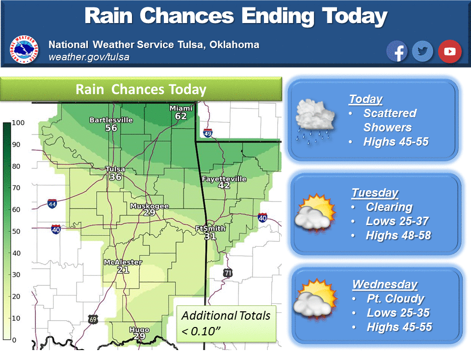
state for awhile before our next system hits next weekend. It doesn't appear at
this time that it will be nearly as strong as the last system, nor will there
be as much cold air with it.
http://ticker.mesonet.org/archive/20151130/todays-forecast-highs.png
http://ticker.mesonet.org/archive/20151130/nws-norman-7day-planner.jpg
http://ticker.mesonet.org/archive/20151130/nws-tulsa-forecast.png
Winter. Ugh.
Gary McManus
State Climatologist
Oklahoma Mesonet
Oklahoma Climatological Survey
(405) 325-2253
gmcmanus@mesonet.org
==================================================
The OCS/Mesonet Ticker
https://ticker.mesonet.org/
To subscribe or unsubscribe from the Ticker
or for questions about the Ticker or its content
Phone or Email the Ticker Manager at OCS
Phone: 405-325-2253 Email: ticker@mesonet.org
---------------------------------------------------
-C- Copyright 2024 Oklahoma Climatological Survey
===================================================
|


 Tweet
Tweet