MESONET TICKER ... MESONET TICKER ... MESONET TICKER ... MESONET TICKER ...
November 20, 2012 November 20, 2012 November 20, 2012 November 20, 2012
Would the real October-November, please stand up
This drought and its statistics continue to trouble me. Here's the deal ... the
October-November 2010 period was what got this whole shebang started, and we
ended up with our second driest water year (Oct. 1, 2010-Sept. 30, 2011) on
record with a statewide average of 20.4" (1956 is still the driest at 18.7").
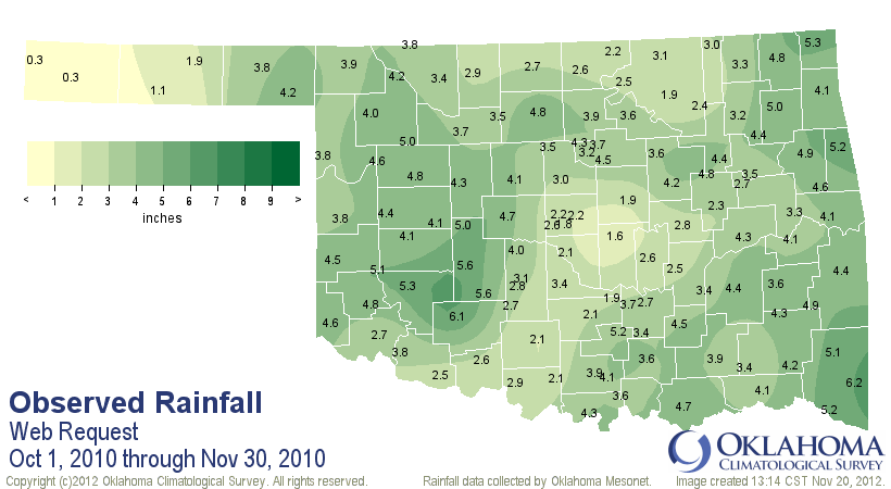
But that October-November period back in 2010 was extremely dry, and the
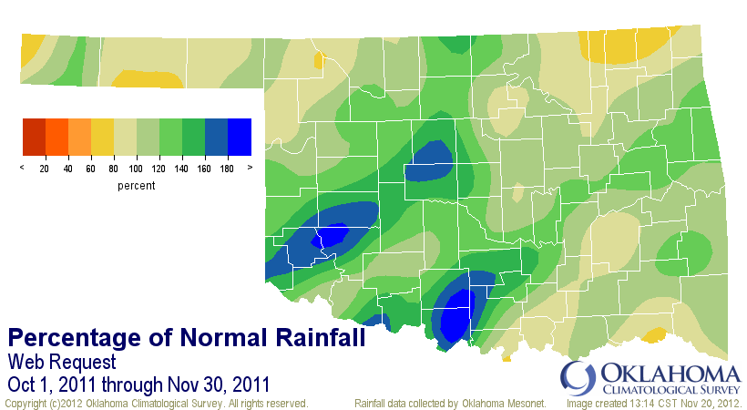
deficits just continued to mount through spring and summer. In comparison, the
October-November period from last year saw the beginning of significant relief
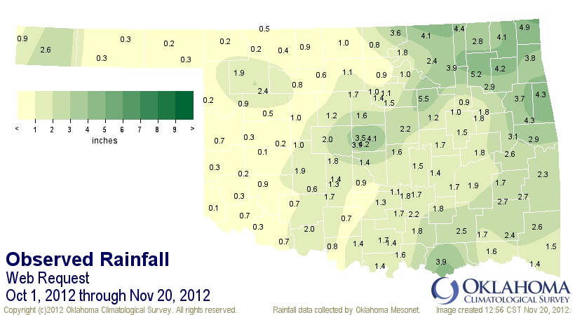
as we went through March 2012. Now this year, we're back to a 2010-style dry
period that is seeing drought intensify once again. Let's take a look at the
last three October-November periods (for 2012, Oct. 1-Nov. 20) and see how they
compare.
-****-
Year Statewide Avg. Departure Rank since 1895
2010 3.65" -2.5" 35th driest
2011 7.21" 0.9" 26th wettest
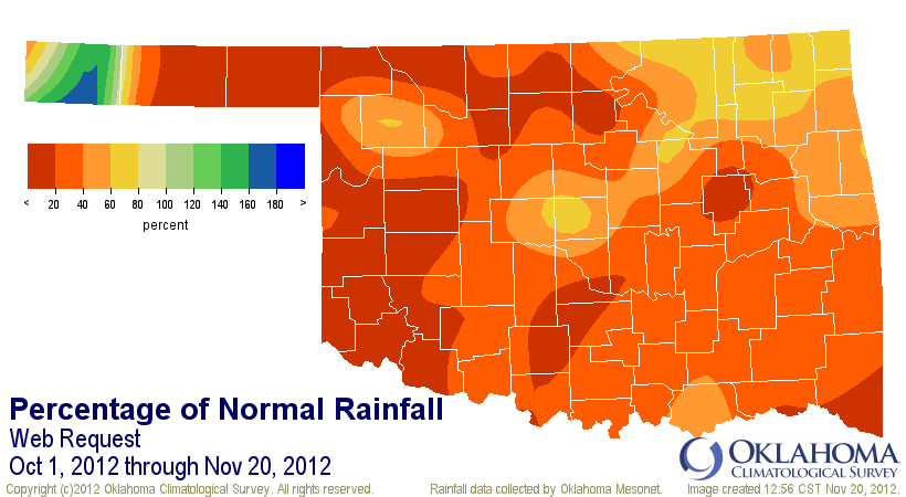
2012 1.66" -3.6" (within top 10 driest)
-***-
This October-November period thus far is more than twice as dry as the same
period during 2010 that started this whole mess off. Here are the three similar
periods in graphical form.
October-November 2010
http://ticker.mesonet.org/archive/20121120/oct-nov-2010-tots.png
http://ticker.mesonet.org/archive/20121120/oct-nov-2010-pct.png
October-November 2011
http://ticker.mesonet.org/archive/20121120/oct-nov-2011-tots.png
http://ticker.mesonet.org/archive/20121120/oct-nov-2011-pct.png
October-Nov. 20, 2012
http://ticker.mesonet.org/archive/20121120/oct-nov20-2012-tots.png
http://ticker.mesonet.org/archive/20121120/oct-nov20-2012-pct.png
Heck, 2010's October-November would be AWESOME right now, comparatively.
There's still not a lot of moisture showing up just yet. The 5-day has some
green painted over Oklahoma, but nothing significant at this time.
http://ticker.mesonet.org/archive/20121120/5day-rain.gif
From the North American Ensemble Forecast System (NAEFS), the chances of our
area receiving at inch of accumulated precipitation over the next 15 days
are not bad in eastern Oklahoma, but not too good across the western half of
the state. This is for today through December 5. Remember, these are the
probabilities of receiving an inch of accumulated precipitation.
http://ticker.mesonet.org/archive/20121120/NAEFS-15day.gif
Not a great start to the 2012-13 water year, but nothing has been normal
around these parts the last few years. So continue to expect the unexpected.
Gary McManus
Associate State Climatologist
Oklahoma Climatological Survey
(405) 325-2253
gmcmanus@mesonet.org
==================================================
The OCS/Mesonet Ticker
https://ticker.mesonet.org/
To subscribe or unsubscribe from the Ticker
or for questions about the Ticker or its content
Phone or Email the Ticker Manager at OCS
Phone: 405-325-2253 Email: ticker@mesonet.org
---------------------------------------------------
-C- Copyright 2024 Oklahoma Climatological Survey
===================================================
|


 Tweet
Tweet