Ticker for November 13, 2019
MESONET TICKER ... MESONET TICKER ... MESONET TICKER ... MESONET TICKER ...
November 13, 2019 November 13, 2019 November 13, 2019 November 13, 2019
All eyes on next week
So, having left the house yesterday morning without a coat (it's a long story, but
to make that long story short...I'm an idiot), I still having gotten my core
temperature up to normal. It doesn't just happen to annoying next door neighbors
who fall asleep in their hot tubs when the power goes off. I just happened to do
it on one of the coldest November days in state history.
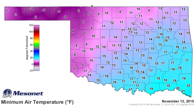
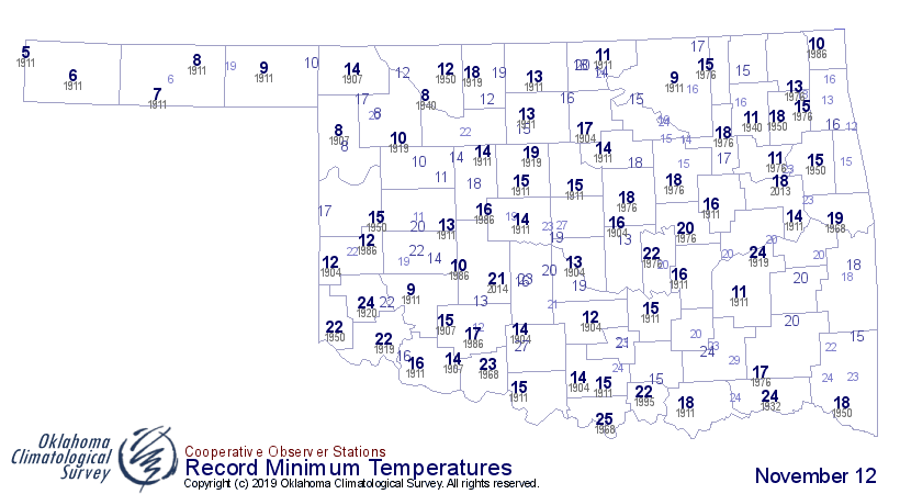
Check out the highs and lows, then compare those to the historical records for
November 12. In this case, we're talking lowest lows AND lowest highs.
Low temperatures
High temperatures
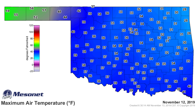
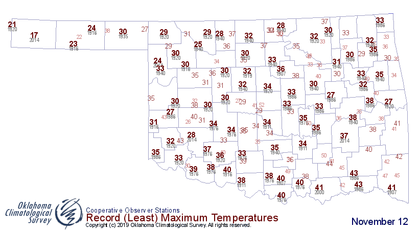
Just eyeballin' it, looks like we broke low temperature records throughout the
state, as well as heckuva lot of those lowest maximum temp records. That -4
degrees in Eva out in the Panhandle would tied for the 8th coldest November
temperature ever recorded for the state (not just November 12, all of November).
Tops (or bottoms?) would be the -15 degrees Kenton enjoyed back on Nov. 28,
1976.
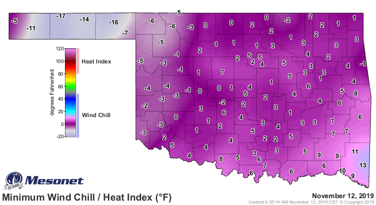
And those maps don't even take into account wind chills, which were absolutely
brutal yesterday.
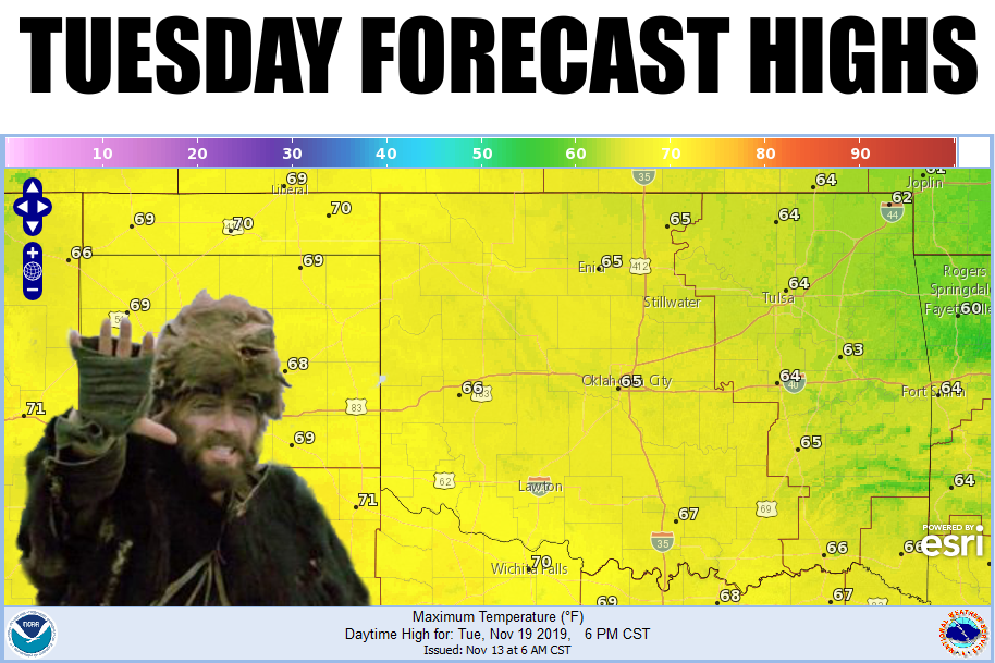
So we look forward, even as another cold front pushes through the state later
tonight. Luckily, it's not gonna be as cold as the last one, but it is going
to interrupt a pretty nice warm up that we'll see today. Heck, it's already
started out west.
We're in the dry doldrums again...occasional fronts, not much moisture, with
temperatures staying steady in the 50s and low 60s. Then we get to next week
where the upward momentum for those highs should continue to go up. How do
60s and 70s sound?
Let's have some 15 degrees ABOVE normal instead of below!
Gary McManus
State Climatologist
Oklahoma Mesonet
Oklahoma Climatological Survey
(405) 325-2253
gmcmanus@mesonet.org
November 13 in Mesonet History
| Record | Value | Station | Year |
|---|---|---|---|
| Maximum Temperature | 85°F | ALV2 | 1999 |
| Minimum Temperature | 7°F | EVAX | 2018 |
| Maximum Rainfall | 1.24″ | SULP | 1994 |
Mesonet records begin in 1994.
Search by Date
If you're a bit off, don't worry, because just like horseshoes, “almost” counts on the Ticker website!