Ticker for November 14, 2019
MESONET TICKER ... MESONET TICKER ... MESONET TICKER ... MESONET TICKER ...
November 14, 2019 November 14, 2019 November 14, 2019 November 14, 2019
Dune
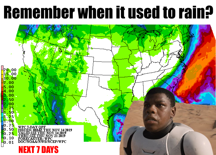
Amember (Okie to English translation: "Remember") when it used to rain? Eastern
Oklahomans, you can go read the Bizarro Ticker where we talk about too much rain,
but for the restovus, it's "what the heck happened?" Check out the Mesonet
precip maps for the last 30 days. Apply lip balm first...it's gonna dry you out.
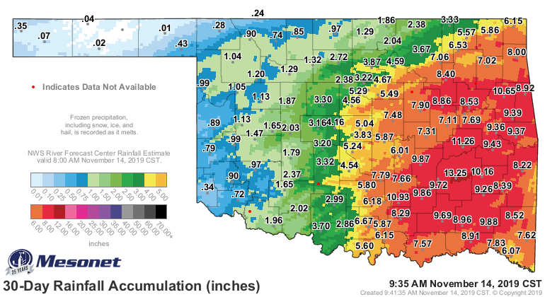
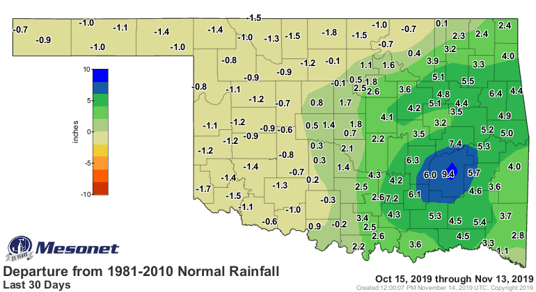

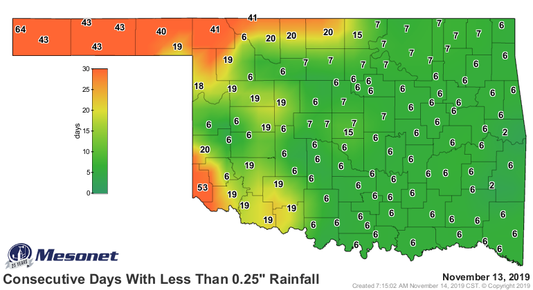
Eva, 0.4 inches. Goodwell, 0.2. Beaver, 0.1.
Hooker? Zero. Point. Zero.
That's not even an accurate picture of the dryness in the Panhandle. Their
scoreless streak goes back to early October. Hooker last saw moisture back on
October 3 when they got four-hundredths.
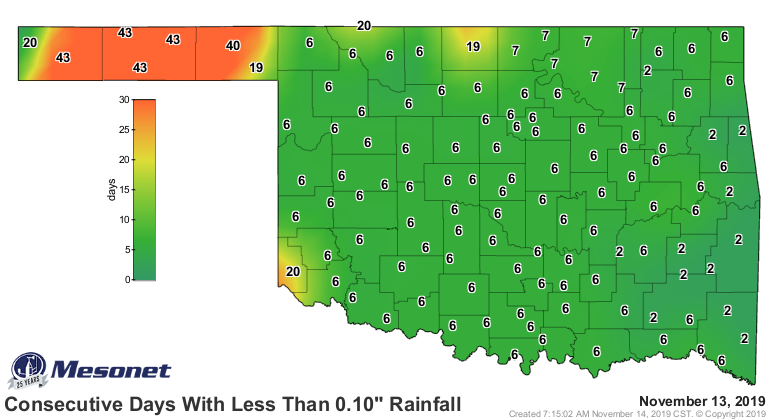
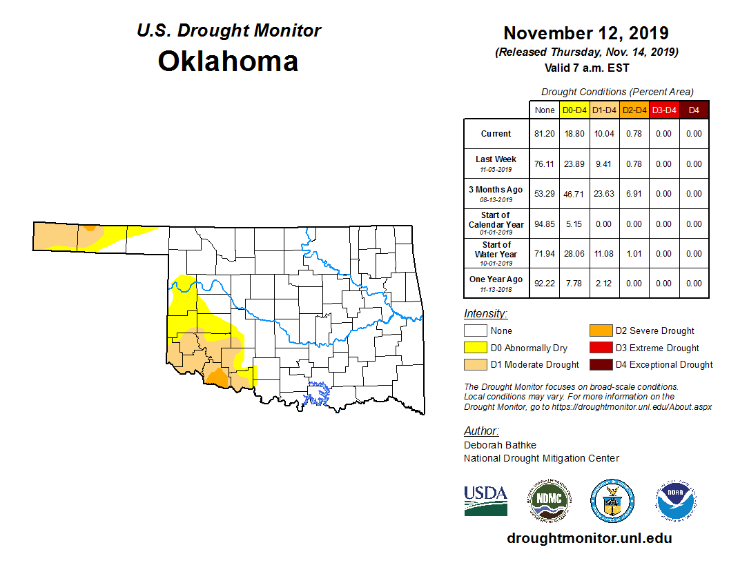
That has led to just a bit of expansion of drought out in the western Panhandle.
The only thing saving us from widespread intensification is that it has been
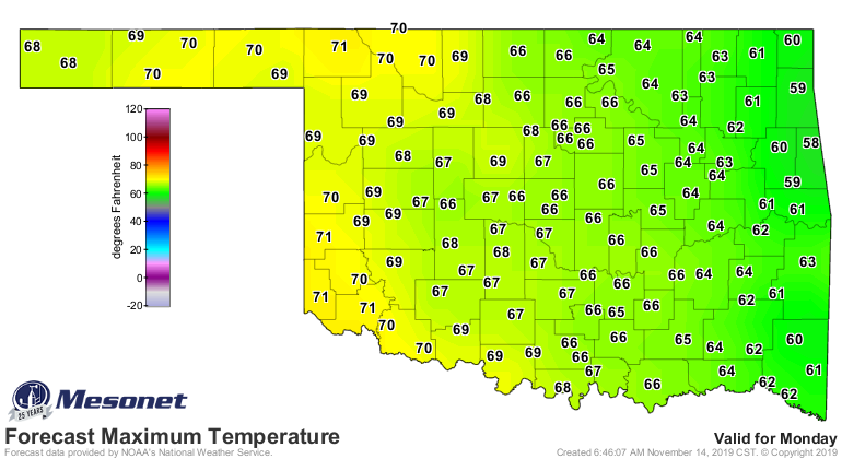
unusually cold through much of this time. That could change, though. Already
seeing 60s and 70s creeping their way, along with a drying downslope wind.
There is a bit of hope for the west. Looking into later next week, possibly
some increased moisture chances according to CPC.
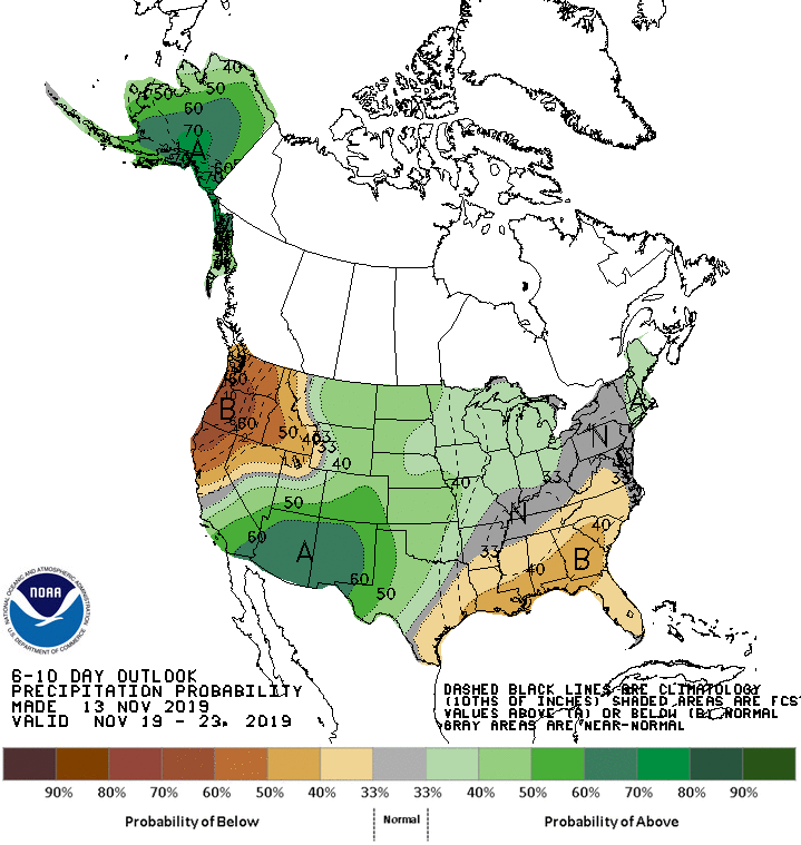
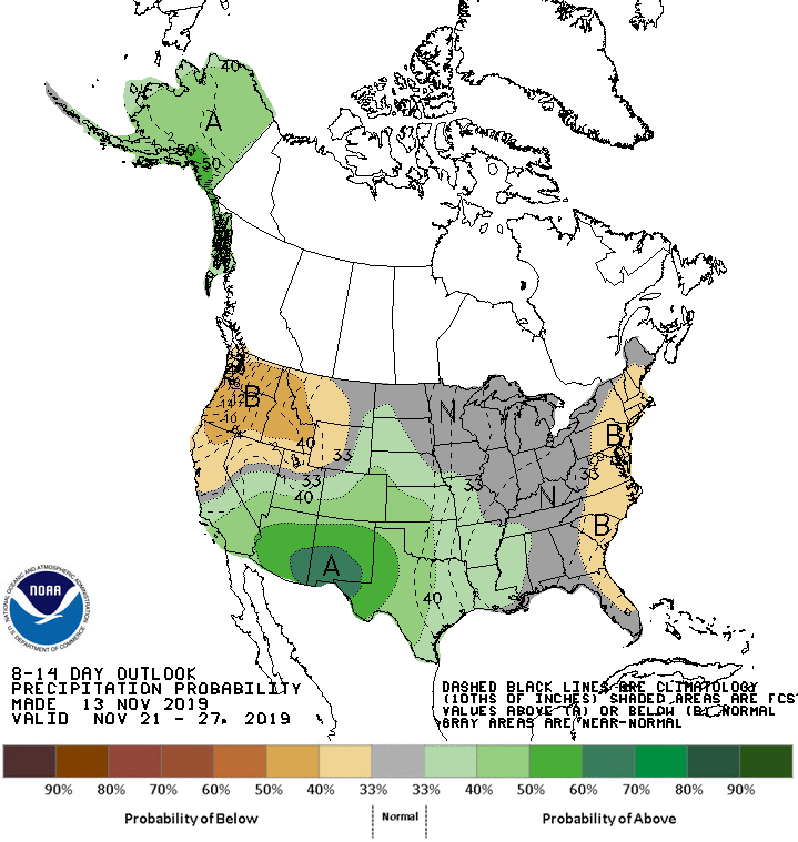
Eastern Oklahoma? Enjoy the dry weather.
Gary McManus
State Climatologist
Oklahoma Mesonet
Oklahoma Climatological Survey
(405) 325-2253
gmcmanus@mesonet.org
November 14 in Mesonet History
| Record | Value | Station | Year |
|---|---|---|---|
| Maximum Temperature | 89°F | GRA2 | 2025 |
| Minimum Temperature | 11°F | OILT | 2018 |
| Maximum Rainfall | 4.93 inches | CLAY | 1994 |
Mesonet records begin in 1994.
Search by Date
If you're a bit off, don't worry, because just like horseshoes, “almost” counts on the Ticker website!