Ticker for November 2, 2023
MESONET TICKER ... MESONET TICKER ... MESONET TICKER ... MESONET TICKER ...
November 2, 2023 November 2, 2023 November 2, 2023 November 2, 2023
I was told there would be no snow
Are ya like me (Oof...that's a tough pill to swallow...and a large stack of
therapy bills) and think...if it's gonna be cold, it might as well snow? I know,
what a brilliant saying that I just came up with (don't bother looking, just trust
me). And it has actually snowed in Oklahoma this season already! Again, don't
bother checking, because this time I'll show ya.
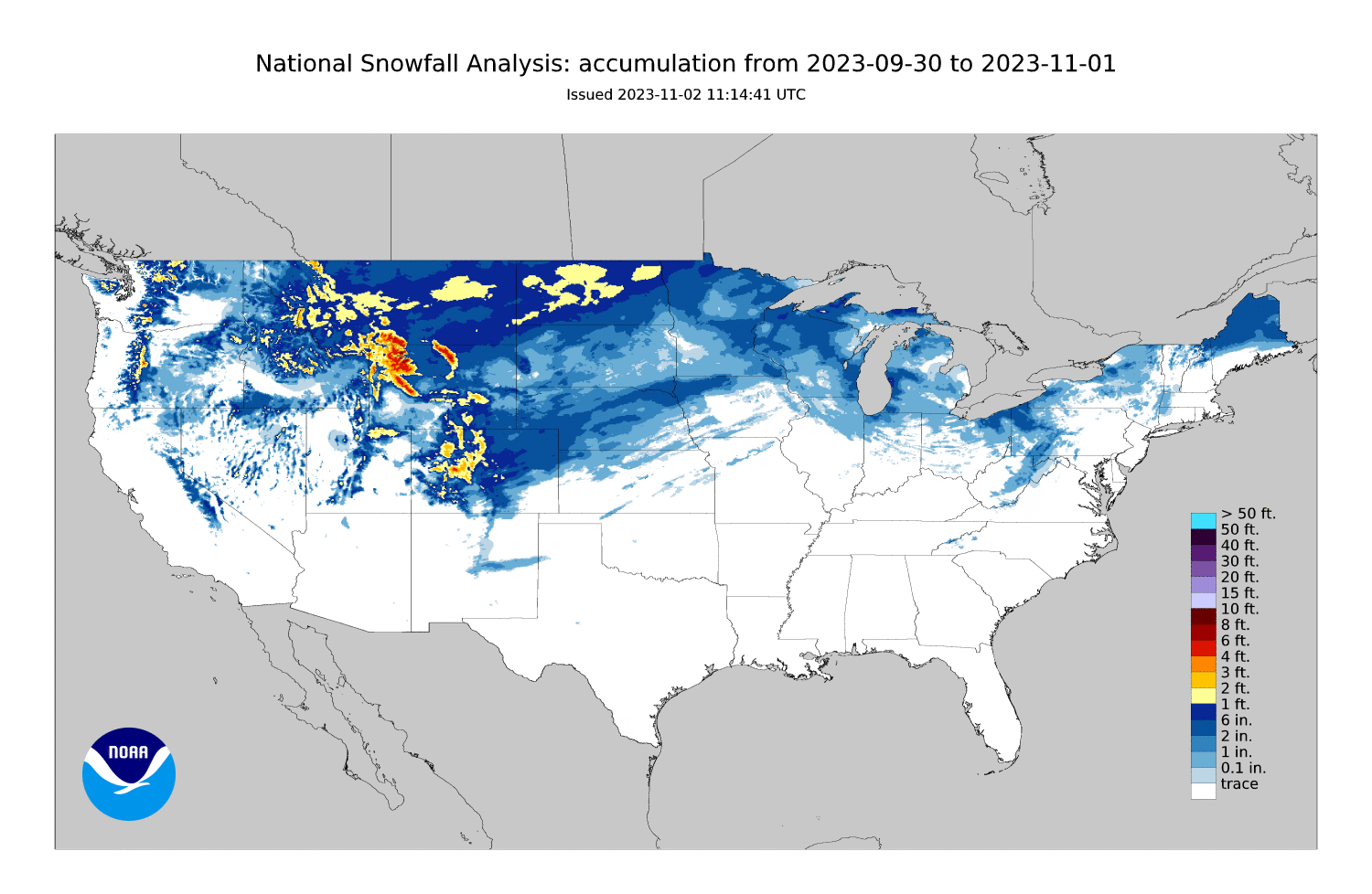
Hey now, snow is snow, and that streak across NW OK was snow last weekend. Do you
agree...yes or s(no)w? So here we are looking at a bit of climatological wizardry
from the fine folks at the Climate Prediction Center, showing what we've been
talking about for a few months, just in a more cogent and coherent manner. I know
it's more cogent and coherent because I DIDN'T KNOW WHAT COGENT MEANT UNTIL I
LOOKED IT UP! It just sounded good. You can read their much more refined research
here:
https://tinyurl.com/yx5r54hk
The gist of it is, due to the strengthening/lengthening of the sub-tropical jet
AND its shift south during El Nino, the chances for above normal precip and
below normal temperatures go along with it. That enhanced storm track, if
combined with the proper conditions (i.e., cold air), would mean an increase in
snow. Not always, of course. As with everything ENSO-related, we see more of a
"tilting of the odds" towards one outcome versus another. A weighting of the
dice. A disturbing of the balance. A disrupting of the status quo. A massive
overuse of metaphors. A beating of dead horses, if you will.
Okay, I'll stop.
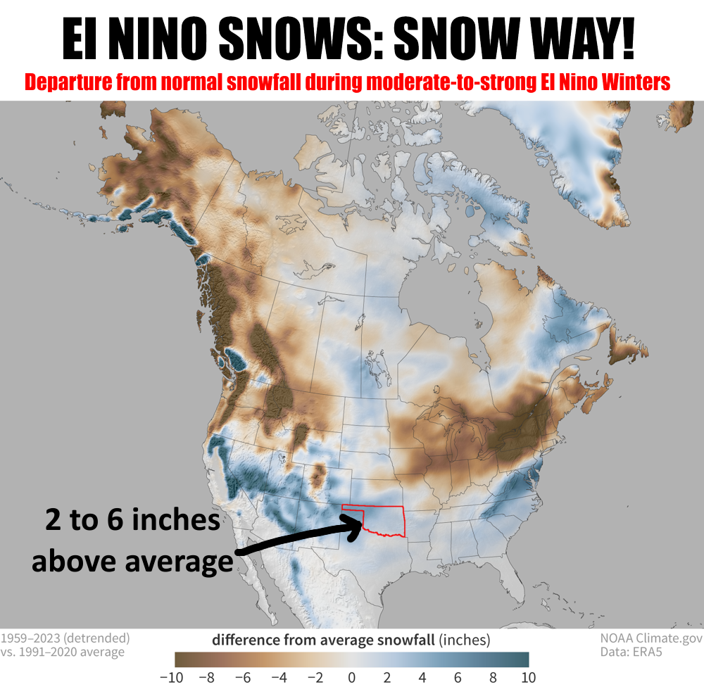
So that top graphic shows the difference from average snowfall for JANUARY
THROUGH MARCH periods during moderate-to-strong El Nino events. What we see
there is an increase in average snowfalls for Oklahoma of 1-2 inches across
eastern and southern OK, and 4-6 inches across NW OK (give or take a bit due
to me eyeballing the color scale). Now what does that actually mean in numbers,
should we see an increase in snowfall? Well, it's a bit complicated since looking
at those departures from averages and even this next map, our average annual
snowfall, are not meant to be a forecast but merely a "this is what has occurred
before." I know that's a bit subtle, bordering on annoying, but each year as
we go forward faces different climatological and meteorological factors that
would influence at attempt at a forecast. For example...the warm ocean waters
of 2023...how are those different than those of the previous 13 moderate-to-
strong El Nino winters since 1950?
Okay, all that out of the way, here's our normal snowfall for Oklahoma, based
off of 1991-2020 data.
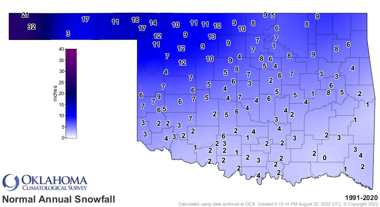
So an increase of 2-6 inches (or so) doesn't seem like a big deal. Well, unless
you're driving in it. But remember the average is derived from adding up all
the events big and small and coming up with that "average" figure. Yeah, duh
on me, right? Well, if there are small AND big numbers that end up as that
middle number, the chances are there for a "big" number every now and again.
In fact, if you look at those past 13 moderate-to-strong El Nino episodes, there
have been some years with less than normal snowfall, which is to be expected
because ENSO "tilts" the odds, remember? It doesn't guarantee a result.
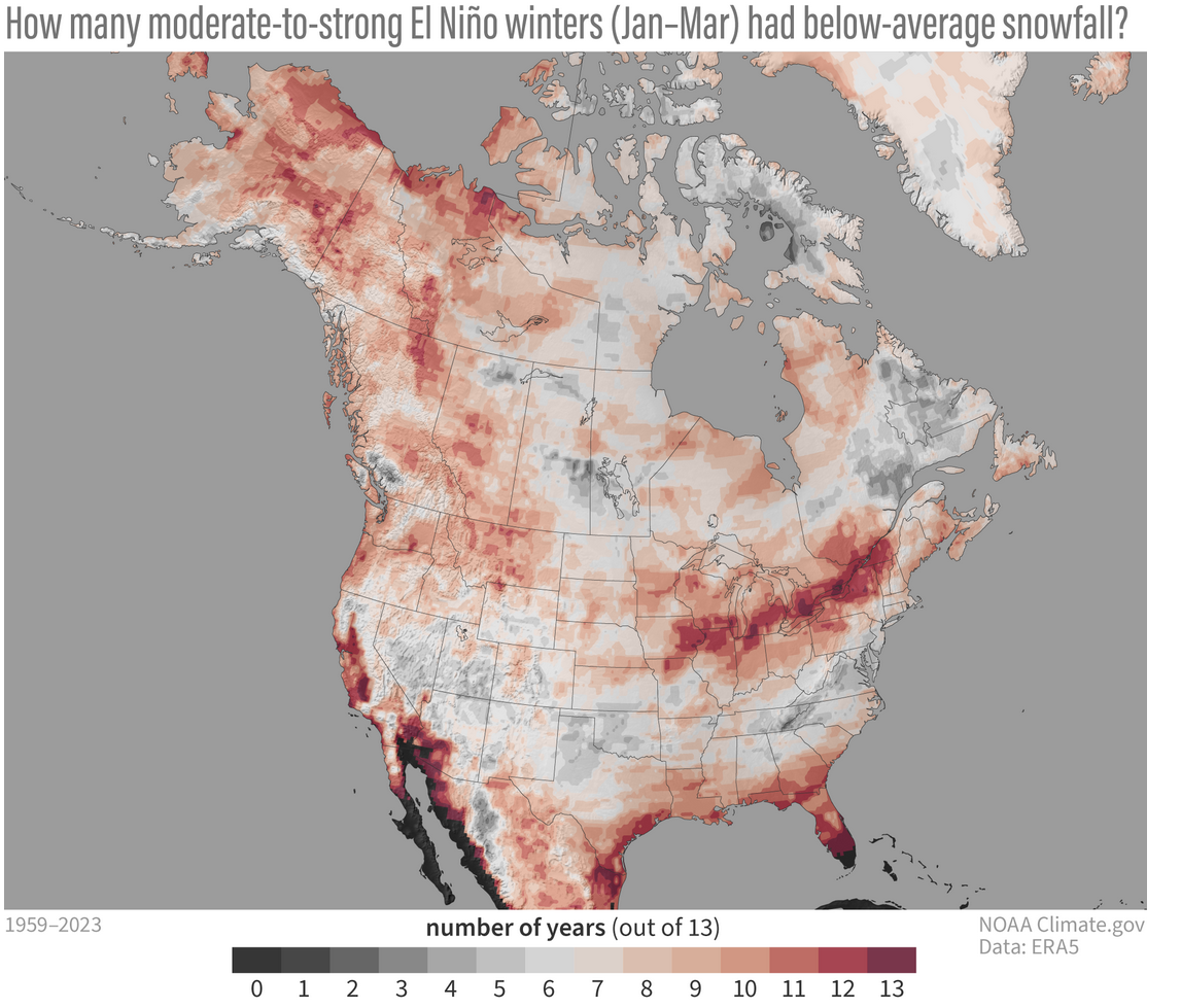
That map also shows that we see above average snows during these El Ninos more
often than not, so our first map isn't just a figment of a few big snows biasing
the results.
I know I've done statisticed the heck out of what was supposed to be something
exciting (MORE SNOW!). A gumming up of the works (oops, I said I would stop).
So here's the bottom line:
1. Our ODDS ARE TILTED towards increased snowfall this winter (don't worry
about the January-March part...it goes for now-forward).
2. Every El Nino is different, as are the impacts.
3. There are many other factors involved influencing our weather, ENSO is but
a part.
D. I'm not good at making lists.
5. At some point, the WEATHER overcomes CLIMATOLOGY, so those day-to-day weather
conditions are the real driver of "will we get snow?".
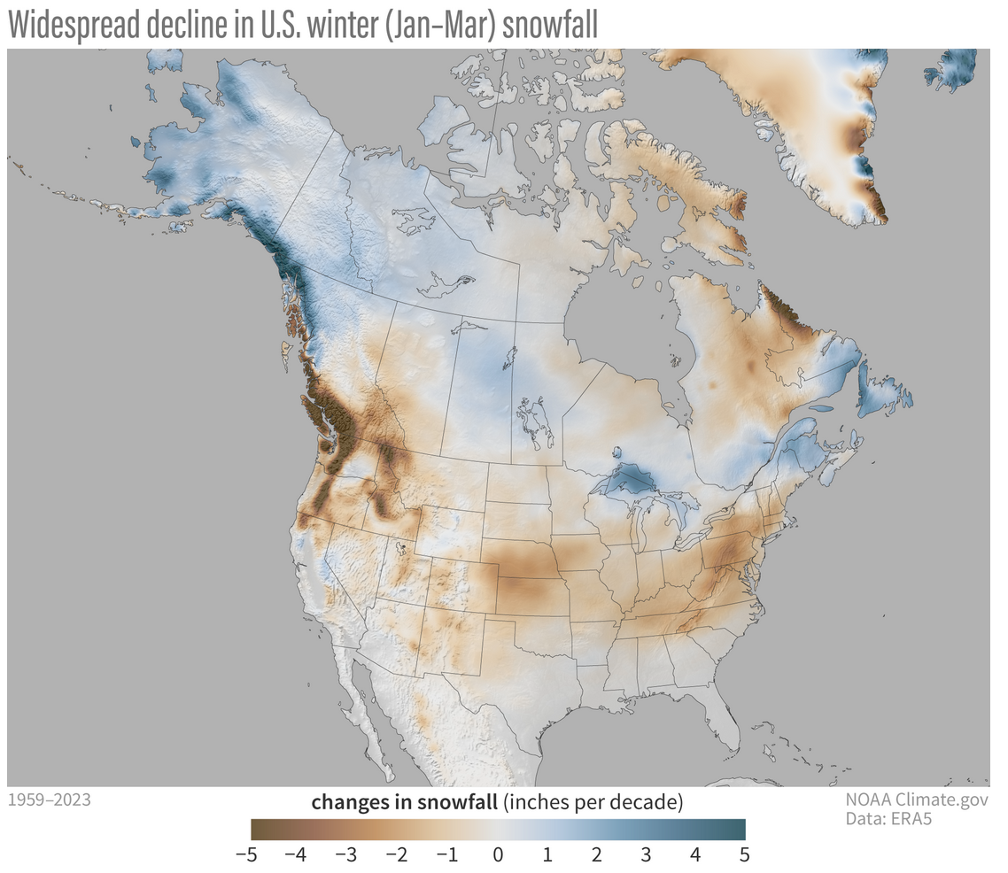
6. Snowfall has been decreasing over time as we've warmed.
So there's a bit of excitement during what is going to be a pretty boring period
of weather ahead.
Sorry, no snow there. But there is less drought!
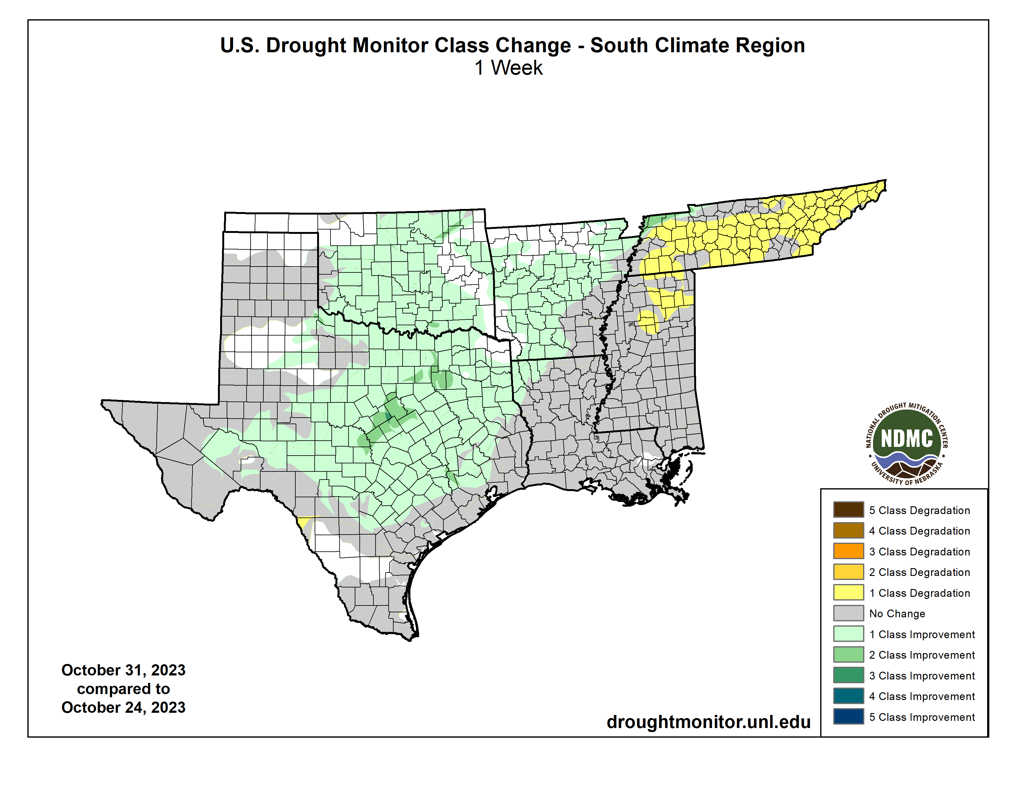
Now that's REALLY exciting!
Gary McManus
State Climatologist
Oklahoma Mesonet
Oklahoma Climatological Survey
gmcmanus@mesonet.org
November 2 in Mesonet History
| Record | Value | Station | Year |
|---|---|---|---|
| Maximum Temperature | 93°F | BURN | 2017 |
| Minimum Temperature | 15°F | KENT | 2004 |
| Maximum Rainfall | 4.12″ | HOLL | 2024 |
Mesonet records begin in 1994.
Search by Date
If you're a bit off, don't worry, because just like horseshoes, “almost” counts on the Ticker website!