Ticker for October 31, 2022
MESONET TICKER ... MESONET TICKER ... MESONET TICKER ... MESONET TICKER ...
October 31, 2022 October 31, 2022 October 31, 2022 October 31, 2022
Frightener
Yes there is, and don't call me Shirley.
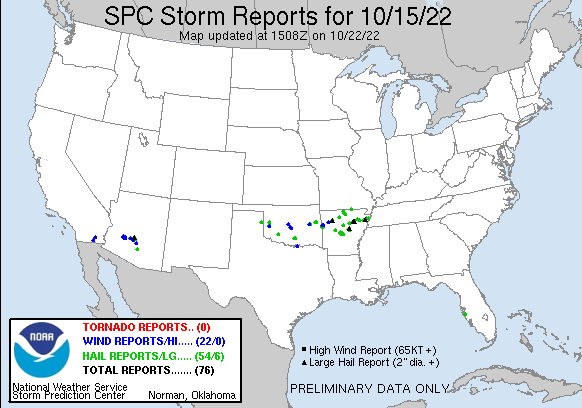
Remember our last big severe weather threat? Yeah, I don't either, so the fact
that this biggie is coming in the first week of November is both a shock and
not-a-shock...sort of like when I found out my hair would still grow fast, but it
was just in my ears and eyebrows. We did have a severe thunderstorm watch back
on Oct. 15 or so, but it wasn't like we had a large area of organized severe
weather being warned (or watched) about 5 days out.
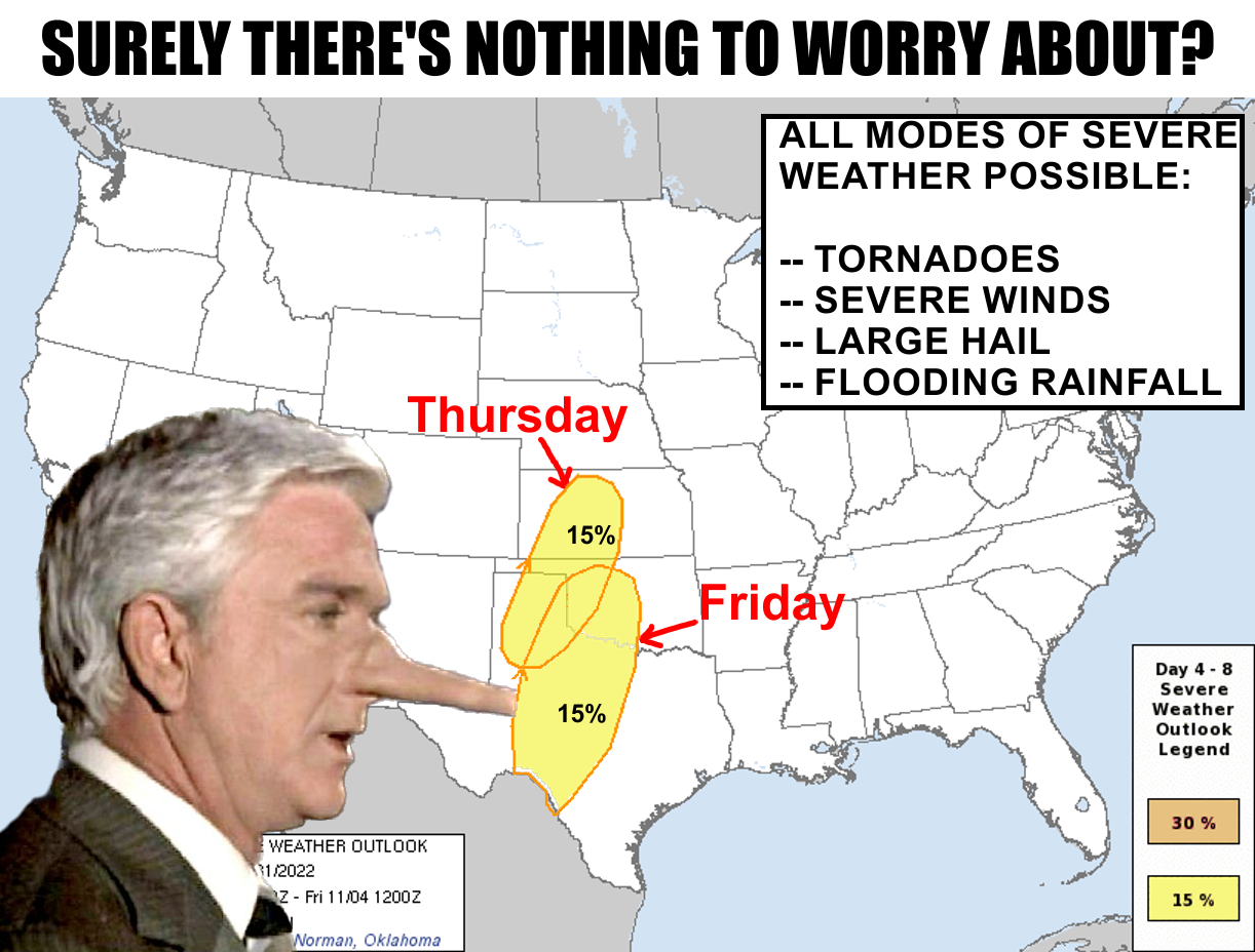
The setup is sorta classical for us as a big closed upper-low moves into the West
and kicks up our southerly winds, bringing lots of Gulf Moisture (and warmer air)
up our way. We'll have a dryline and front to deal with as we get into Thursday
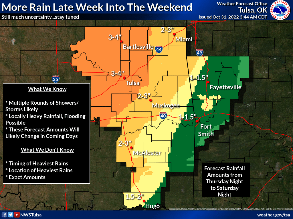
and Friday, so a focus for severe storms. Then as that upper low swings out over
us, the threat turns more towards heavy rain on Saturday.
At least that's how it looks now. Here's the word from SPC's mouth:
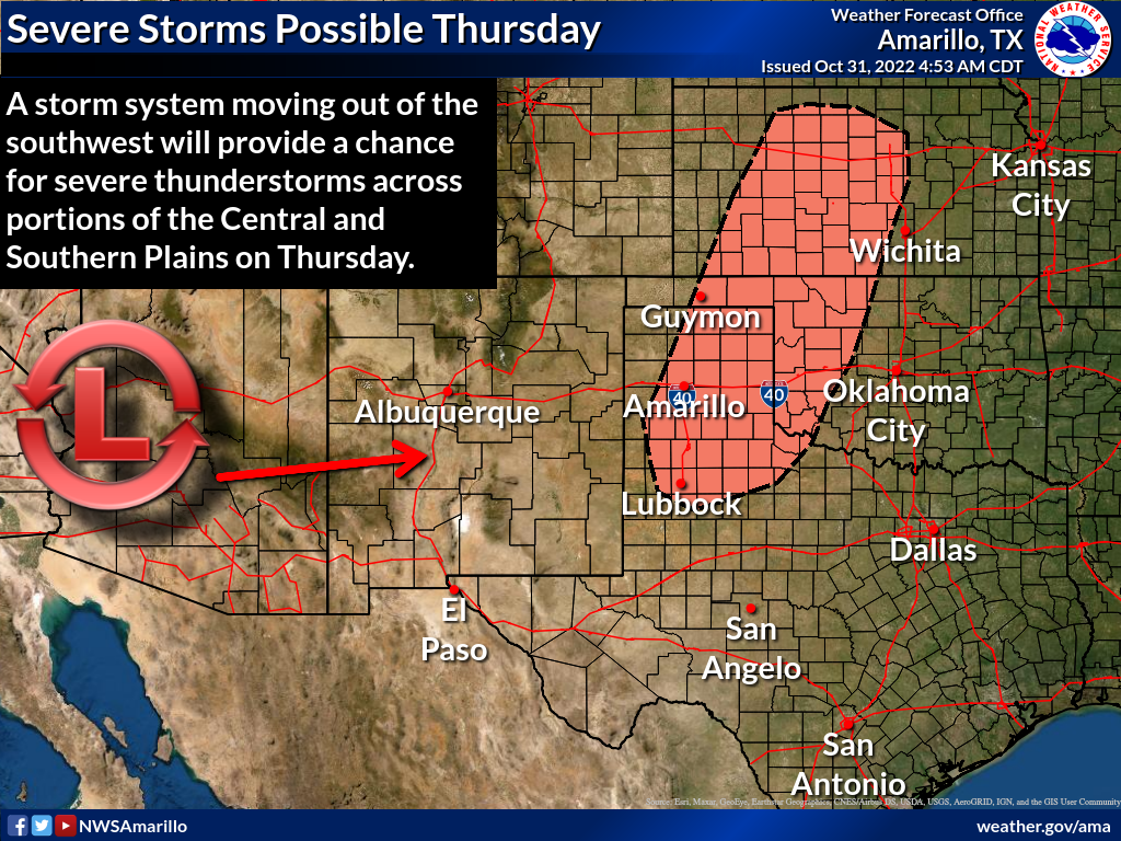
"Severe potential appears most likely across portions of the TX
Panhandle into northwest OK and western KS beginning Thursday
evening into the overnight hours as stronger height falls and
increasing ascent spreads eastward into western portions of the
central/southern Plains. Forecast soundings indicate thermodynamic
and shear profiles favorable for organized cells capable of all
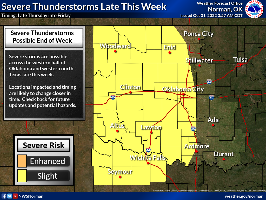
severe hazards. On Friday, the surface front is forecast to move
slowly eastward across western TX/OK. A combination of heavy rain
and severe potential is expected, with greatest relative severe
potential likely focused across southern portions of OK into
western/central TX near and south of a surface low."
Right, "all severe hazards." Not to focus too much on tornadoes...
"Tornadoes? Heck, the hail will probably kill ya!"
Well, that's how meteorologists watch that waterfall scene from "Butch Cassidy
and the Sundance Kid."
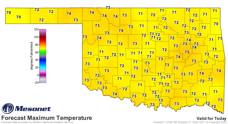
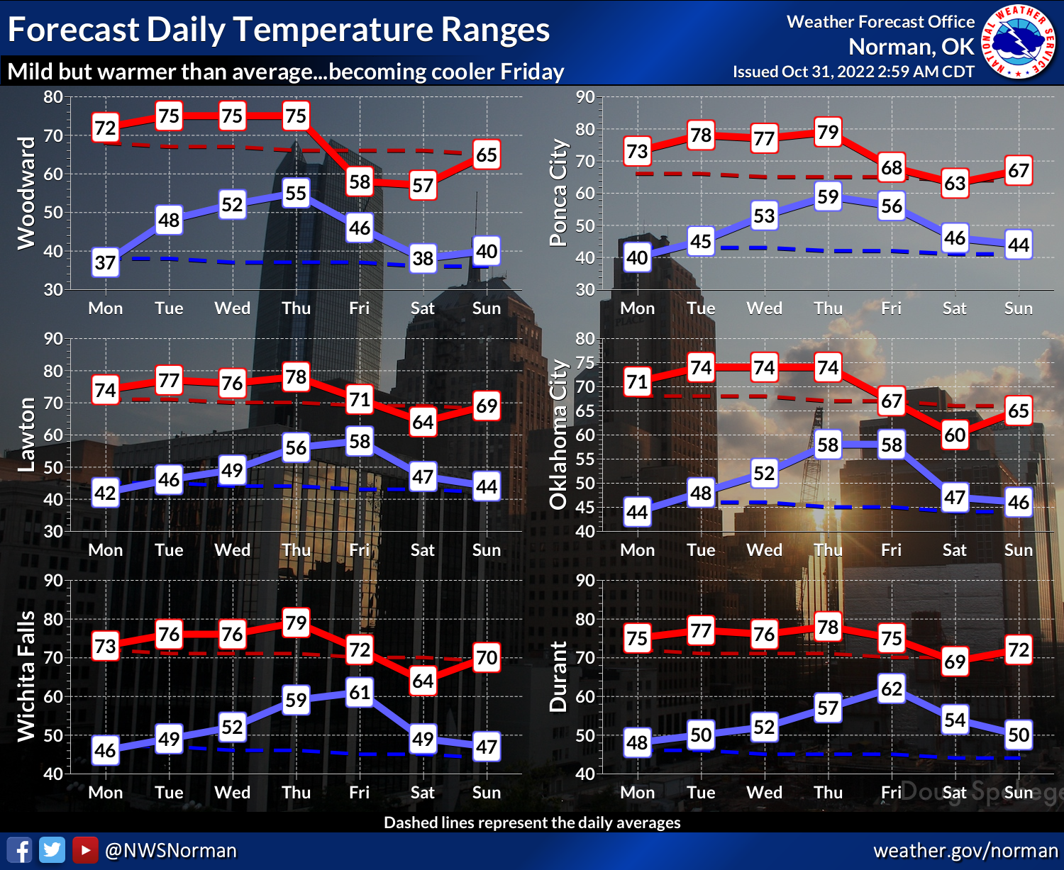
Still lots to sort out, but we will have another week of temperatures 10-15
degrees above normal as that wind machine kicks in, and the added moisture
should help us stay pretty warm in the mornings. Another added benefit:
Halloween looks fantastical.
Now of course we do need to wait and see how the forecast maps and outlooks
change as the storm draws more near...things could and probably WILL change,
but that rainfall map looks deliciously wet for this weekend.
Here are the scenarios and the cautionary language coming from our local NWS
offices, in order of westness.
So obviously the time to prepare is now. Yes, for the possibility of severe
weather, but also for eating all that candy tonight.
One final word, and this is important...always, and I mean ALWAYS, pick Snickers
over Milky Way.
Gary McManus
State Climatologist
Oklahoma Mesonet
Oklahoma Climatological Survey
gmcmanus@mesonet.org
October 31 in Mesonet History
| Record | Value | Station | Year |
|---|---|---|---|
| Maximum Temperature | 92°F | BEAV | 2016 |
| Minimum Temperature | 0°F | KENT | 2019 |
| Maximum Rainfall | 4.64″ | KING | 1998 |
Mesonet records begin in 1994.
Search by Date
If you're a bit off, don't worry, because just like horseshoes, “almost” counts on the Ticker website!