Ticker for October 24, 2023
MESONET TICKER ... MESONET TICKER ... MESONET TICKER ... MESONET TICKER ...
October 24, 2023 October 24, 2023 October 24, 2023 October 24, 2023
Subtropical fun
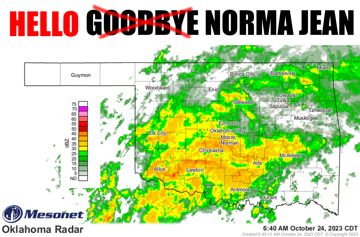
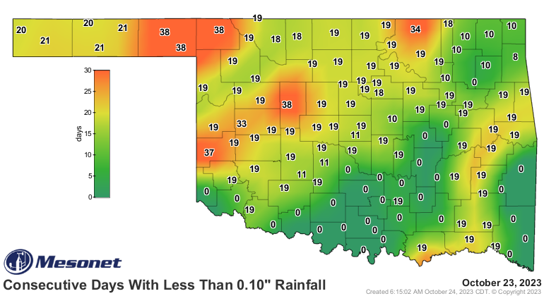
The Ticker is officially off again today but I had to Tick this morning to Tock
about the remnants of Norma, FINALLY arriving after all the talk and FINALLY
breaking our rain embargo, otherwise known as flash drought. At least for much
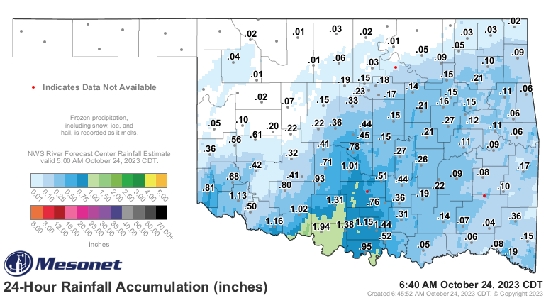
of southern OK. The rain totals are increasing even as I type.
At the very least, it's good to see these maps being reset.

And remember, this is one of three storms visiting the state over the next 5 or 6
days. Oh what the heck, let's call it 7 just in case. So those rainfall totals are
gonna be going up even more after today's rain.

Unfortunately, not all will enjoy those larger amounts with the northwest and
Panhandle being largely (relatively speaking, which is an odd way to speak--try it
for yourself and find out) left out, but then again not all will "enjoy" those
large amounts if it leads to flooding.
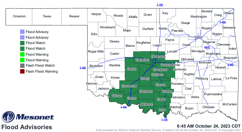
The risk for flooding will continue with our second storm moving through late
tonight through Thursday morning as those soils become saturated from the
Norma remnants moisture.
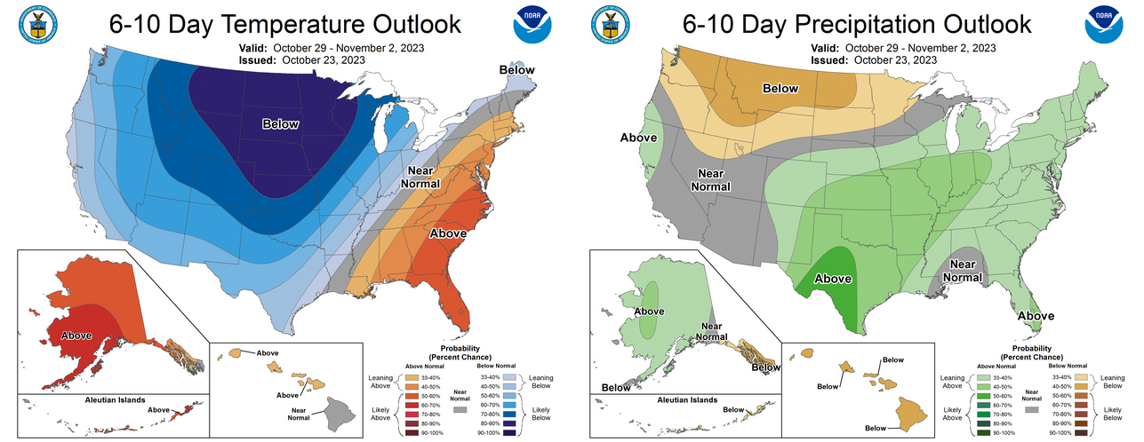
Also as we noted yesterday, a big change is coming for this weekend with a
more widespread (and hard) freeze, more moisture, and the possibility of
frozen precip for NW OK. The outlooks for the end of the month and early
November give those hints for our first bigtime arctic cold front, a veritable
Blue Norther. No, I don't know what "veritable" means, but I used it anyway.
By the way, Blue Norther was my band's name in seminary school (which I flunked
out of for drinking all the sacramental grape juice).
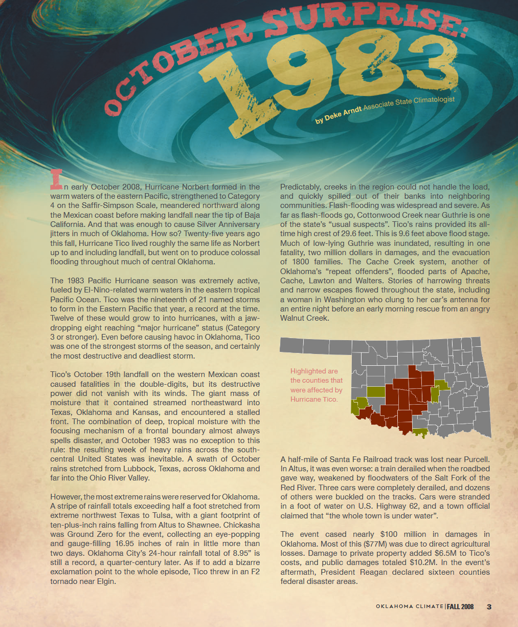
Hey, did you know that 40 years ago, Norma's Uncle Tico made a visit from nearly
the same spot in the Pacific off the west coast of Mexico, bringing Oklahoma
some of its worst flooding in its history? Yep, in 1983 Hurricane Tico made
the same journey north and interacted with a stalled cold front, dumping as
much as 16.95 inches of rainfall in Chickasha over a two-day period. Former
Ticker writer extraordinaire and now Chief of the U.S. climate branch NCEI wrote
about Tico's visit back in our 2008 seasonal summary. I've captured the pages
here.

Luckily, no stalled front over us right now, so we'll get breaks in the action
as the storm systems roll through.
Gary McManus
State Climatologist
Oklahoma Mesonet
Oklahoma Climatological Survey
gmcmanus@mesonet.org
October 24 in Mesonet History
| Record | Value | Station | Year |
|---|---|---|---|
| Maximum Temperature | 96°F | GRA2 | 2003 |
| Minimum Temperature | 20°F | BEAV | 2005 |
| Maximum Rainfall | 6.72″ | MCAL | 2019 |
Mesonet records begin in 1994.
Search by Date
If you're a bit off, don't worry, because just like horseshoes, “almost” counts on the Ticker website!