Ticker for October 23, 2023
MESONET TICKER ... MESONET TICKER ... MESONET TICKER ... MESONET TICKER ...
October 23, 2023 October 23, 2023 October 23, 2023 October 23, 2023
Icy pumpkins
I'll be darned if I didn't speak a Blue Norther into existence, just in time for
Halloween! I had no idea I had this kind of power. Let's see...
FULL HEAD OF HAIR!
HAIR LIKE STALIN!
PATRICK SWAYZE IN-"DIRTY DANCING" HAIR!!
Rats.
MORE EYEBROW HAIR!
Okay, maybe it does work.
How about this...
HEAVY RAIN!
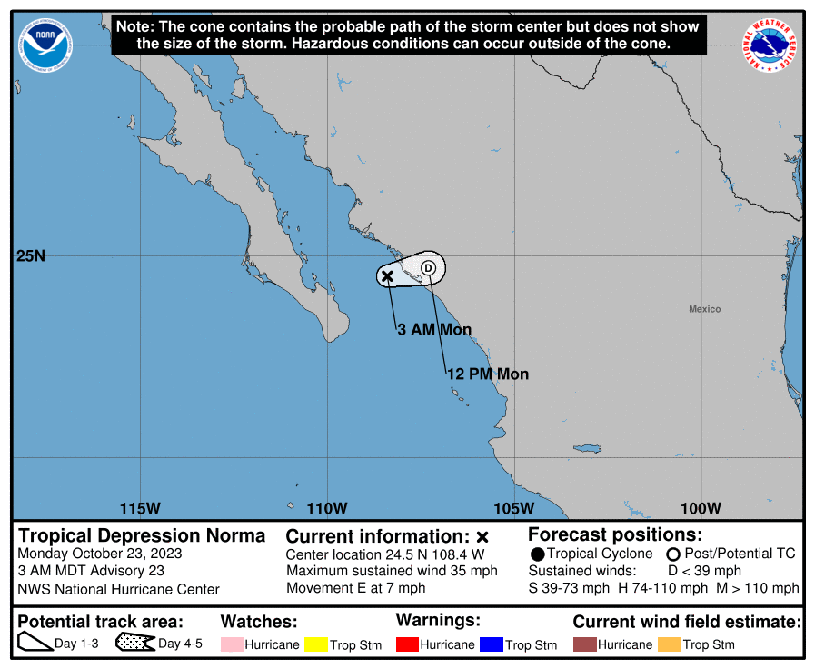
Hmmm, we might be onto something. As promised (guessed??), Hurricane Norma-now
Tropical Depression Norma-is onshore down in western Mexico and headed
northeast towards Oklahoma. I really don't know why it needs to be depressed.
I mean, it's a nice looking storm and all. Anyway, it will arrive in the form
of a short-wave with some nice mid-level moisture associated with it later today
into tonight, possibly giving us showers and storms. The real benefit is the
return low-level moisture from the Gulf thanks to a high pressure system to
our east and an approaching upper-level trough to our west. That will give all
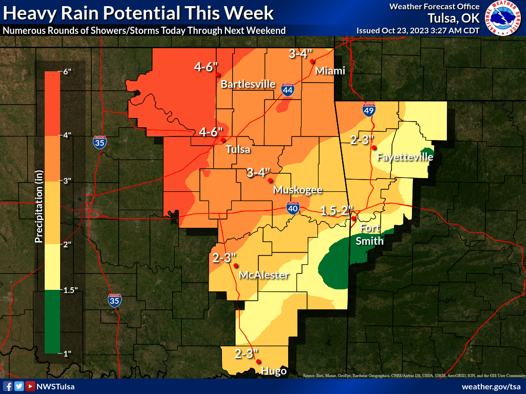
that "lift" something to work with. Rainfall amounts over the next 5-7 days
could be considerable, at least for SW through central parts of the state. Totals
diminish to both sides from there, but somebody is getting some really big
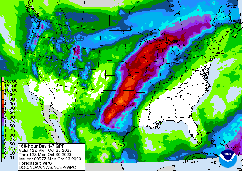
rains, it would appear. Here's the 5-day rain forecast. I'll throw the 7-day
in there as well, because we are expecting some possible rains through the
weekend.
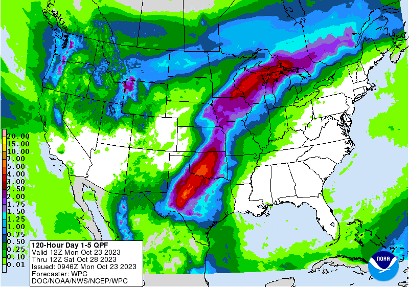
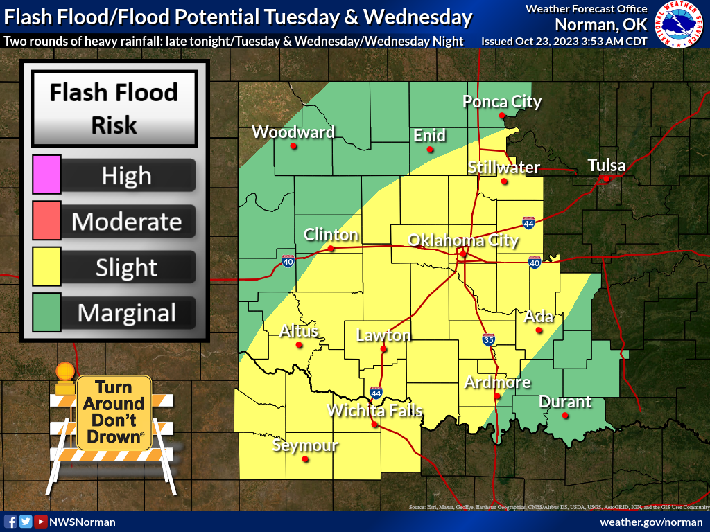
Now the worry with this type of heavy rain during drought is the possibility of
flash flooding, so that will need to be watched.
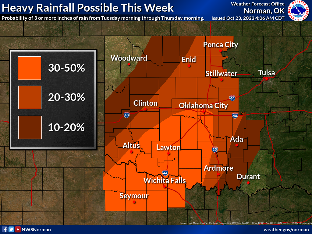
As per usual, with this type of training from southwest to northeast, somebody
will get a ton of rain and their friends in another part of the county might
get a lot less, so keep that in mind when you look at those rainfall forecast
maps.
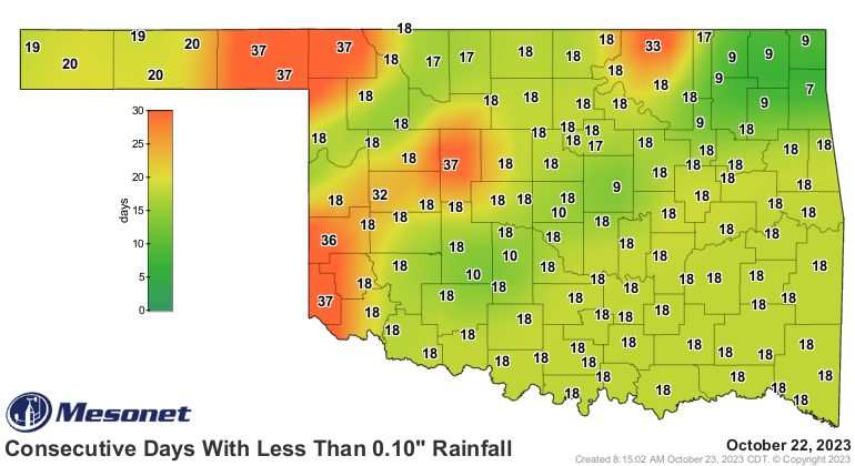
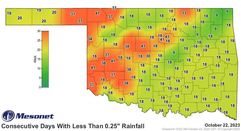
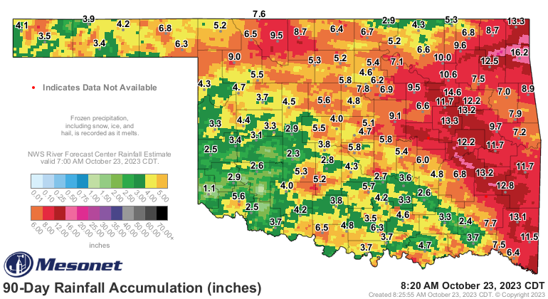
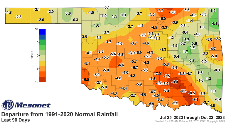
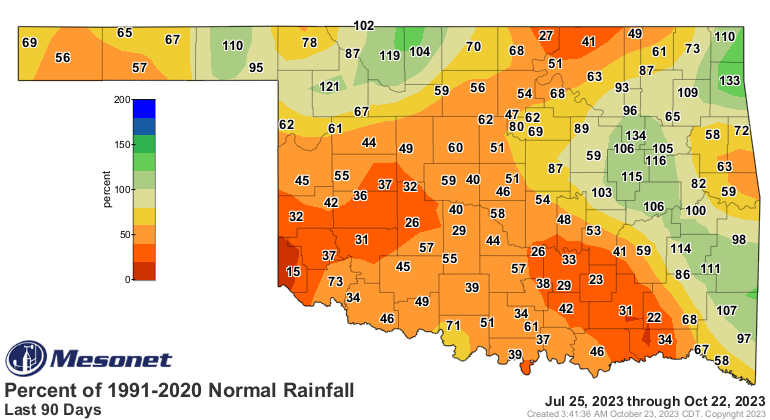
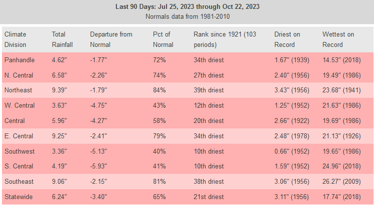
We desperately need that rain. This flash drought AND long-term drought,
depending on where you are, has gotten worse as we go out to the 90-day period.
To add insult to injury (oh, I've had plenty of injuries added to my insults as
well!), us folks that abhor (English to Okie translation: hate) cold weather
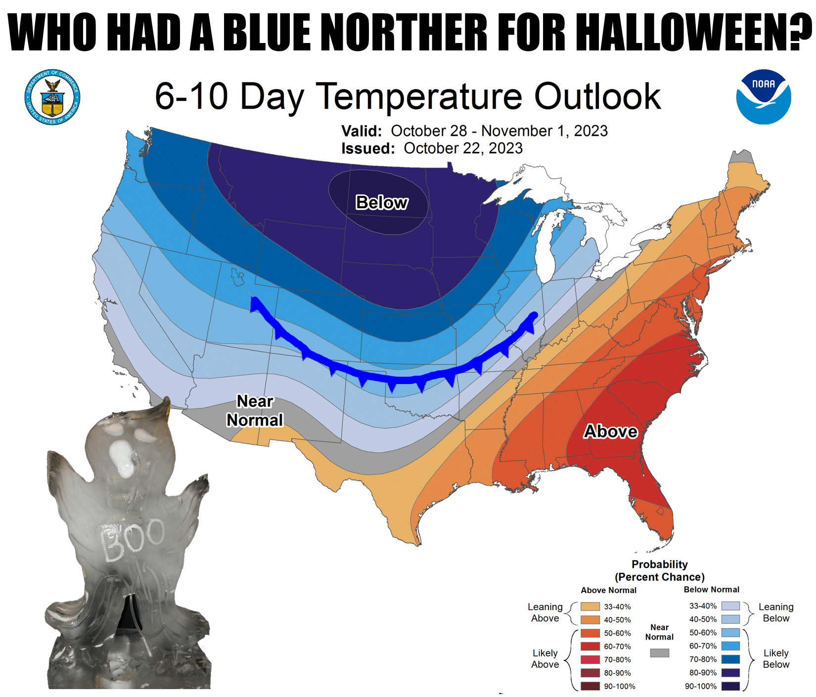
are going to have to put up with a transition to winter for Halloween. As I
said previously, I have been joking about our first big winter incursion coming
sometime for Halloween, and now that looks distinctly possible. It's too
difficult to say exactly when yet, being just at the edge of Fantasy-cast
territory, but sometime between Friday and Sunday, Oklahoma's gonna get a nice
layer of frost on its pumpkins! And given that there will be some moisture
around with it, don't be shocked if there is some sort of wintry precip up in
the Panhandle, and maybe a bit into northern OK.
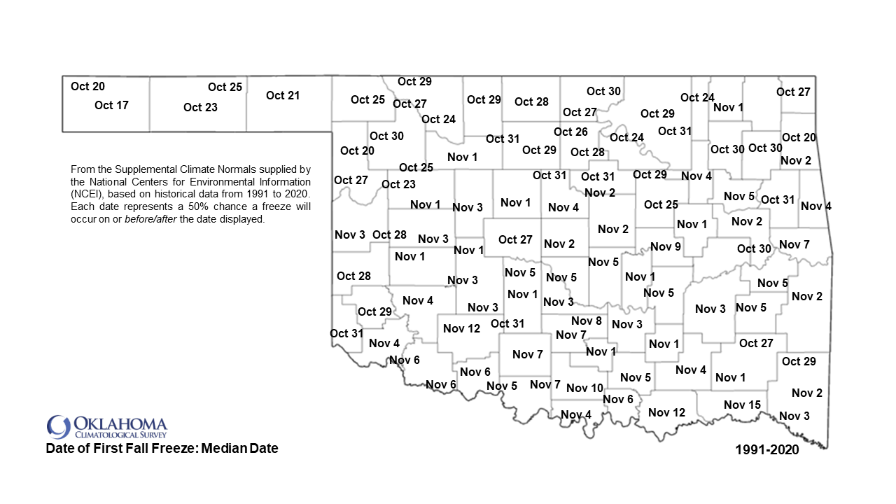
We will worry more about that as the pattern change starts to solidify (frozen
solid??), but we are getting dangerously close to those average first freeze
dates, for those that haven't already hit that mark.
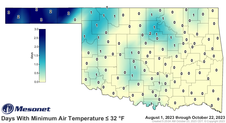
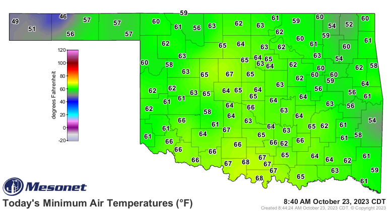
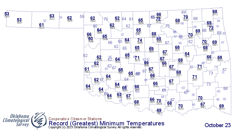
We hot weather lovers can bask in today's record-breaking low temperatures
on the WARM side, at least.
HAIR LIKE JASON MOMOA!!
Rats!
Gary McManus
State Climatologist
Oklahoma Mesonet
Oklahoma Climatological Survey
gmcmanus@mesonet.org
October 23 in Mesonet History
| Record | Value | Station | Year |
|---|---|---|---|
| Maximum Temperature | 96°F | WAUR | 2024 |
| Minimum Temperature | 21°F | EVAX | 2020 |
| Maximum Rainfall | 4.31 inches | BROK | 2015 |
Mesonet records begin in 1994.
Search by Date
If you're a bit off, don't worry, because just like horseshoes, “almost” counts on the Ticker website!