MESONET TICKER ... MESONET TICKER ... MESONET TICKER ... MESONET TICKER ...
October 13, 2015 October 13, 2015 October 13, 2015 October 13, 2015
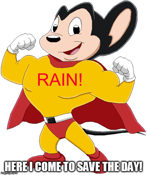
Mighty Rain?
http://ticker.mesonet.org/archive/20151013/rain.jpg
Well, maybe. I don't have to tell you that it has gotten dry across most of
Oklahoma. I did that yesterday. And I don't have to tell you that it has been
unseasonably warm, either. But I'm going to anyway. Since September 1, the
statewide average temperature is 2.9 degrees above normal at 73 degrees. Average
highs are running 2.7 above normal and average lows about 3.2 degrees above.
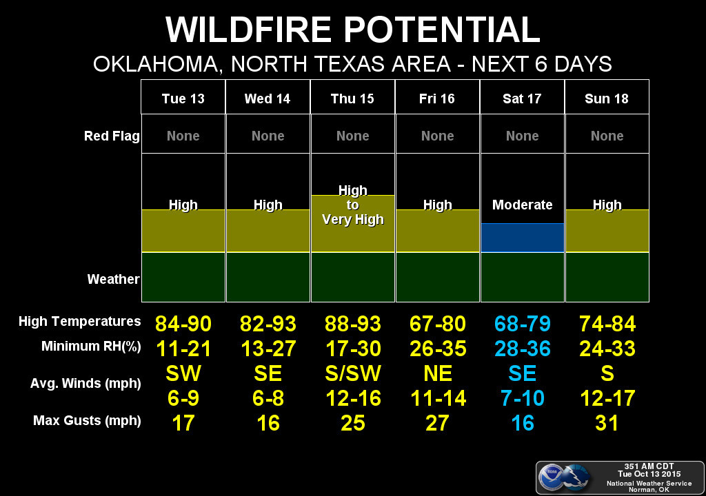
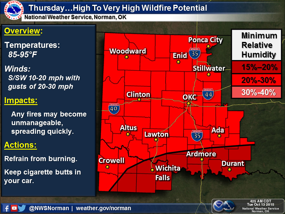
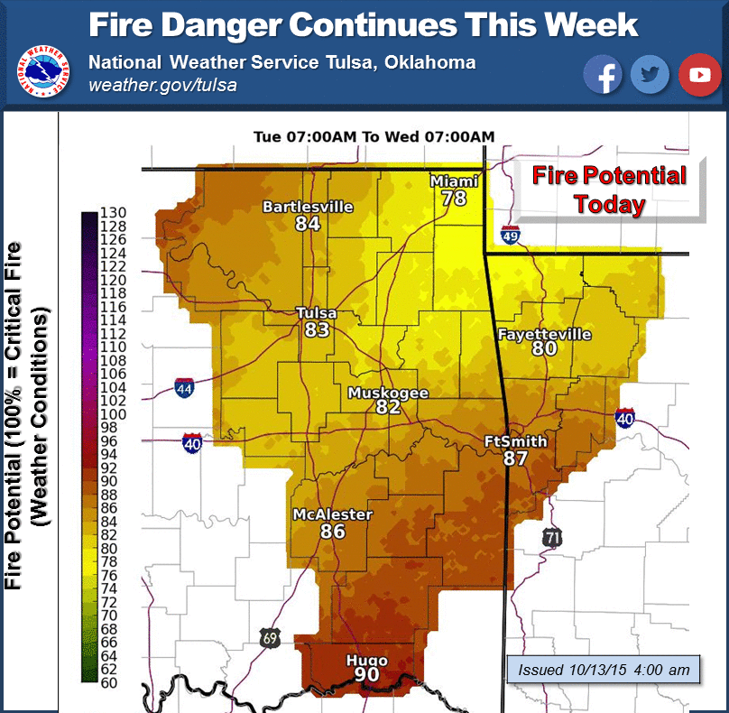
All of that has intensified drought conditions from south to north, and also given
us this lovely fire danger lately.
http://ticker.mesonet.org/archive/20151013/nws-norman-7day-firedanger.jpg
http://ticker.mesonet.org/archive/20151013/nws-norman-firedanger.jpg
http://ticker.mesonet.org/archive/20151013/nws-tulsa-firedanger.png
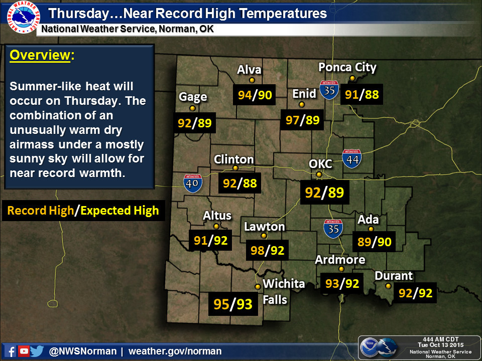
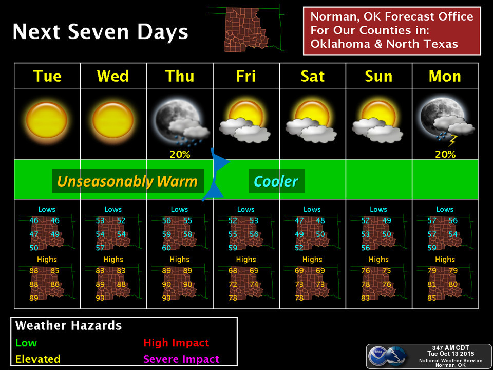
And the heat is still on for a few days, then off, then probably back after that.
In other words, late summer, fall, then back to late summer.
http://ticker.mesonet.org/archive/20151013/nws-norman-heat.jpg
http://ticker.mesonet.org/archive/20151013/nws-norman-7day-planner.jpg
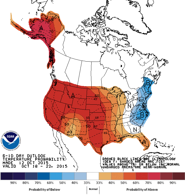
http://ticker.mesonet.org/archive/20151013/oct18-22-temp-outlook.gif
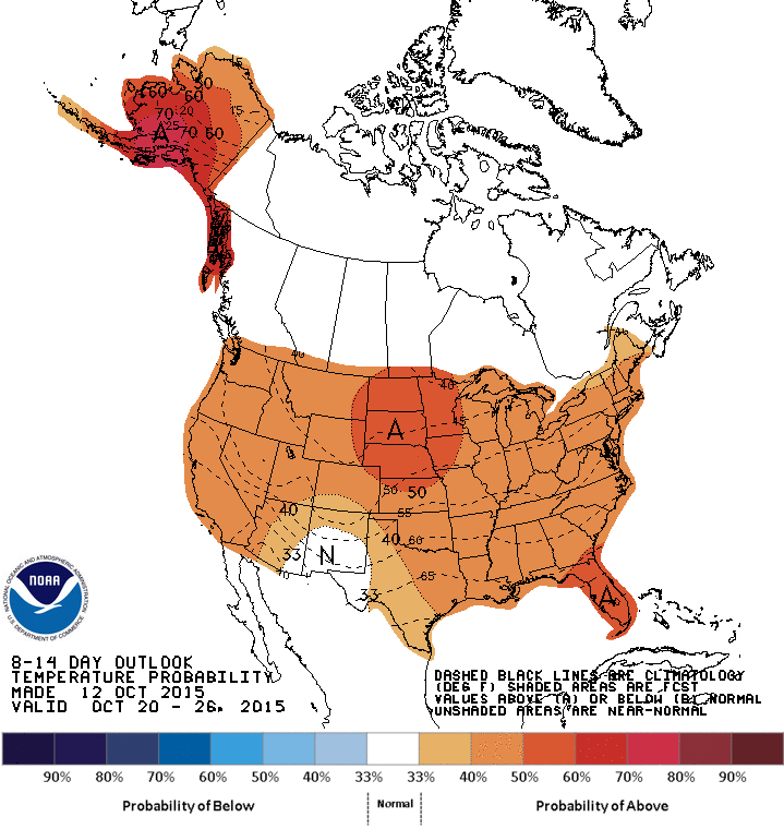
http://ticker.mesonet.org/archive/20151013/oct20-26-temp-outlook.gif
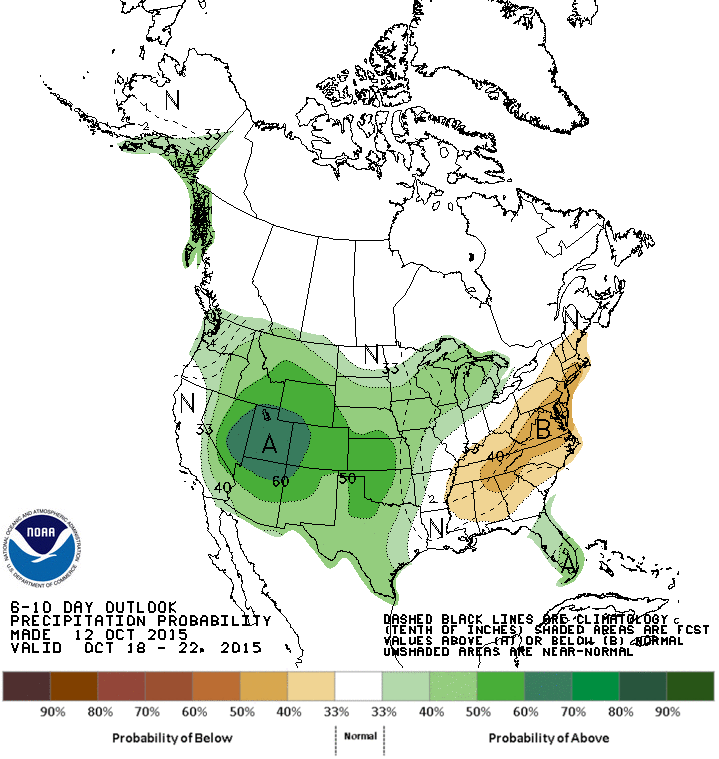
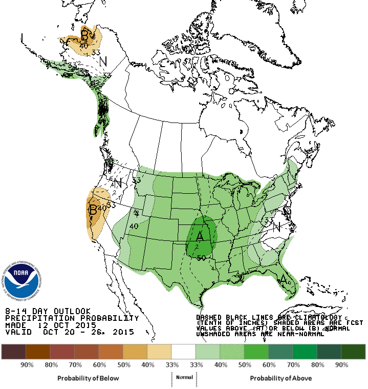
But do you see that white area down in the Desert Southwest in the midst of all
that increased probability for above normal temperatures area? I do believe that
is that crazy upper-level low pressure system that has been wandering around
in that area, cut off from any sort of flow or steering mechanism to push it
this way. Those maps seem to indicate that it is possibly going to move this
way, and maybe bring some rain chances with it. The precipitation outlooks sure
feel that way.
http://ticker.mesonet.org/archive/20151013/oct18-22-precip-outlook.gif
http://ticker.mesonet.org/archive/20151013/oct20-26-precip-outlook.gif
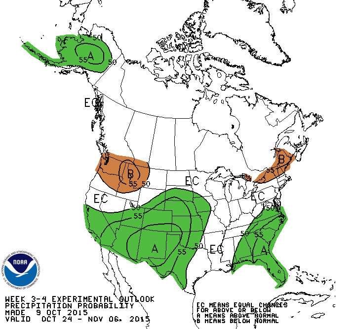
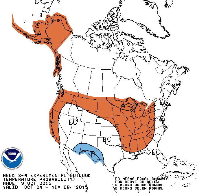
And CPC's new experimental 3-4 week precip outlook seems to agree as well, and
a little less bullish on the heat sticking around.
http://ticker.mesonet.org/archive/20151013/oct24-nov6-precip-outlook.gif
http://ticker.mesonet.org/archive/20151013/oct24-nov6-temp-outlook.gif
Complete transparency here, those were issued last Friday, so the models used
to generate them might have changed a bit. A new one will be issued this Friday.
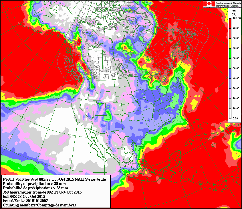
To bolster that precip outlook, we also see indications of better rain chances
in the Canadian model (this is through the 28th, and is an indication of the
odds of seeing at least an inch of rain accumulate through that period)
http://ticker.mesonet.org/archive/20151013/1inch-accum-precip-odds.gif
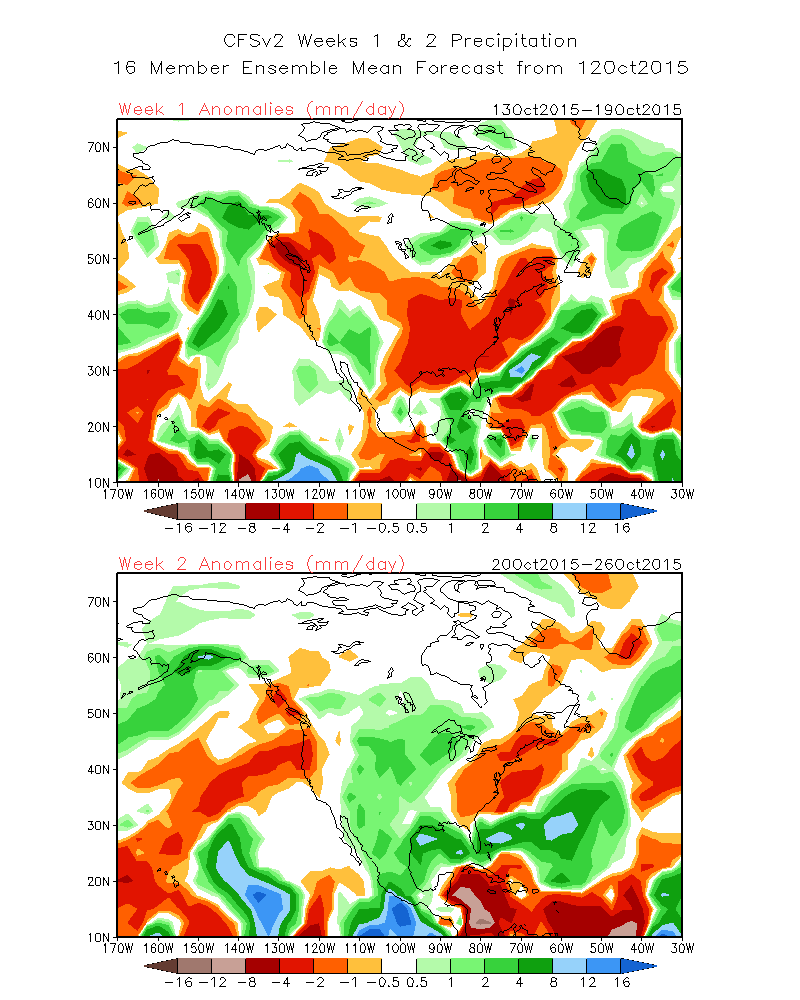
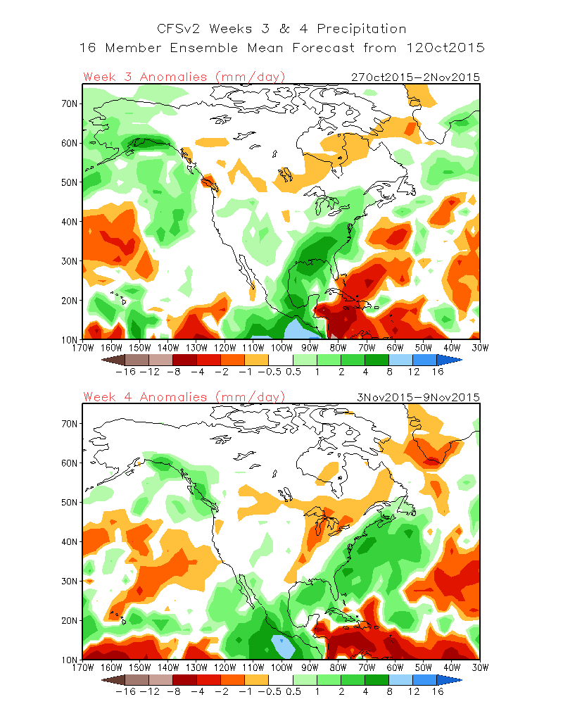
and also in one of the prime U.S. medium-range forecast models, especially in
week 2 (Oct. 20-26) and week 3 (Oct. 27-Nov. 2)
http://ticker.mesonet.org/archive/20151013/CFS-week1-2.precip-anomalies.gif
http://ticker.mesonet.org/archive/20151013/CFS-week3-4.precip-anomalies.gif
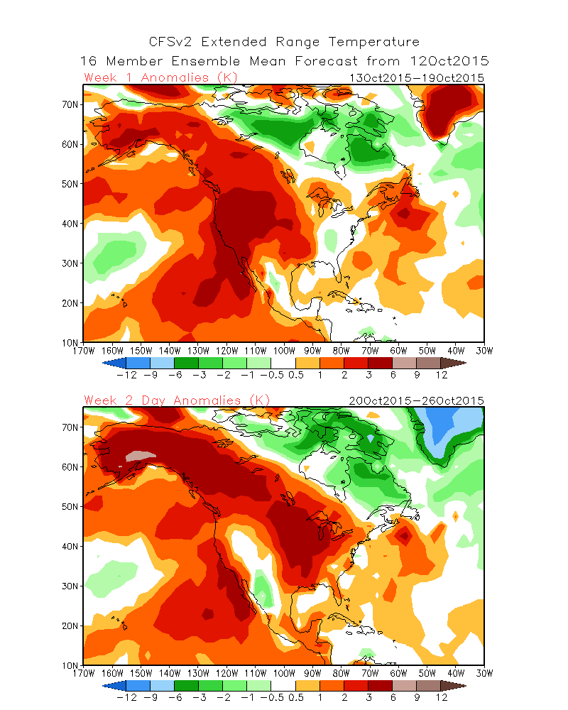
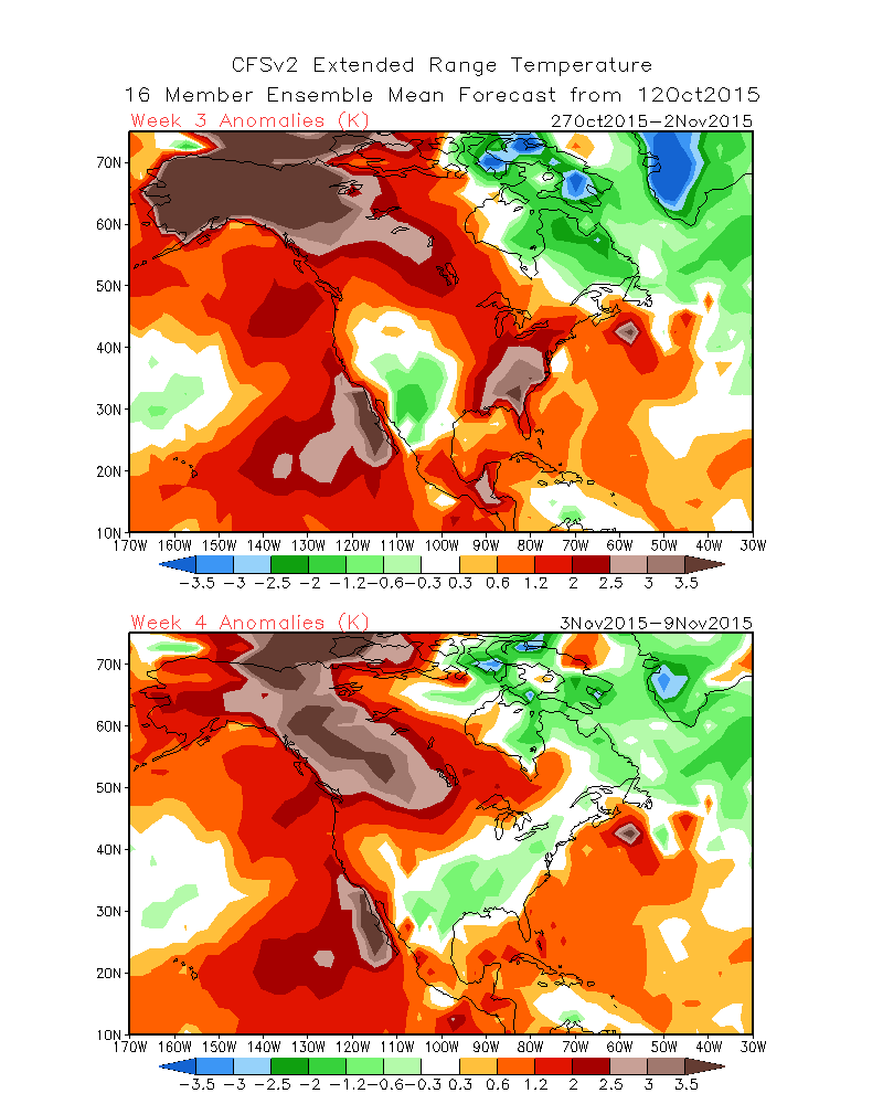
Unfortunately, for those of you looking for that first freeze to help with
the sneezing and whatnot, that doesn't look like it will be occurring anytime
soon either
http://ticker.mesonet.org/archive/20151013/CFS-week1-2.temp-anomalies.gif
http://ticker.mesonet.org/archive/20151013/CFS-week3-4.temp-anomalies.gif
Remember, these forecasts are well out past the period of great skill, and a
big pattern change could happen at any time past that 1-week point. But one
thing we do know, the sun is getting lower in the sky, and is out for shorter
periods of time. It will get cooler, regardless of above normal temperatures.
Until then, enjoy the sun, hope for rain, and bide your time until winter. That's
coming too.
Gary McManus
State Climatologist
Oklahoma Mesonet
Oklahoma Climatological Survey
(405) 325-2253
gmcmanus@mesonet.org
==================================================
The OCS/Mesonet Ticker
https://ticker.mesonet.org/
To subscribe or unsubscribe from the Ticker
or for questions about the Ticker or its content
Phone or Email the Ticker Manager at OCS
Phone: 405-325-2253 Email: ticker@mesonet.org
---------------------------------------------------
-C- Copyright 2024 Oklahoma Climatological Survey
===================================================
|


 Tweet
Tweet