Ticker for September 23, 2021
MESONET TICKER ... MESONET TICKER ... MESONET TICKER ... MESONET TICKER ...
September 23, 2021 September 23, 2021 September 23, 2021 September 23, 2021
Droughtplosion
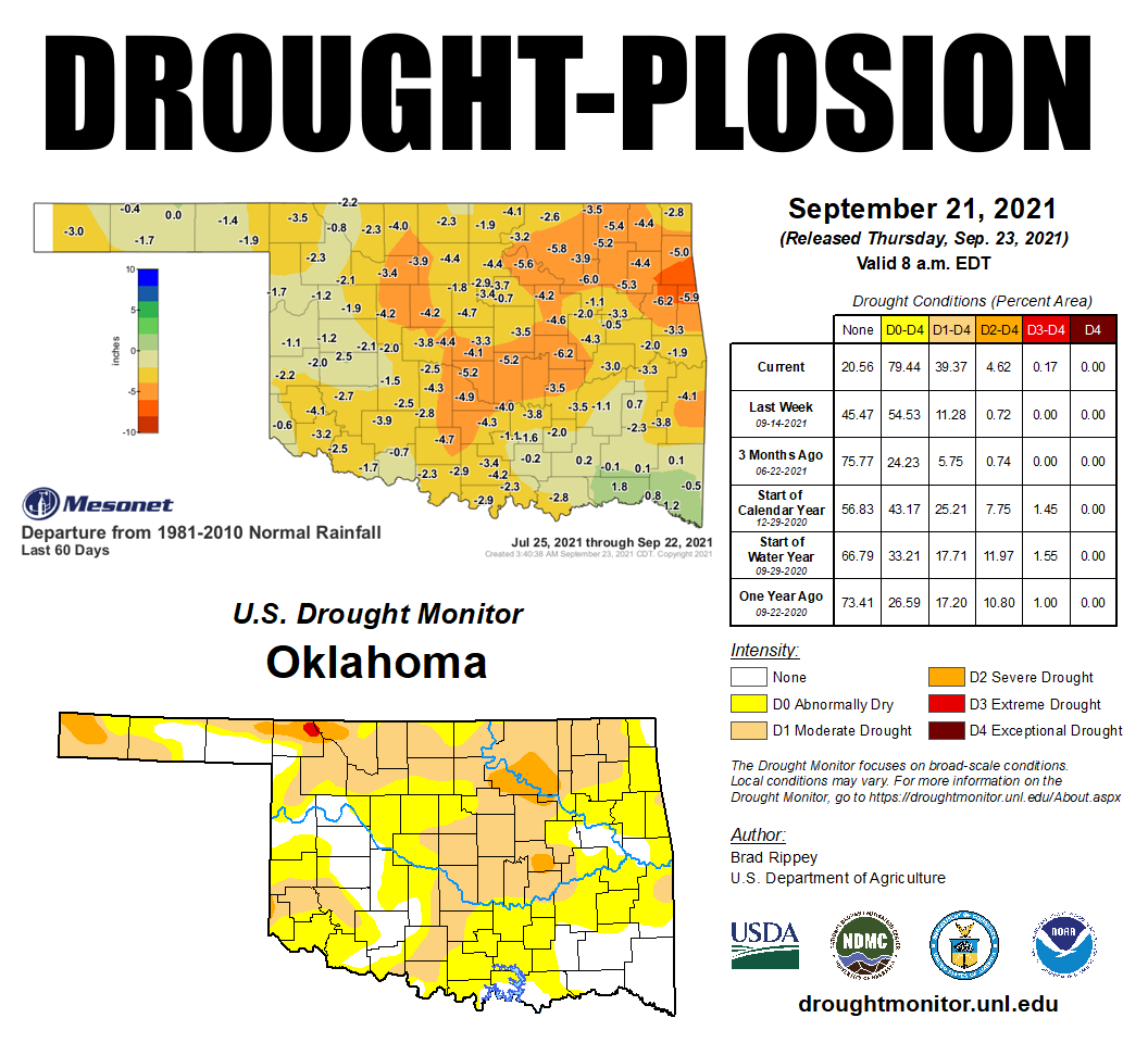
Flash drought is defined as "...the rapid onset or intensification of drought.
It is set in motion by lower-than-normal rates of precipitation, accompanied by
abnormally high temperatures, winds, and radiation. Together, these changes in
weather can rapidly alter the local climate" by our friends at the National
Drought Mitigation Center, which oversees the U.S. Drought Monitor. We need look
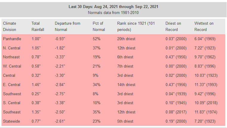
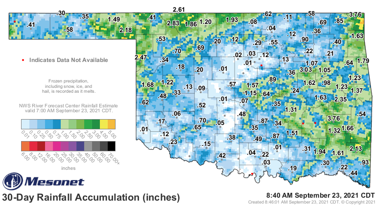
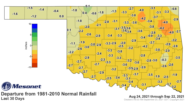
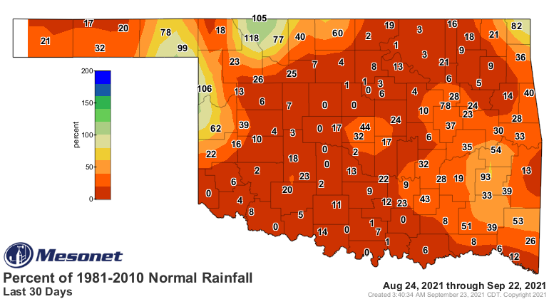
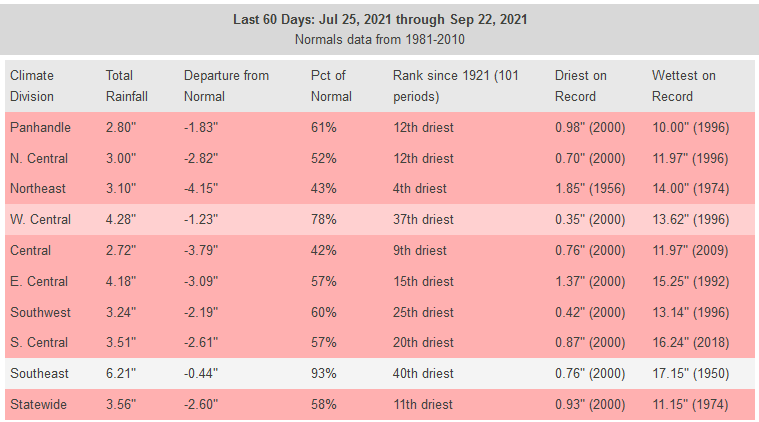
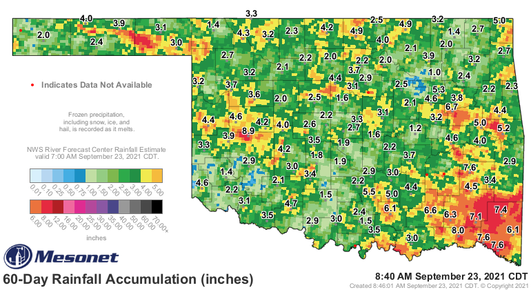
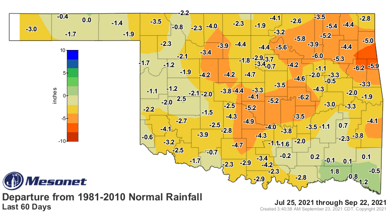
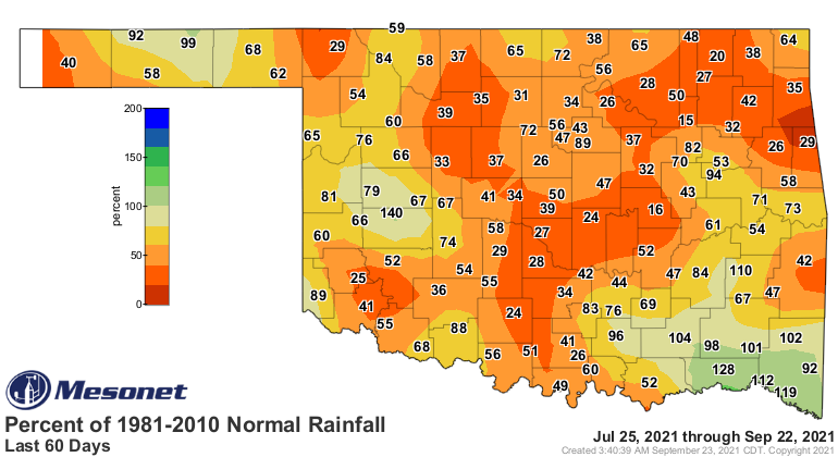
no further than the last 60 days in Oklahoma to see the reality of that
definition. The rains that were so plentiful through late spring into mid-summer
abruptly shut off about 60 days ago, with that lack of precipitation accelerating
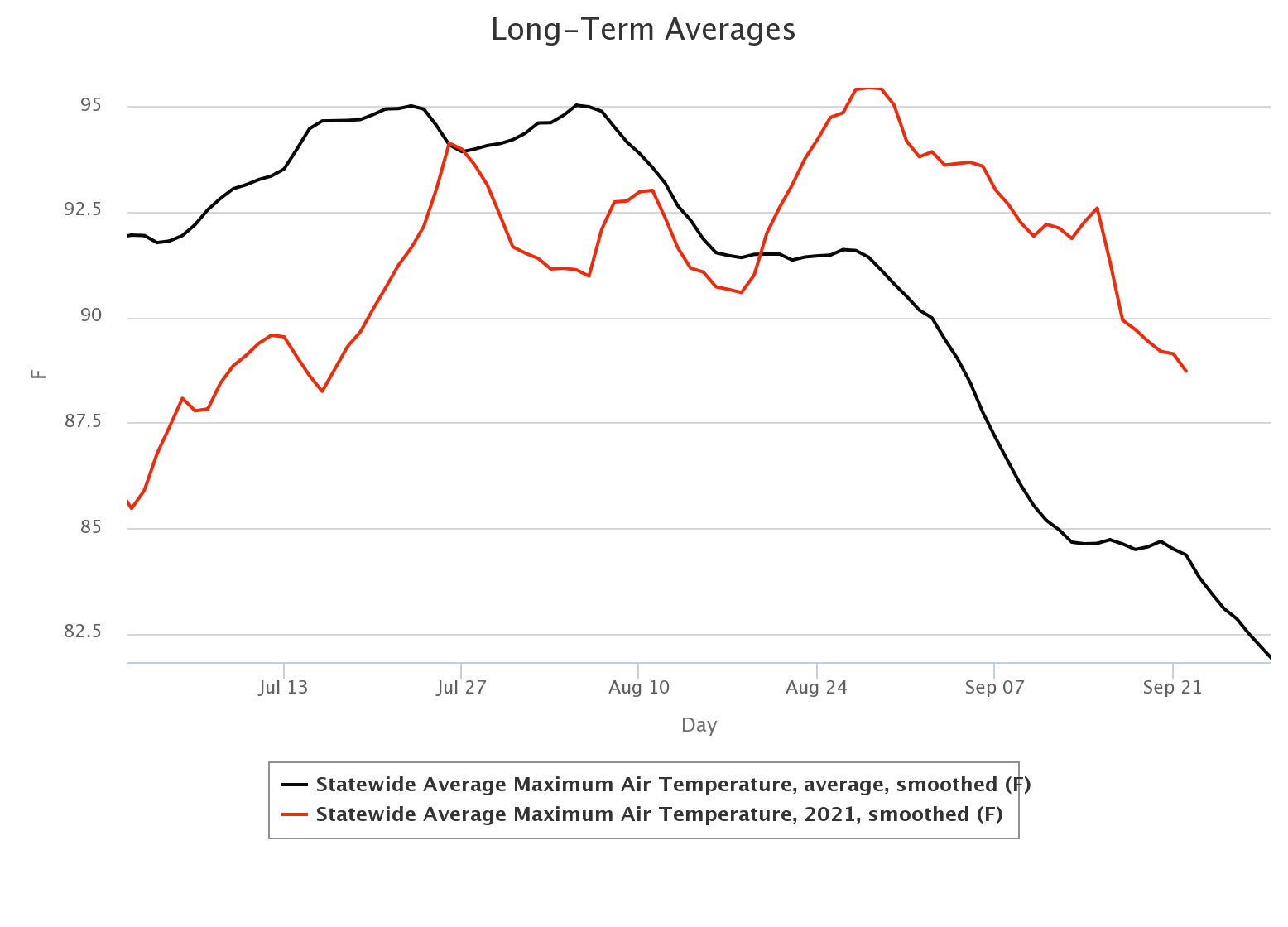
in the last 30 days. Also some time around mid-August, Oklahoma exited its
prolonged stay in cooler than normal territory and went straight to blast furnace
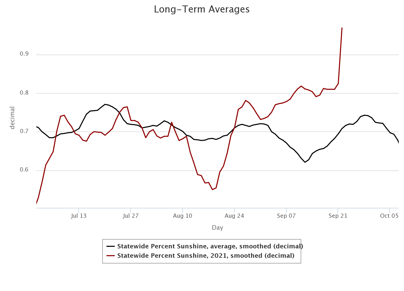
style summer conditions. All of this is evident from examining the Oklahoma Mesonet
data.
When all of these things together happen during the winter, it is concerning.
When they happen during the summer, it is disastrous. What we've seen is an
explosion of drought that has left us with the highest percentage of the state
in drought since July 21, 2020, and an increase of more than 38% from just
2 months ago when just over 1% of the state was considered in drought.
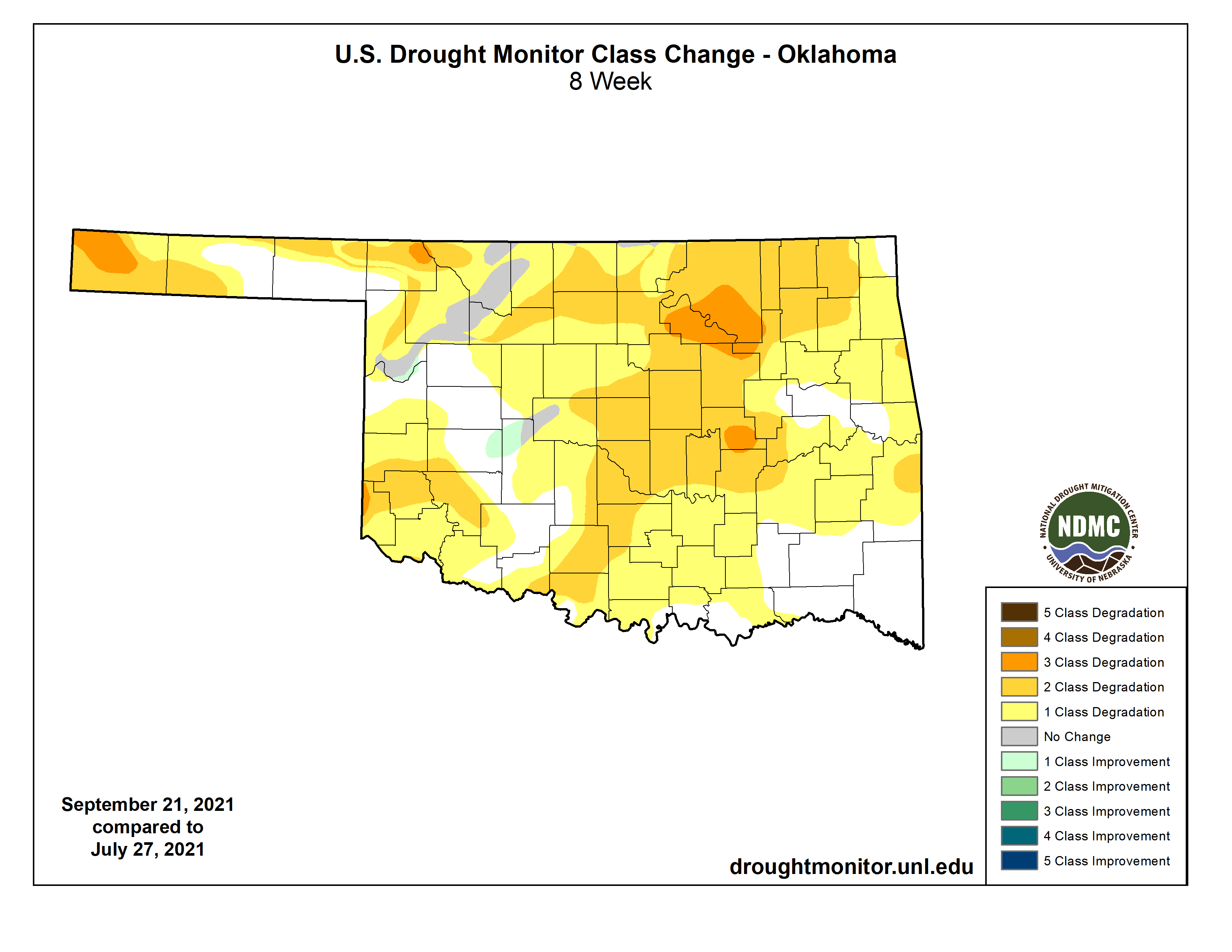
THAT is flash drought, and it's a heckuva thing to catch up to in drought
monitoring due to most of the drought indices used to track drought coming in
30-day intervals. So between that 30-day and 60-day period, drought is
increasing physically but staying sort of static in the drought index values.
Thus, the rapid increase in just a week as more of the drought has started to
show up on those drought indexes.
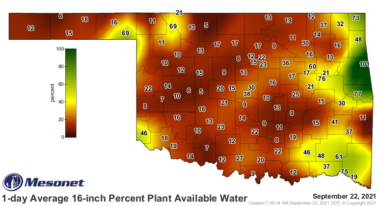
But it has been showing up in the data like above, and the soil moisture
across the state, which has plummeted right at a critical time for Oklahoma's
AG producers, especially those that rely on planting winter wheat early to
graze cattle.
So what can we do about it? Well, help *MIGHT* be on the way next week. A
cutoff low pressure system is forecast to meander about to our west before
finally heading our way later in the week, hopefully bringing increased rain
chances. However, remember this phrase: "Cutoff low, weatherperson's woe."
Yeah, so since that low pressure system is essentially cutoff from the jet
stream and the steering winds of the atmosphere, at least the stronger winds,
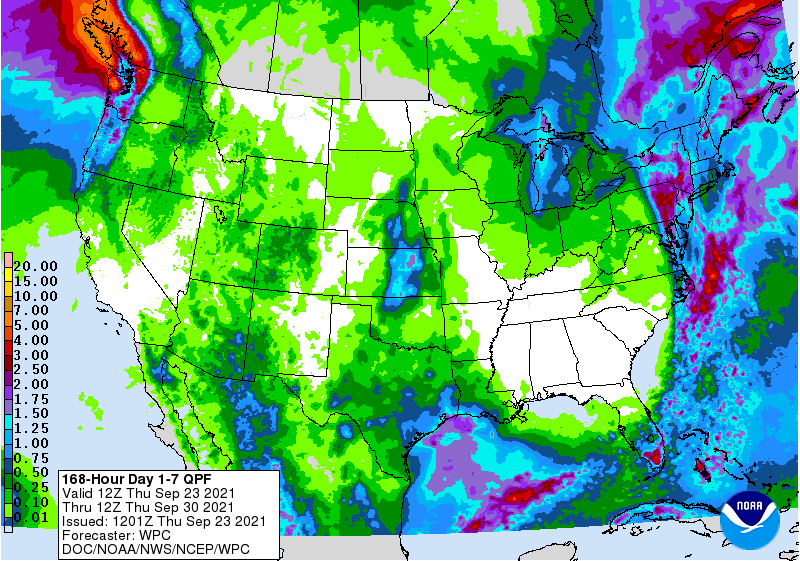
it will again be free to wander around before finally moving our way. There is
at least some rain showing up on the 7-day forecast. Hopefully this will
increase as we go forward, but again, still uncertain to some degree.
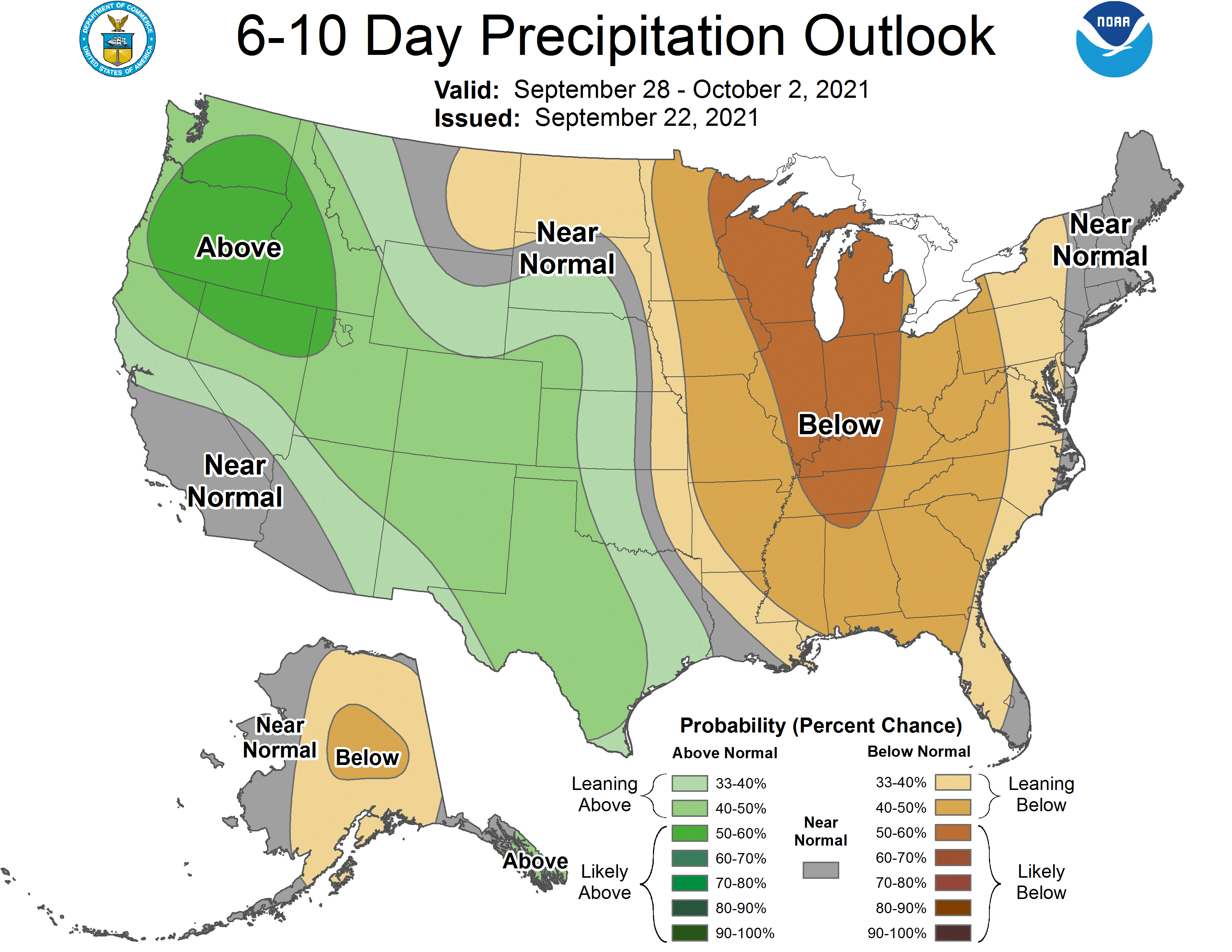
The increased chance of moisture is also showing up on the outlooks for next
week. Don't expect a plunge down to below normal just yet, unless there are
just lots of clouds. probably still in above normal territory for temps.
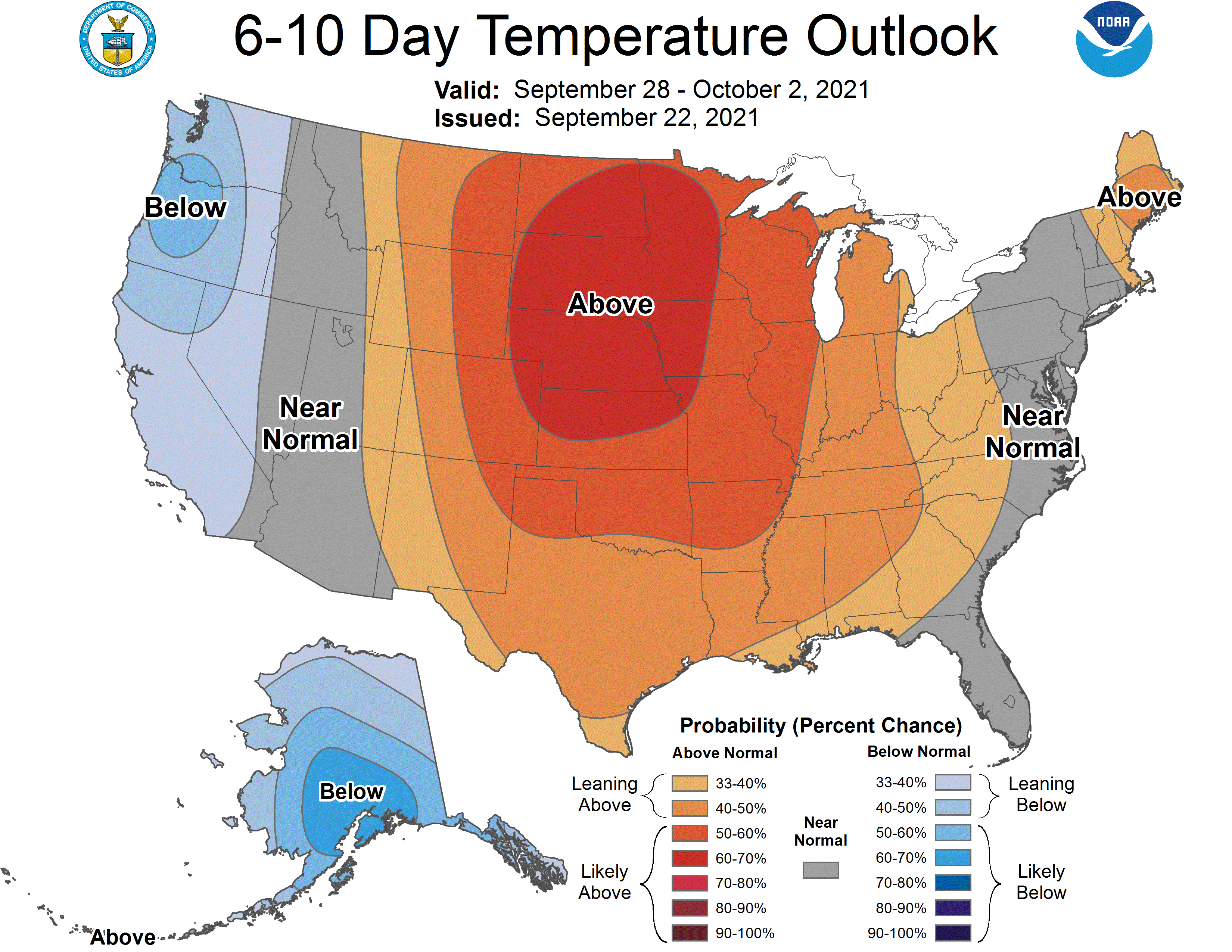
What we are sure of is that it's gonna be hot for the next few days, through
the weekend. And windy with lots of sun, so whatever damage the drought is
doing now will only intensify until we see rainfall. In fact, fire danger will
be the norm until we do.
Wish there was better news for this week, but maybe better news is coming next
week.
Gary McManus
State Climatologist
Oklahoma Mesonet
Oklahoma Climatological Survey
(405) 325-2253
gmcmanus@mesonet.org
September 23 in Mesonet History
| Record | Value | Station | Year |
|---|---|---|---|
| Maximum Temperature | 106°F | ALTU | 2023 |
| Minimum Temperature | 37°F | KENT | 2004 |
| Maximum Rainfall | 7.07″ | BROK | 2019 |
Mesonet records begin in 1994.
Search by Date
If you're a bit off, don't worry, because just like horseshoes, “almost” counts on the Ticker website!