MESONET TICKER ... MESONET TICKER ... MESONET TICKER ... MESONET TICKER ...
September 17, 2014 September 17, 2014 September 17, 2014 September 17, 2014
Odile is getting angry!
Just a quick Tick as we barely have time to "tock" here at Ticker Central Command.
But this weekend's rain event thanks to the remnants of Hurricane Odile and a
strong cold front. Unfortunately, this is starting to look a lot more like a
flash-flooding threat as the forecast amounts go up even as the spread of the
precipitation's timing appears to shrink to mostly Saturday and Sunday. Yes, it
will wipe out some drought, but there will be some unfortunate consequences. Twas
ever thus in Oklahoma, no?
Check out this graphic from the folks over at NWS Norman to see the forecast
totals as of this morning's forecast. This forecast can and probably will change,
but it's still trending wetter thus far.
http://ticker.mesonet.org/archive/20140917/nws-norman.jpg
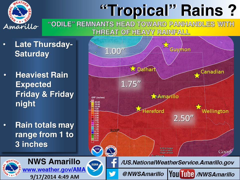
Even the High Plains NWS offices are starting to go all tropical on us.
http://ticker.mesonet.org/archive/20140917/nws-amarillo.jpg
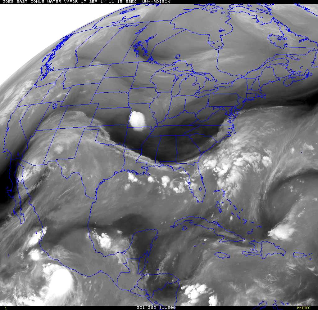
You can see the impending conflagration taking shape as the remnants of Odile
approach the Desert Southwest in this water vapor satellite picture.
http://ticker.mesonet.org/archive/20140917/latest_east_wv_conus.jpg
Stay tuned to your favorite weather source to stay informed for changes in
the forecast.
Gary McManus
State Climatologist
Oklahoma Mesonet
Oklahoma Climatological Survey
(405) 325-2253
gmcmanus@mesonet.org
==================================================
The OCS/Mesonet Ticker
https://ticker.mesonet.org/
To subscribe or unsubscribe from the Ticker
or for questions about the Ticker or its content
Phone or Email the Ticker Manager at OCS
Phone: 405-325-2253 Email: ticker@mesonet.org
---------------------------------------------------
-C- Copyright 2024 Oklahoma Climatological Survey
===================================================
|


 Tweet
Tweet