Ticker for September 1, 2015
MESONET TICKER ... MESONET TICKER ... MESONET TICKER ... MESONET TICKER ...
September 1, 2015 September 1, 2015 September 1, 2015 September 1, 2015
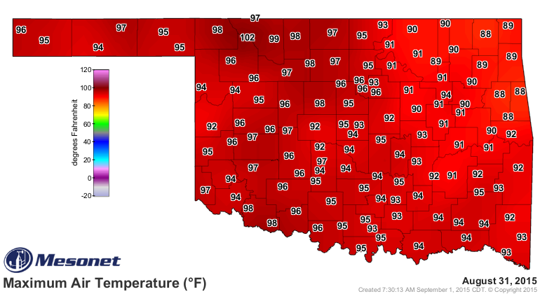
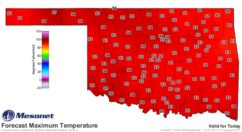
Getting a bit crispy!
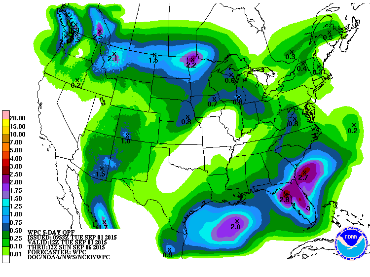
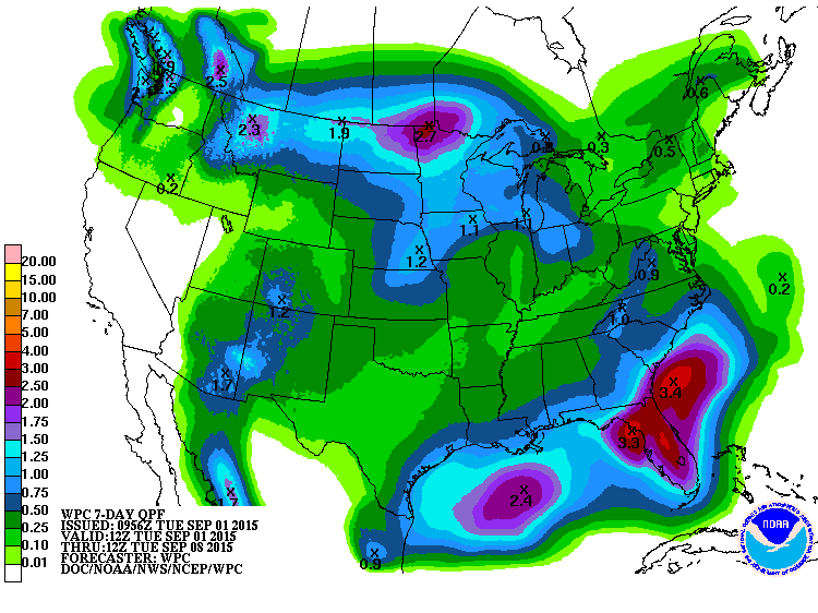
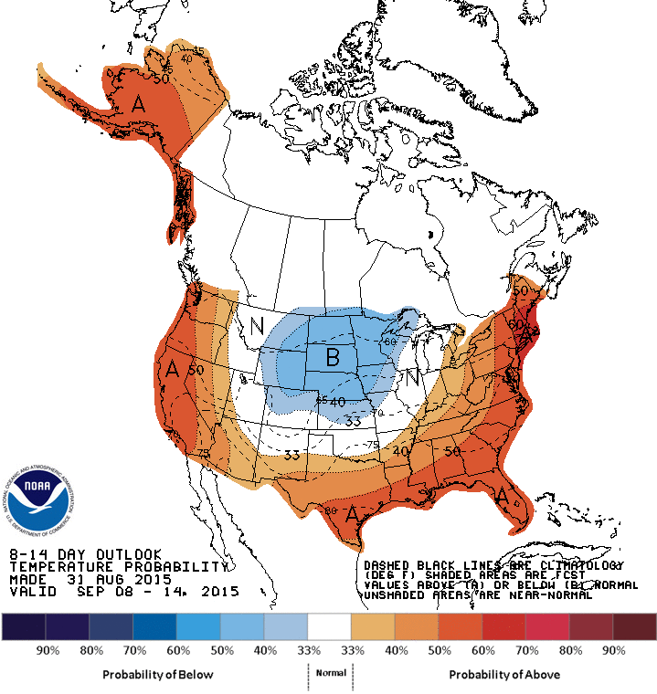
Still not much rain in the forecast, although it might look a bit more soggy
next week, according to the latest CPC outlooks.
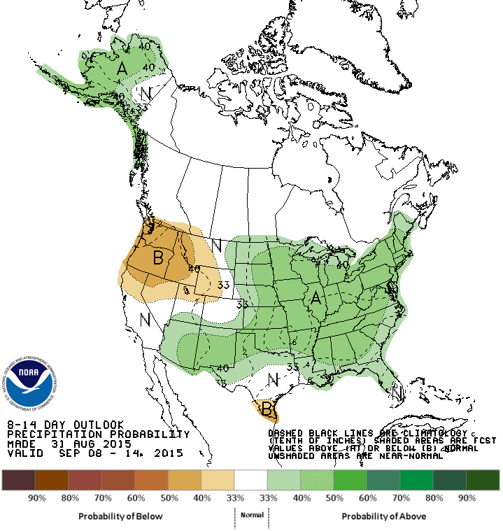
And while the heat is back
and appears ready to stick around for a bit
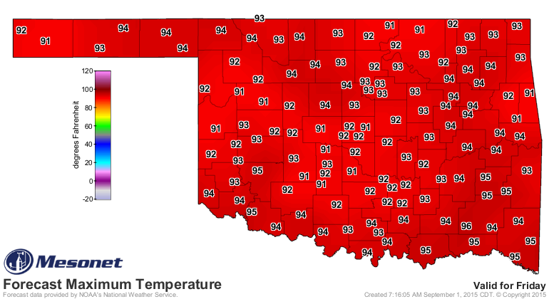
the CPC outlook for next week at least indicates something of a cool front for
that period.
Until then, however, we're faced with building flash drought across the southeast
that threatens to spread to the west if some decent rains fail to materialize.
Soil moisture conditions look pretty sad all across southern Oklahoma, if not
a lot more of the state than most realize. I'll just let you sort through all
the maps. None of them are pretty. The one consolation...it IS August, so dry
weather, vegetation and soils aren't TOO out of the ordinary.
http://www.mesonet.org/index.php/weather/category/soil_moisture
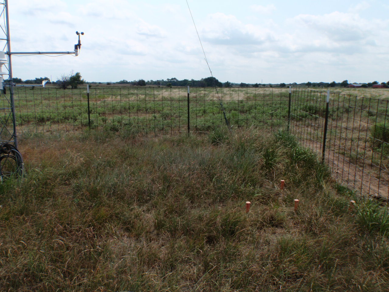
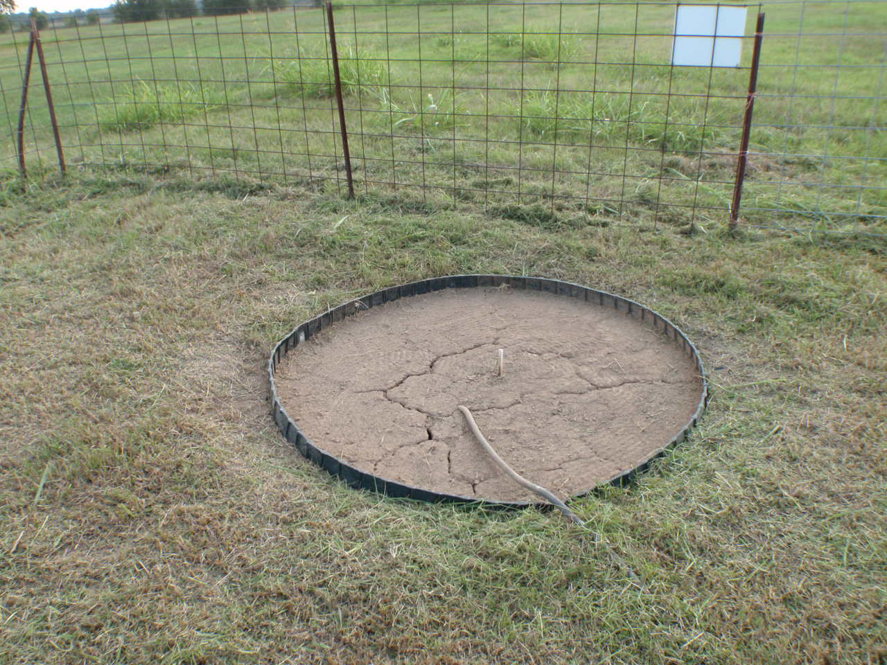
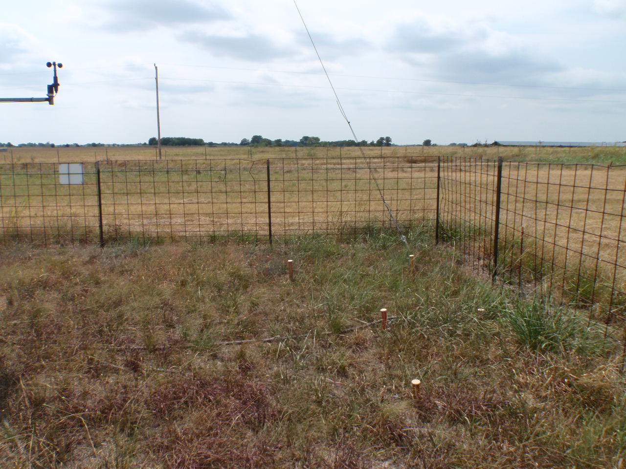
For the southeast, however, these views from our Mesonet Field Technicians on
their summer pass show some crispy conditions across the southeast, certainly
more yellow than you'd expect for that region of the state.
But August did us no favors, at least for the most part. So let's take a look
back at August. It was hot. REALLY hot. But it was also cool (and even cold
a time or two).
==============================================================================
Rainy Summer Evaporates In August
Many a rainy summer has stared into the unyielding gaze of August and faltered.
Coming off the wettest May-July period on record for Oklahoma, this August was
met with similar expectations. In that regard, however, it was an unmitigated
failure with preliminary data from the Oklahoma Mesonet indicating a statewide
average of 2.3 inches. That is more than half an inch below normal and ranks
the month as the 46th driest August on record, dating back to 1895.
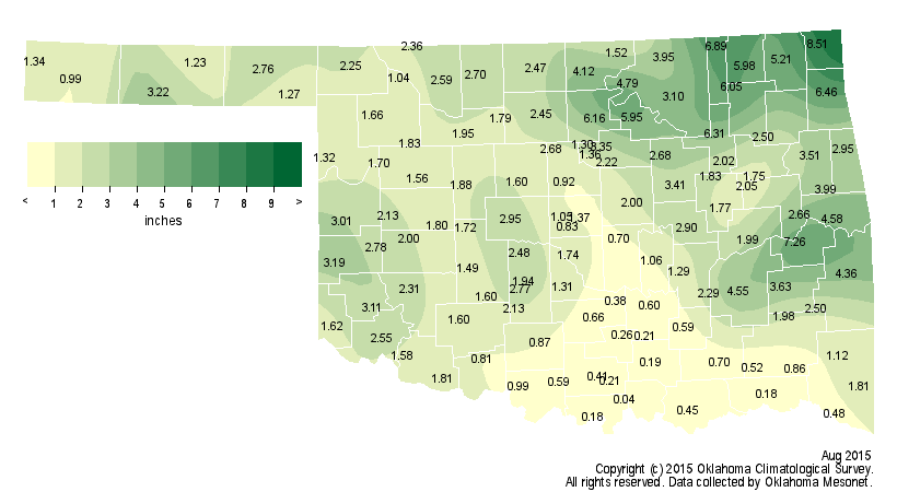
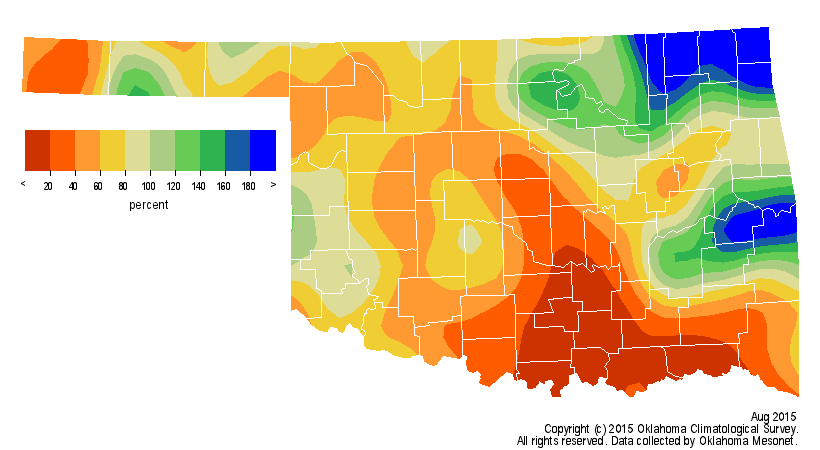
The northeast saw a surplus of more than 1.7 inches to rank as the 24th wettest
August for that area. South central Oklahoma, the epicenter of the extreme
rains from the previous few months, dried out considerably with a deficit of
more than 2.1 inches and ranked as the seventh driest. Miami led the state with
8.51 inches of rain, which is more than 5 inches above normal for that location.
Madill, in far south central Oklahoma, barely wet the gauge with 0.04 inches.
That is a stark contrast to the 43.71 inches of rain Madill received April-July,
including 23.25 inches in May alone.
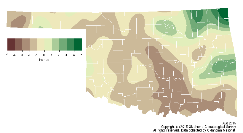
August?s rain totals might have diminished the climatological summer?s
(June-August) ranking, but the season still finished as the 28th wettest on
record with a statewide average of 12.13 inches, 1.78 inches above normal.
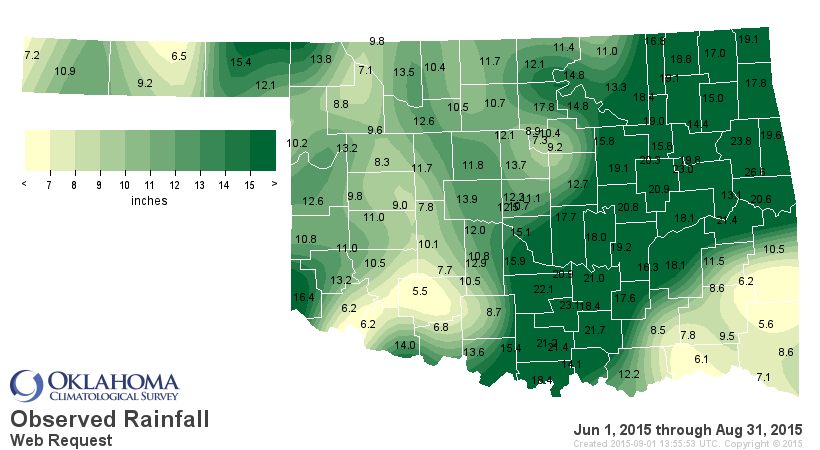
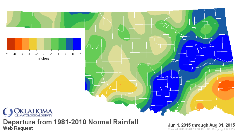
Much of that wetter than normal weather was concentrated from south central
through northeast Oklahoma. The southeast and southwest were drier than normal.
The year still leads 1957 in the race to finish as the wettest on record for
Oklahoma. The 2015 January-August statewide average was 36.19 inches, 11.33
inches above normal and 0.32 inches ahead of 1957?s mark.
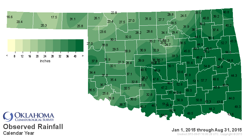
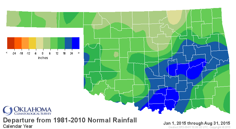
That leaves 2015 just 11.69 inches off 1957?s calendar year record total of
47.88 inches. The final four months of the year average 12.07 inches of
precipitation, so even a slightly below normal finish to the year can still
garner 2015 the record.
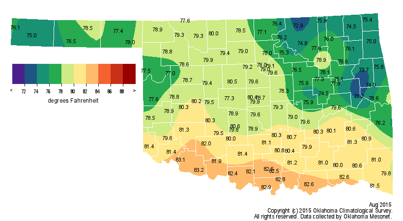
The outlooks called for a cooler than normal August, and those prognostications
were prophetic with a statewide average of 78.8 degrees. That?s 2 degrees below
normal to rank the month as the 24th coolest August on record.
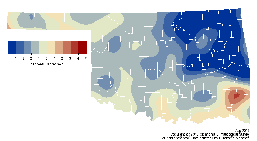
Of course, that?s not the entire story with the temperature data, as is often
the case. High temperatures ranged from a maximum of 107 degrees at Hollis on
the sixth to a chilly 68 degrees at Boise City on the 23rd. The former occurred
during a period of above normal temperatures and the latter following an
unusually strong cold front for that part of the year. That cold front was also
apparent in the minimum temperatures readings. El Reno got down to an October-
like 47 degrees on the 20th, and many other Mesonet sites reached lows in the
40s or lower 50s on the 19th and 20th. Record lows were set at Oklahoma City,
Muskogee, McAlester and Bartlesville on the 20th according to National Weather
Service (NWS) reports. The cool weather continued for several more days with
additional record lows reported through the 25th. The first week of the month
was a scorcher, nevertheless. The Mesonet recorded 143 instances of heat index
values of 110 degrees or more during that period, including a miserable 117
degrees at Eufaula and Okmulgee on the seventh. On the month?s final day,
temperatures had reached into the mid- to upper-90s across much of the western
half of the state, and even a triple-digit reading at Freedom. The summer and
January-August statewide average temperatures were both near normal.
With the dry conditions mounting across the southeast, flash drought conditions
continued to intensify in that region. Dead and dormant vegetation, desiccated
soils and flagging streamflows were some of the key indicators of the spreading
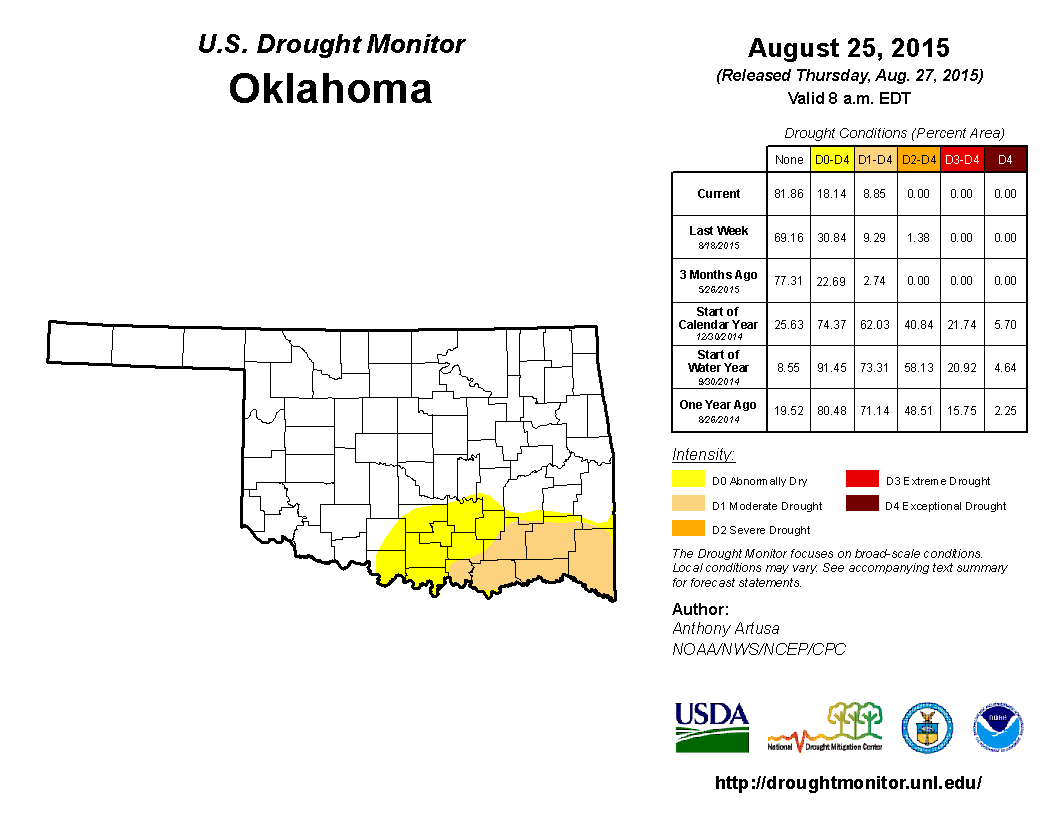
hazard. By the end of August, more than 18 percent of the state was considered
in at least abnormally dry conditions according to the U.S. Drought Monitor,
and nearly 9 percent in moderate drought. There were no drought or abnormally
dry designations in Oklahoma at the end of July.
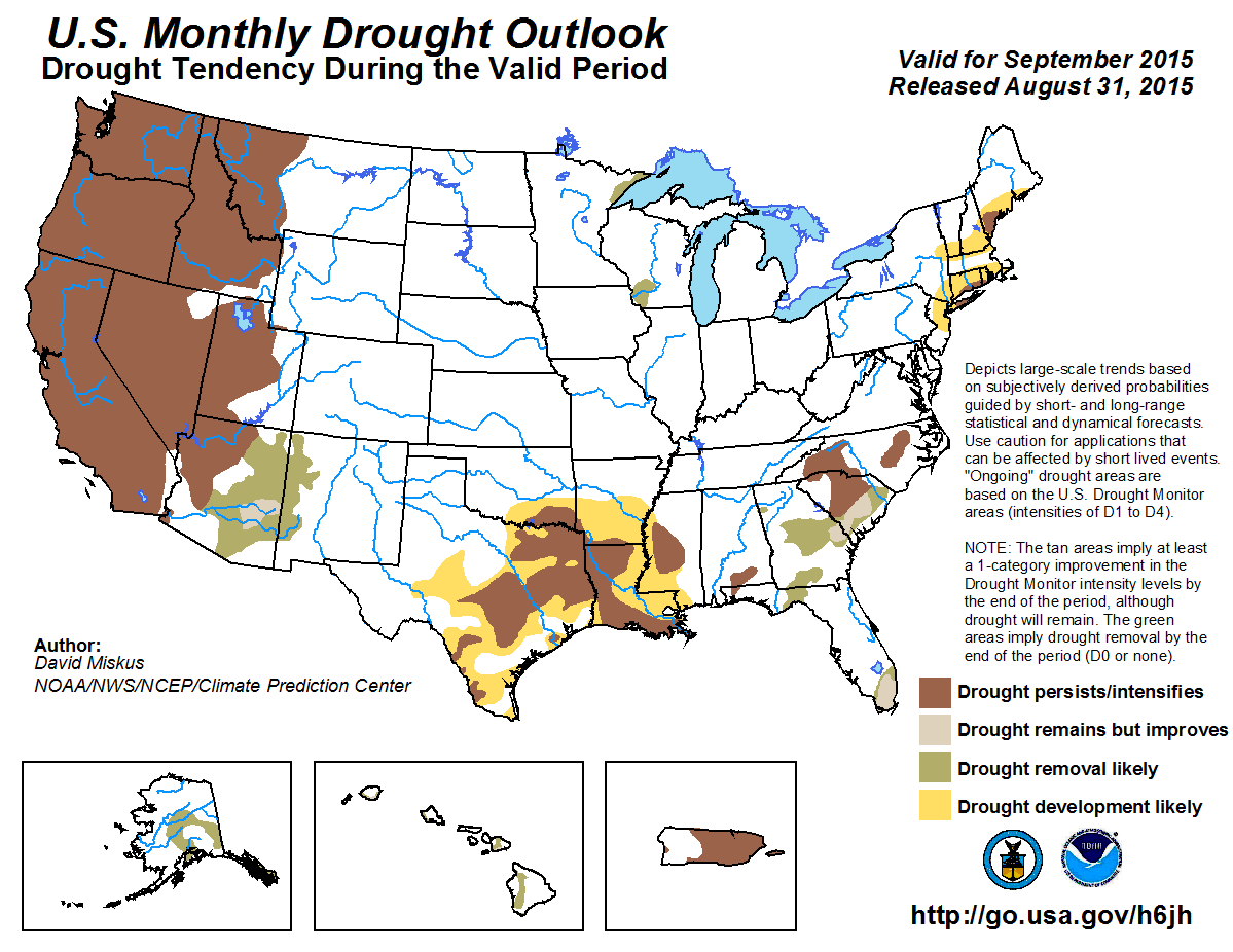
Drought is expected to persist or even intensify through September where it
exists now across the southeast, with some development likely farther to the
west and north, according to the Climate Prediction Center (CPC).
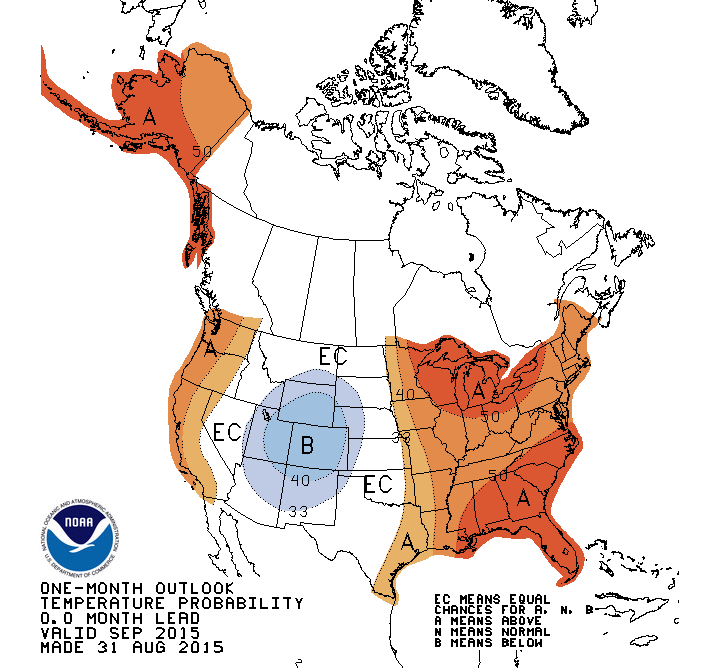
The CPC sees increased odds for above normal temperatures across far eastern
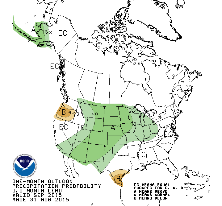
Oklahoma during September, with similar odds for above normal precipitation in
the northwestern half of the state, especially the Panhandle.
Gary McManus
State Climatologist
Oklahoma Mesonet
Oklahoma Climatological Survey
(405) 325-2253
gmcmanus@mesonet.org
September 1 in Mesonet History
| Record | Value | Station | Year |
|---|---|---|---|
| Maximum Temperature | 110°F | WAUR | 2000 |
| Minimum Temperature | 49°F | GOOD | 2024 |
| Maximum Rainfall | 7.50″ | BYAR | 2020 |
Mesonet records begin in 1994.
Search by Date
If you're a bit off, don't worry, because just like horseshoes, “almost” counts on the Ticker website!