MESONET TICKER ... MESONET TICKER ... MESONET TICKER ... MESONET TICKER ...
August 28, 2017 August 28, 2017 August 28, 2017 August 28, 2017
Certiainly uncertain
http://ticker.mesonet.org/archive/20170828/7day-rain-forecast.png
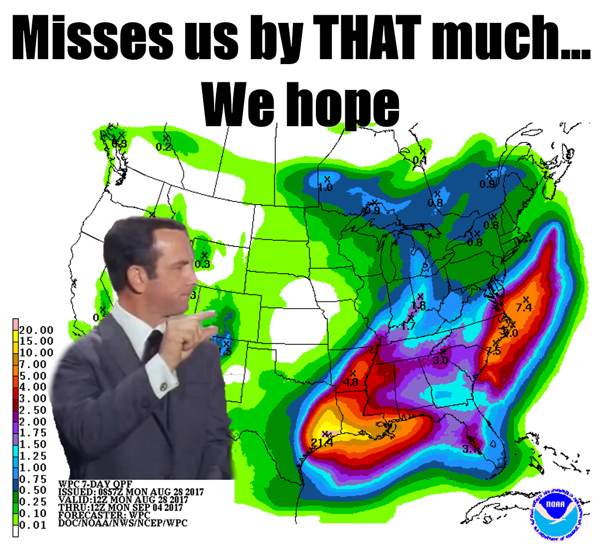
You know that the term "catastrophic" isn't strong enough when you've already had
more than 30 inches of rain down in the area impacted by Hurricane Harvey, and
the forecast calls for 20+ inches more. I won't dwell on the destruction occurring
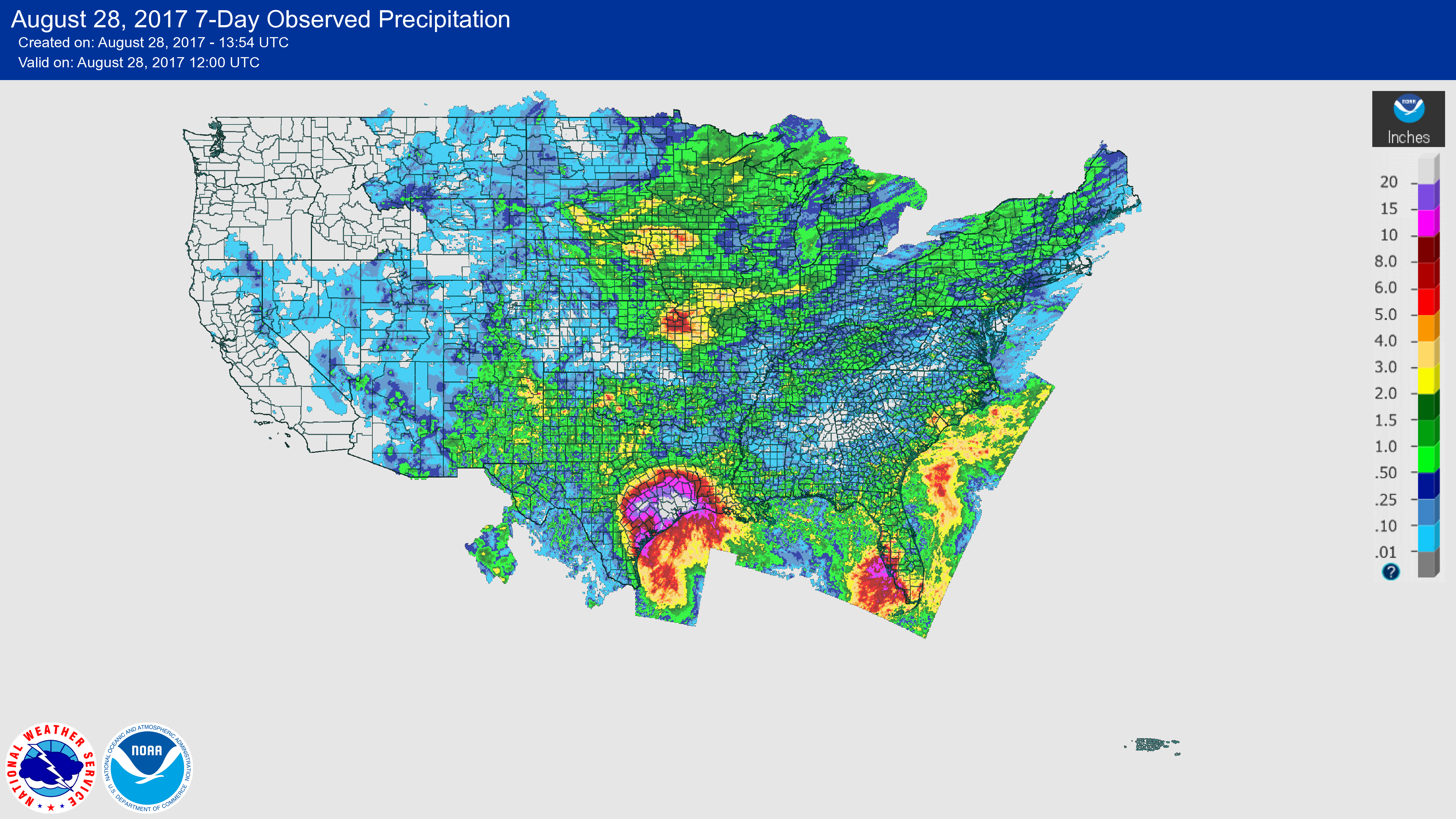
down south, that's well covered by numerous sources. The observed rainfall map
below covering the last 7 days speaks volumes on the flooding disaster down south.
http://ticker.mesonet.org/archive/20170828/7day-rain-totals.png
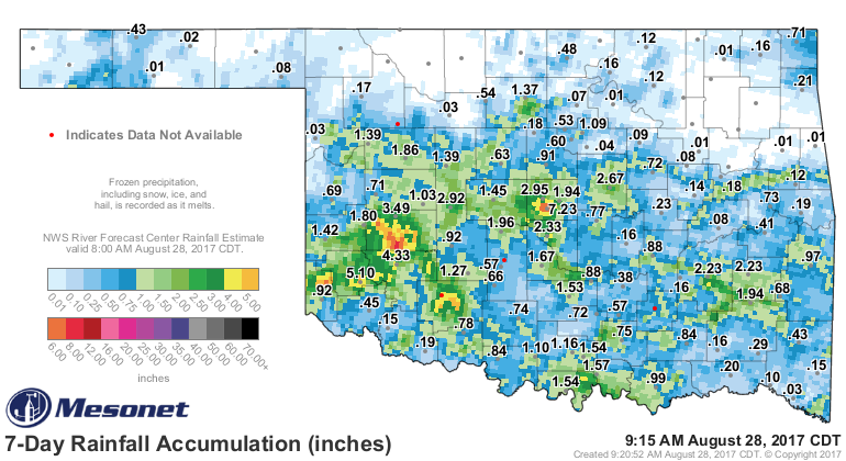
Closer to home, we've had our own bouts of flooding, but on a much smaller and
minor scale (although if you have had flooding at your location, it's bad
regardless of whether it's from a hurricane or a thunderstorm).
http://ticker.mesonet.org/archive/20170828/7day-OK-rain-totals.png
So monumental rainfall totals going on along the Gulf Coast, but we have our own
monumental totals occurring up here. The statewide average rainfall total from
the Oklahoma Mesonet now stands at 6.42 inches, 0.06 inches away from 1915's all-
time record of 6.48 inches!
-***-
Year Statewide Avg.
1915 6.48"
2017 6.42"
1906 6.30"
1974 5.89"
1914 5.78"
1917 5.66"
1996 5.54"
1933 5.31"
1966 5.13"
2005 5.13"
-****-
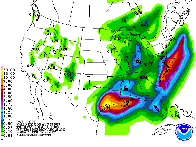
The normal statewide average for August in 2.95 inches.
Can we reach the pinnacle? Do we even want to? I always think if you're gonna
get close to records, might as well go ahead and break them as long as it
doesn't cause chaos and mayhem (Riggs was chaos, Murtaugh was mayhem for those
not up on their Lethal Weapon 3 trivia). The 3-day rainfall forecast says...it's
gonna be close.
http://ticker.mesonet.org/archive/20170828/3day-forecast.gif
I don't think we're going to end up with the coolest on record, although it
has been tremendously mild most of the month. Maybe top-10 coolest? Our minimum
temperatures just never tracked as far below normal as our high temperatures
did for most of the month.
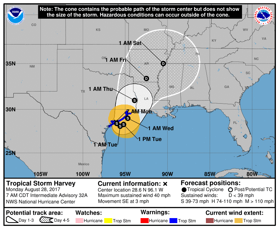
Should Harvey track more up this way (and it is still just BARELY in the cone
of probable path), that would definitely push us over the top on the rainfall
record. If that's what it takes, I say stay away. We'll settle for second
wettest.
http://ticker.mesonet.org/archive/20170828/harvey-forecast-cone.png
Gary McManus
State Climatologist
Oklahoma Mesonet
Oklahoma Climatological Survey
(405) 325-2253
gmcmanus@mesonet.org
==================================================
The OCS/Mesonet Ticker
https://ticker.mesonet.org/
To subscribe or unsubscribe from the Ticker
or for questions about the Ticker or its content
Phone or Email the Ticker Manager at OCS
Phone: 405-325-2253 Email: ticker@mesonet.org
---------------------------------------------------
-C- Copyright 2024 Oklahoma Climatological Survey
===================================================
|


 Tweet
Tweet