Ticker for August 22, 2017
MESONET TICKER ... MESONET TICKER ... MESONET TICKER ... MESONET TICKER ...
August 22, 2017 August 22, 2017 August 22, 2017 August 22, 2017
Eclipsing summer
Very impressive...very impressive indeed. I'm not going to spend a lot of time on
the eclipse, as my time is waning faster than my hairline. So I'll not be waxing
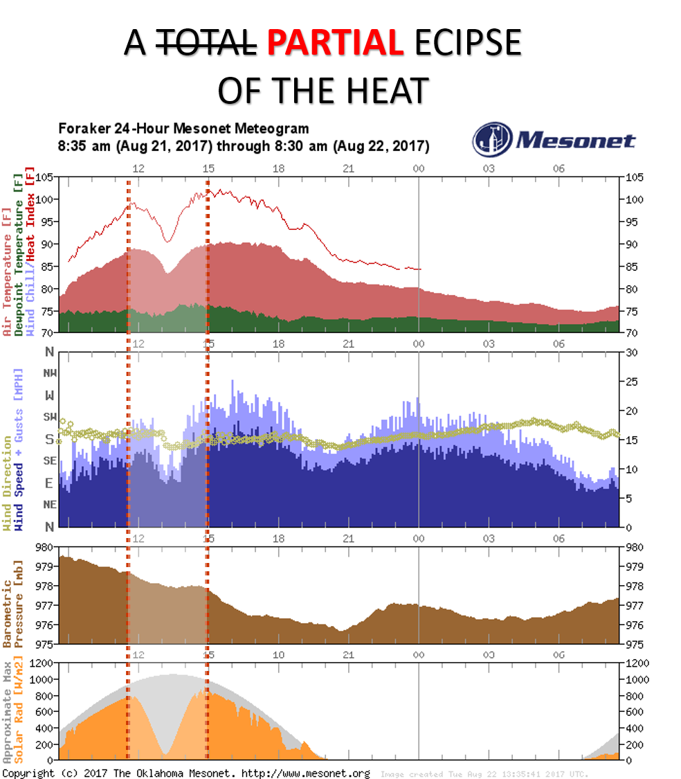
poetic too much, but take a look at that meteogram from the Foraker (Osage County)
Mesonet site. You can see the obvious drop in solar radiation at the bottom as
the eclipse began and ended, as well as an equally obvious drop in temperature (top)
AND wind speed (2nd from top). Not quite as noticeable is a leveling off somewhat
of the barometric pressure (3rd from top). All demonstrate exactly how important
that daytime heating is to the microscale-to-mesoscale-to-synoptic scale changes
in our environment. Less sunlight, less turbulent mixing of the air, less wind
speed, etc. Here's a close up view of the Foraker eclipse period. Notice on the
bottom we have plotted the Tair (temperature at 1.5 meters) and also the Ta9m
(temperature at 9 meters). The obvious drop in temperature down where we're at
around 1.5 meters is more pronounced than the temperature at 9 meters.

So the drop in sensible heat was greater close to the ground than about 30 feet
up. Verrrrry interesting physics at play.
Okay, let's close the book on the solar eclipse and head to another important
eclipse...another eclipse of summer. We had a good run of about 2 weeks at
the beginning of August where the month seemed to jump ahead to mid-September.
Then summer came roaring (AND I MEAN ROARING!!) back with heat indices jumping
back into the 105-110 range. Even yesterday was roasting across most of the
state.

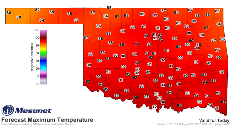
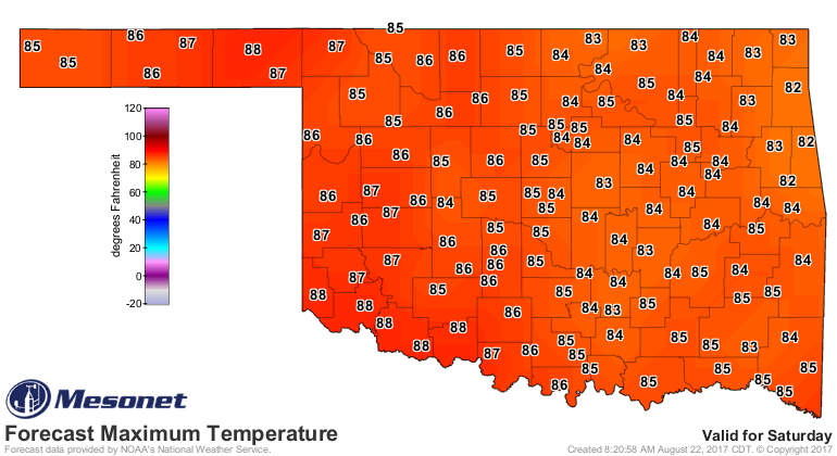
Notice the rain-cooled air for those unfortunate souls in the NW. They were
lucky to get rain, but much more unlucky to miss out on the eclipse. Well,
good timing for the rest of us as a cold front will move into the state and
bring a chance of rain and cooler weather over the next several days. We'll
show you today's forecast highs and then Saturday's as bookends.
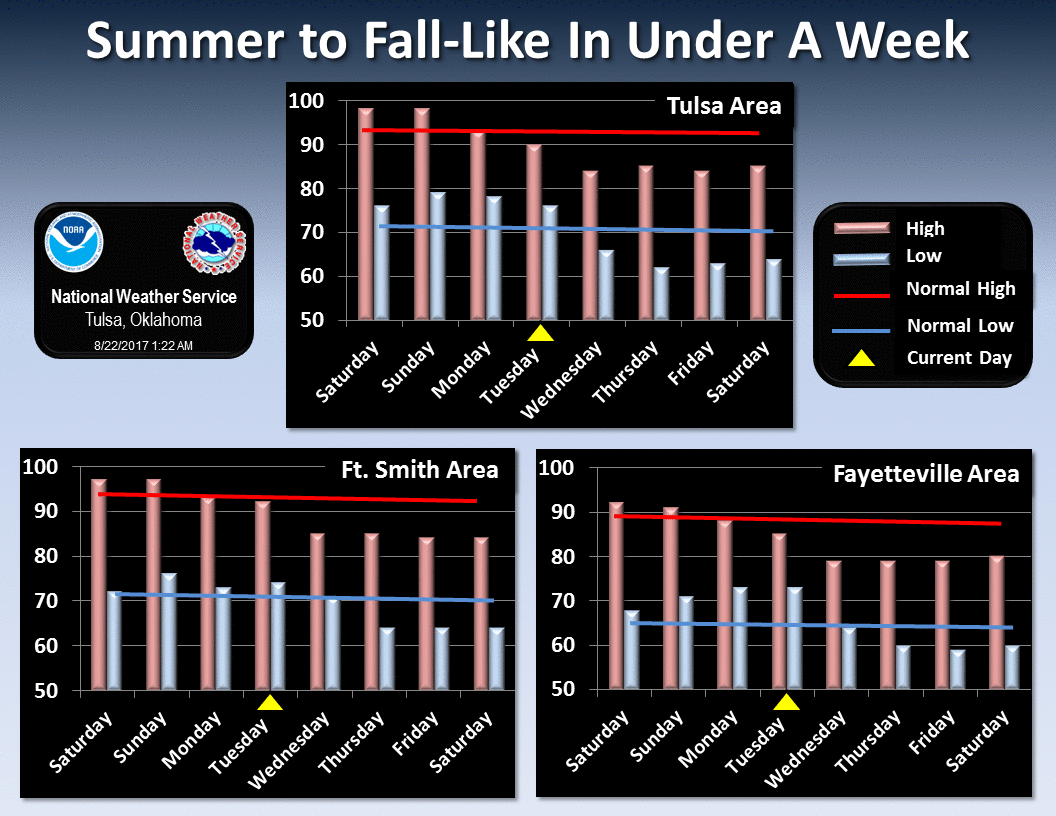
Here are some looks ahead by our NWS friends that will give you a better idea
of what I'm talking about.
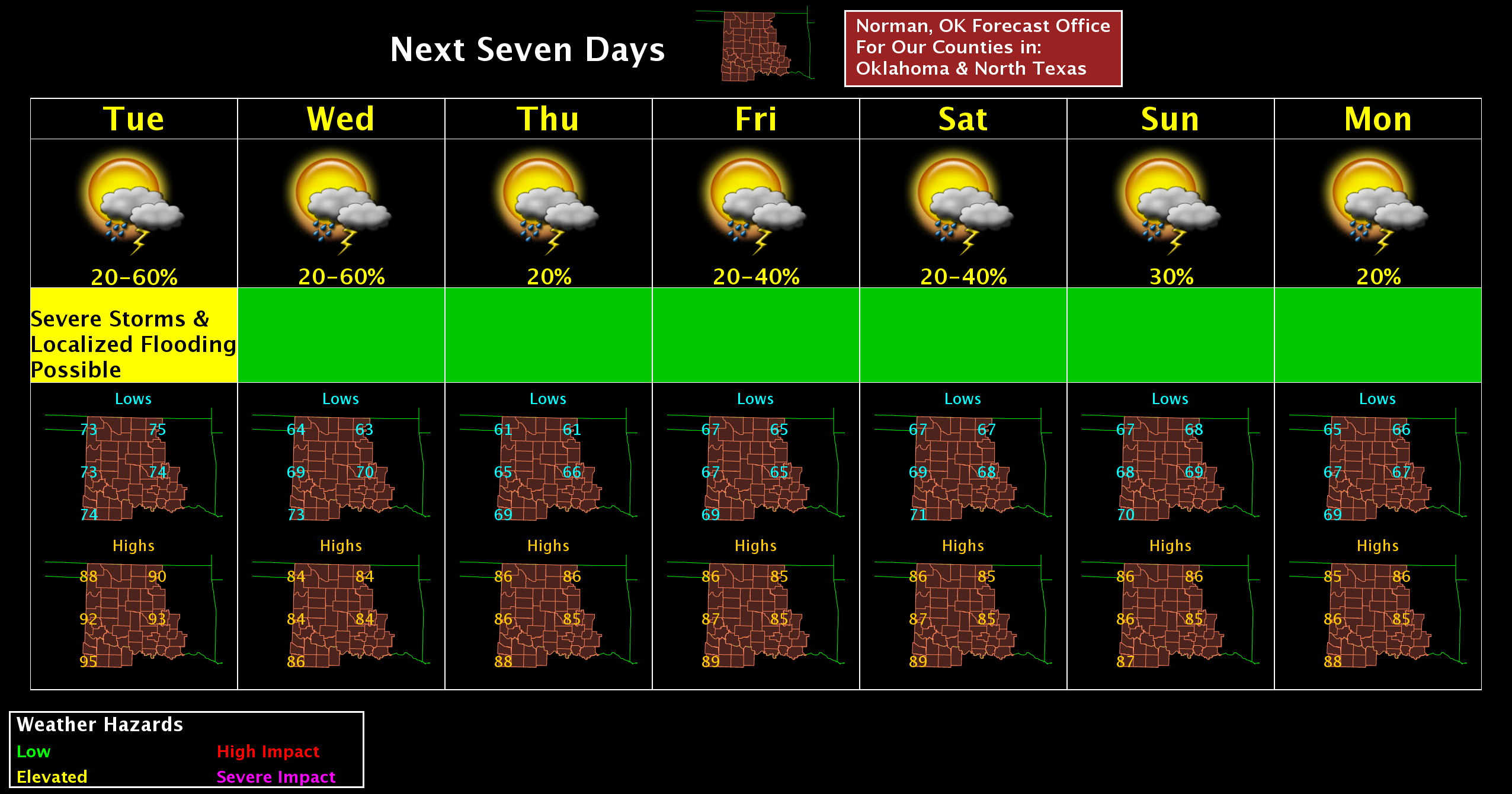
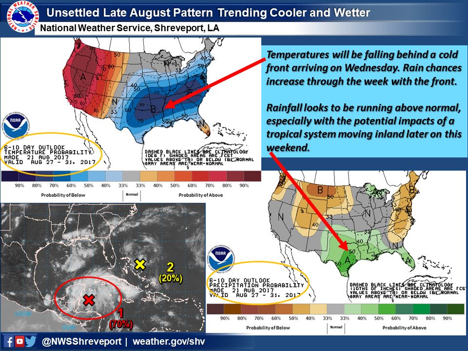
Like the Shreveport folks say, there will possibly be a tropical system moving
ashore sometime over the weekend, which COULD impact Oklahoma, ESPECIALLY far
southeast Oklahoma, but right now it looks as if the system MAY stay to our
southeast.
Verrrrry interesting indeed.
Gary McManus
State Climatologist
Oklahoma Mesonet
Oklahoma Climatological Survey
(405) 325-2253
gmcmanus@mesonet.org
August 22 in Mesonet History
| Record | Value | Station | Year |
|---|---|---|---|
| Maximum Temperature | 108°F | GRA2 | 2023 |
| Minimum Temperature | 48°F | BRIS | 2016 |
| Maximum Rainfall | 4.25″ | MRSH | 2005 |
Mesonet records begin in 1994.
Search by Date
If you're a bit off, don't worry, because just like horseshoes, “almost” counts on the Ticker website!