MESONET TICKER ... MESONET TICKER ... MESONET TICKER ... MESONET TICKER ...
August 6, 2018 August 6, 2018 August 6, 2018 August 6, 2018
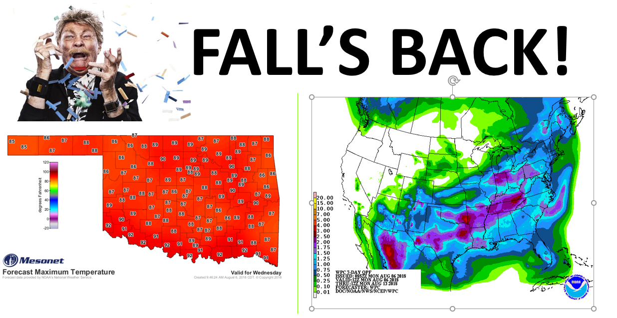
Summer Ripped away again!
http://ticker.mesonet.org/archive/20180806/AugTember.png
Mother Nature's done gone and done it again...she's bringing fall back. AugTember,
right after a good dose of JulTember! Soon it will be SepTober, then maybe some
OctVember? Then We'll be into DArch, then JanRil. See how this works?
I don't either, but if it gets Rip Taylor on a map, then it's a good thing. I
think?
Whatever the case, we're about to go back to what we saw in late July with highs
into the 80s and more importantly...RAIN! And this does looks like it will hit
some of those hard luck folks in southern Oklahoma. The setup is somewhat the
same as well...NW flow aloft should allow a front or two down into our area to
interact with some rich Gulf moisture and produce drops of liquid falling from
the sky. Tuesday night and Wednesday night are best chances, with a chance of
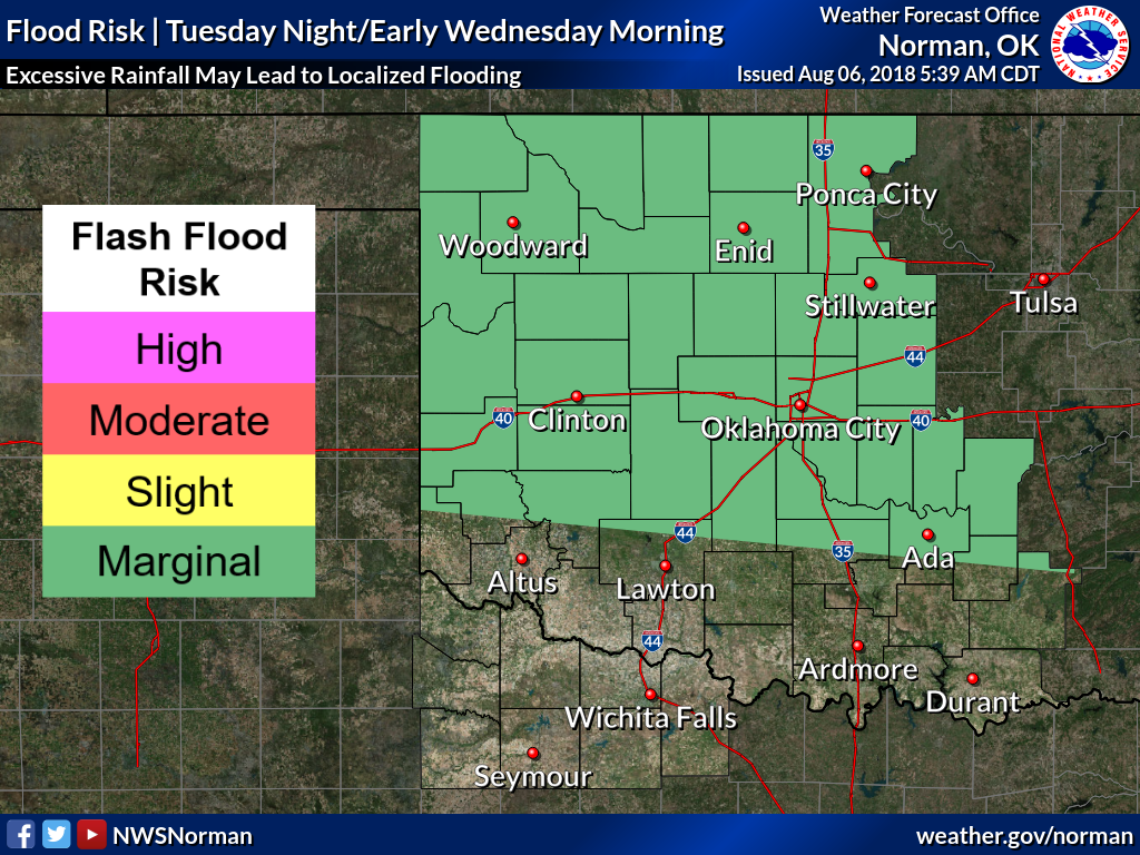
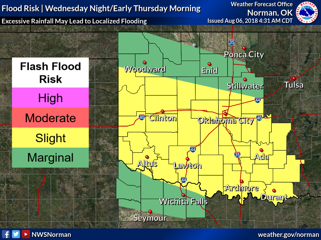
severe weather (mostly winds) Wednesday night. There will also be a flood risk
north of I-40 Tuesday into the night, and along and south of I-40 Wednesday night,
as noted by the Norman NWS office.
http://ticker.mesonet.org/archive/20180806/NWS-norman-tue-flood-risk.png
http://ticker.mesonet.org/archive/20180806/nws-norman-wed-flood-risk.png
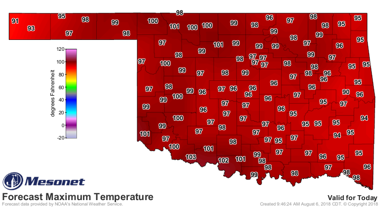
There's a chance of storms later tonight along a cold front in NW OK...maybe
a few severe. After the rain, which will help our temps, we'll stay with
NW flow which will keep ushering in that cooler air from up that way. Highs
will be near or below normal through the next week or so. That is, after we
get roasted again today.
http://ticker.mesonet.org/archive/20180806/todays-forecast-highs.png
So back we go to FUmmer. SAll. SAutumn. Take your pick, make your own.
Just be sure to bring Rip Taylor along.
Gary McManus
State Climatologist
Oklahoma Mesonet
Oklahoma Climatological Survey
(405) 325-2253
gmcmanus@mesonet.org
==================================================
The OCS/Mesonet Ticker
https://ticker.mesonet.org/
To subscribe or unsubscribe from the Ticker
or for questions about the Ticker or its content
Phone or Email the Ticker Manager at OCS
Phone: 405-325-2253 Email: ticker@mesonet.org
---------------------------------------------------
-C- Copyright 2024 Oklahoma Climatological Survey
===================================================
|


 Tweet
Tweet