MESONET TICKER ... MESONET TICKER ... MESONET TICKER ... MESONET TICKER ...
July 30, 2009 July 30, 2009 July 30, 2009 July 30, 2009
Overnight Rains Bolster July Totals
I was just going to say "Overnight Rains" but I wanted to show off and use "Bolster"
in there somewhere. That probably says more about me that I would think the word
"Bolster" is a highfalutin' term, so humor me.
This northwesterly flow continues to offer up much-needed relief (for most)
during July, normally our driest warm season month. And it comes right on the
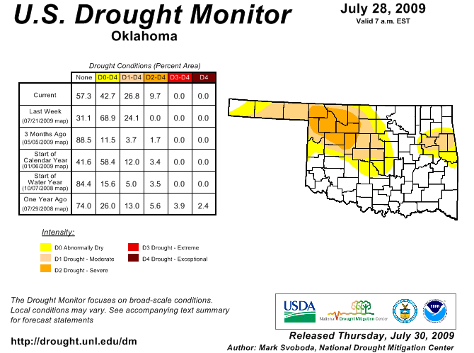
heels of this morning's latest U.S. Drought Monitor release which saw severe (D2)
drought introduced into Oklahoma for the first time since May 12.
http://ticker.mesonet.org/archive/20090730/ok_dm.png
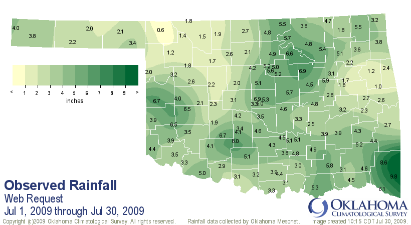
Looking at the rainfall stats for the past seven days and the past month, some of
that area currently depicted in severe drought up in the northwest is still
sorely lacking in rainfall.
http://ticker.mesonet.org/archive/20090730/rain168.hour.gif
http://ticker.mesonet.org/archive/20090730/rain_july1-30.png
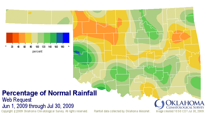
The percent of normal precip map for July 1-30 shows the area centered around
Buffalo (how does that town continue to make it into the Ticker so much??) has
been very dry, especially bad since they were so hot previously this month.
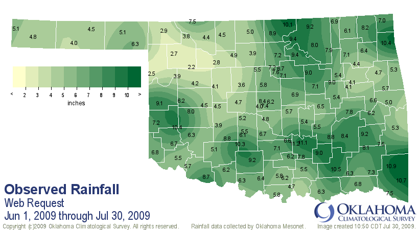
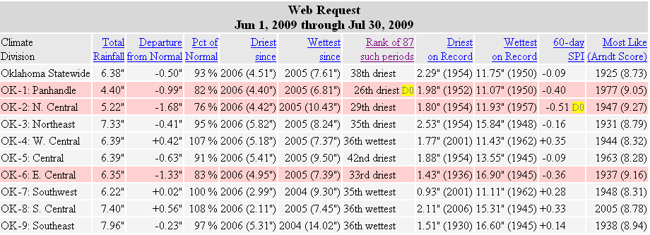
The summer season so far (June 1-July 30...we're climatologists. WE decide when
summer starts!)also depicts that dryness, with a deficit running into eastern
Oklahoma as well. That eastern Oklahoma dryness resulted in our request for a
moderate (D1) drought depiction in that area in the U.S. Drought Monitor.
http://ticker.mesonet.org/archive/20090730/rain_totals_jun1-jul30.png
http://ticker.mesonet.org/archive/20090730/pct_of_normal_jun1-july30.png
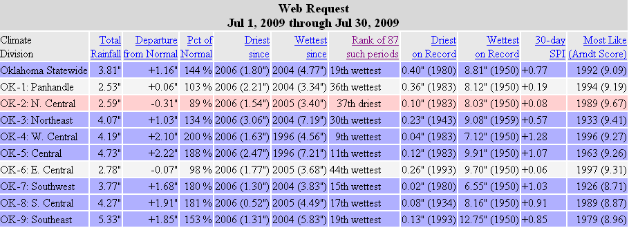
For tabular stats, you can see how the climate division have fared during July
and the summer thus far:
http://ticker.mesonet.org/archive/20090730/july1-30_stats.png
http://ticker.mesonet.org/archive/20090730/jun1-jul30_stats.png
Hopefully we'll see some lessening of the drought conditions with this current
rainfall and that will be reflected on next week's drought monitor map.
Until we meet again...case is solved!
Gary McManus
Associate State Climatologist
Oklahoma Climatological Survey
http://www.facebook.com/pages/Oklahoma-Mesonet/101813120731
http://www.facebook.com/pages/Oklahoma-City-Micronet/108107256598
http://twitter.com/OCSTicker
http://twitter.com/OKCNET
==================================================
The OCS/Mesonet Ticker
https://ticker.mesonet.org/
To subscribe or unsubscribe from the Ticker
or for questions about the Ticker or its content
Phone or Email the Ticker Manager at OCS
Phone: 405-325-2253 Email: ticker@mesonet.org
---------------------------------------------------
-C- Copyright 2024 Oklahoma Climatological Survey
===================================================
|


 Tweet
Tweet