Ticker for July 30, 2007
MESONET TICKER ... MESONET TICKER ... MESONET TICKER ... MESONET TICKER ...
July 30, 2007 July 30, 2007 July 30, 2007 July 30, 2007
News Flash: It's Starting to Dry Out
Here's a quick look at how the soil moisture has changed in the last
seven days:
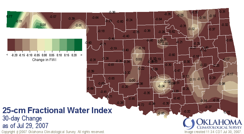
All of that brown represents a profound drying of the soils during
the week. There are some particularly pertinent points to ponder:
1. Drying of the soil column is very typical of summer
2. After June's huge rains, soil moisture really had nowhere to
go but down (drier).
Dryness Becoming an Issue in Parts of Oklahoma
One other thing to notice is the little splotch of green in the
western tippy-tip of the Panhandle. That's a good sight, and it
would be even better to see that expand eastward into the heart
of the panhandle.
It might seem hard for folks in some parts of the state to fathom,
but it's been a pretty dry summer for the Panhandle. After getting
socked with a colossal snowfall to ring in 2007, precip events have
been few and far between, even for a region used to dryness.
This is the "wet" time of year for the western panhandle, unlike the
rest of the state, which relies on April-May-June for the bulk of
its precip.
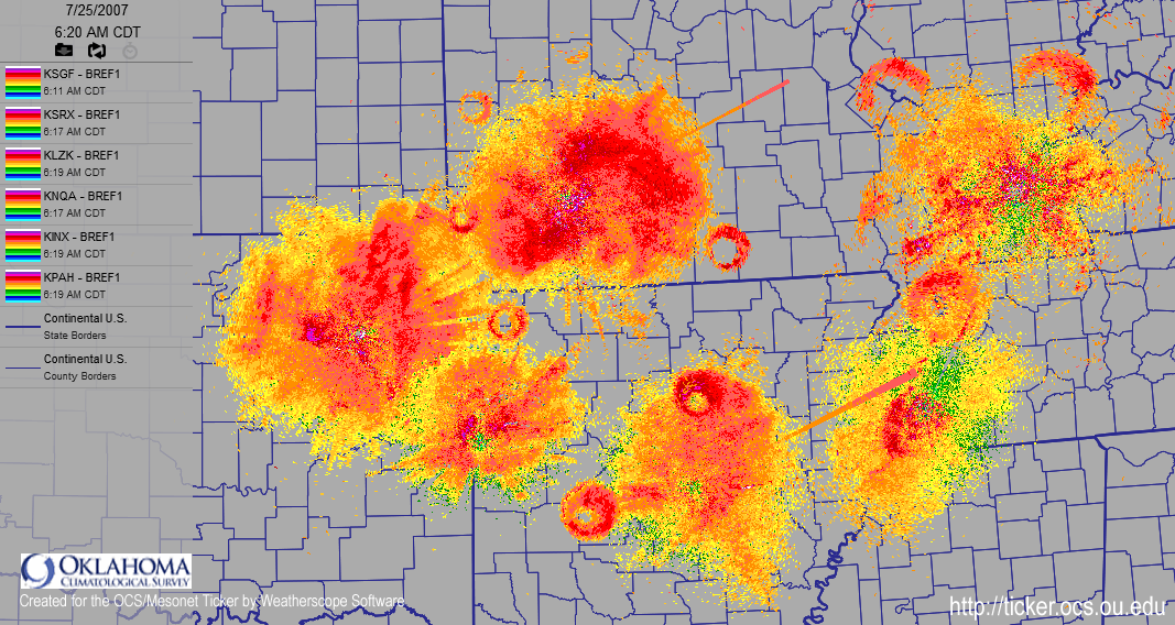
More Crazy Radar Rings
Last week, we saw an exciting explosion of expanding circles on our
radar scope. These were evidence of squadrons of purple martins
leaving their communal roosts to dine on bugs.
Well, today we see more rings, spawned by a completely different
process:
Movie: https://content.mesonet.org/ticker/archive/20070730/vance-rings.mov
Frame 1: 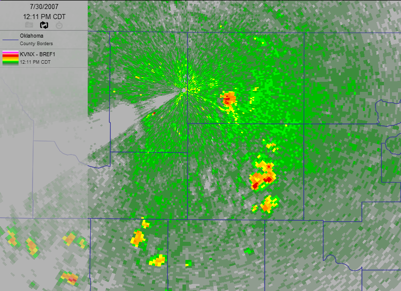
Frame 2: 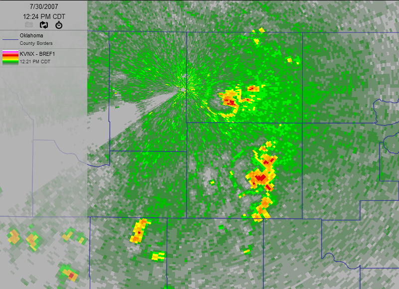
Frame 3: 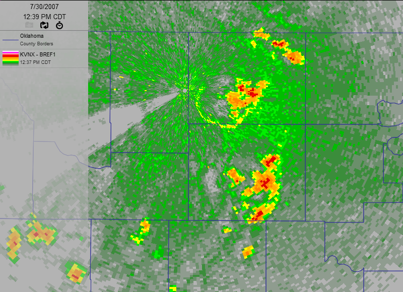
Frame 4: 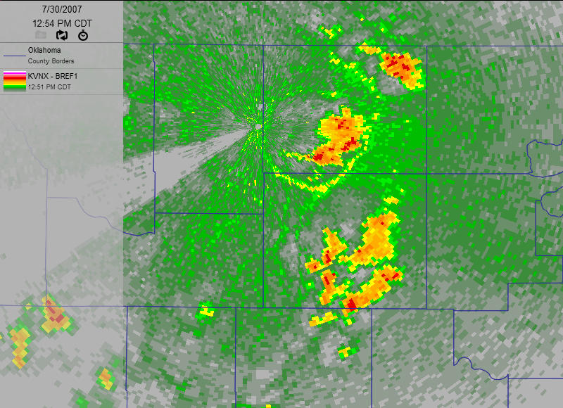
These rings are caused by the downdraft of rain and rain-cooled air
from early afternoon thundershowers. When the downdraft hits the
ground, it spreads out as a "footprint" underneath a storm. There
are several factors at play that help us see such perfect circles:
1. Raindrops and rain-cooled air are heavier than the air of the
surrounding hot July environment. So storms need to work to
suspend them.
2. These storms are going up in a non-sheared environment. In other
words, the upper atmosphere's winds are light. This causes storms
to move slowly. More importantly, it means the updraft points
straight up.
3. The combination of #1 and #2 mean that, the downdraft part of the
storm (the stuff coming down) falls very, very near the updraft
of the storm (the stuff going up). This tends to make pretty
circles near the radar.
In the summer, it's not uncommon for the downdraft to crash right down
into the updraft, killing off the storm.
July 30 in Mesonet History
| Record | Value | Station | Year |
|---|---|---|---|
| Maximum Temperature | 111°F | CHER | 2012 |
| Minimum Temperature | 54°F | BOIS | 2004 |
| Maximum Rainfall | 4.89″ | SPEN | 2014 |
Mesonet records begin in 1994.
Search by Date
If you're a bit off, don't worry, because just like horseshoes, “almost” counts on the Ticker website!