MESONET TICKER ... MESONET TICKER ... MESONET TICKER ... MESONET TICKER ...
July 15, 2019 July 15, 2019 July 15, 2019 July 15, 2019
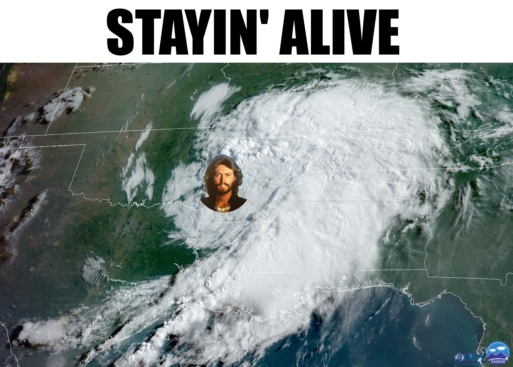
Jive Talkin'
http://ticker.mesonet.org/archive/20190715/barry-goes16.png
To quote another great icon of years past, "Missed it by THAT much." While
Hurricane Barry only made it to a Category 1 level, and is now "merely" a tropical
depression, it certainly made itself known to our southeast. It now resides just
to our east as said tropical depression, nearly skirting the OK/AR state line
around Ft. Smith as indicated by the storm's titular namesake in the
above map, in all his 1970's hirsute glory. And feel free to look up both
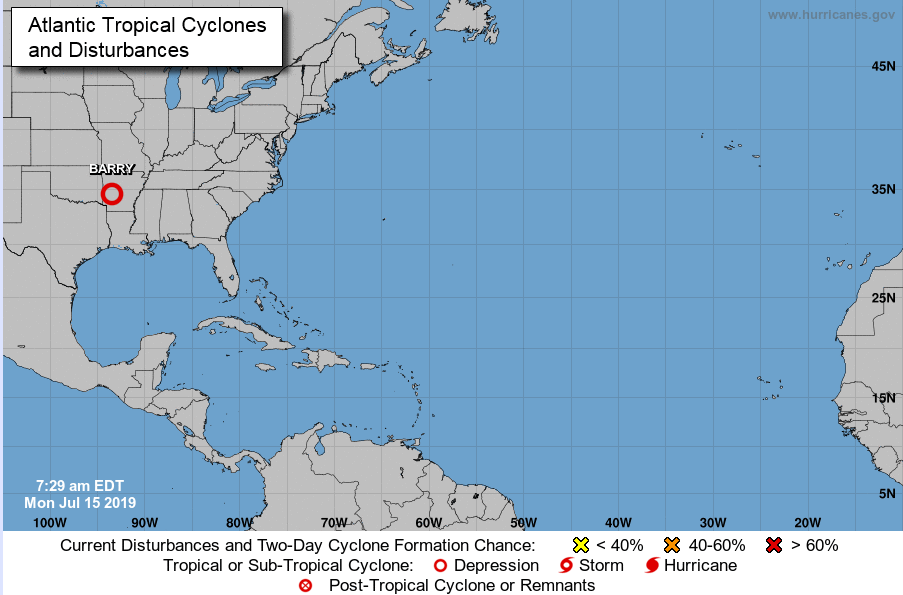
"titular" and "hirsute." I did. Here's the official National Hurricane Center
view.
http://ticker.mesonet.org/archive/20190715/Barry.png
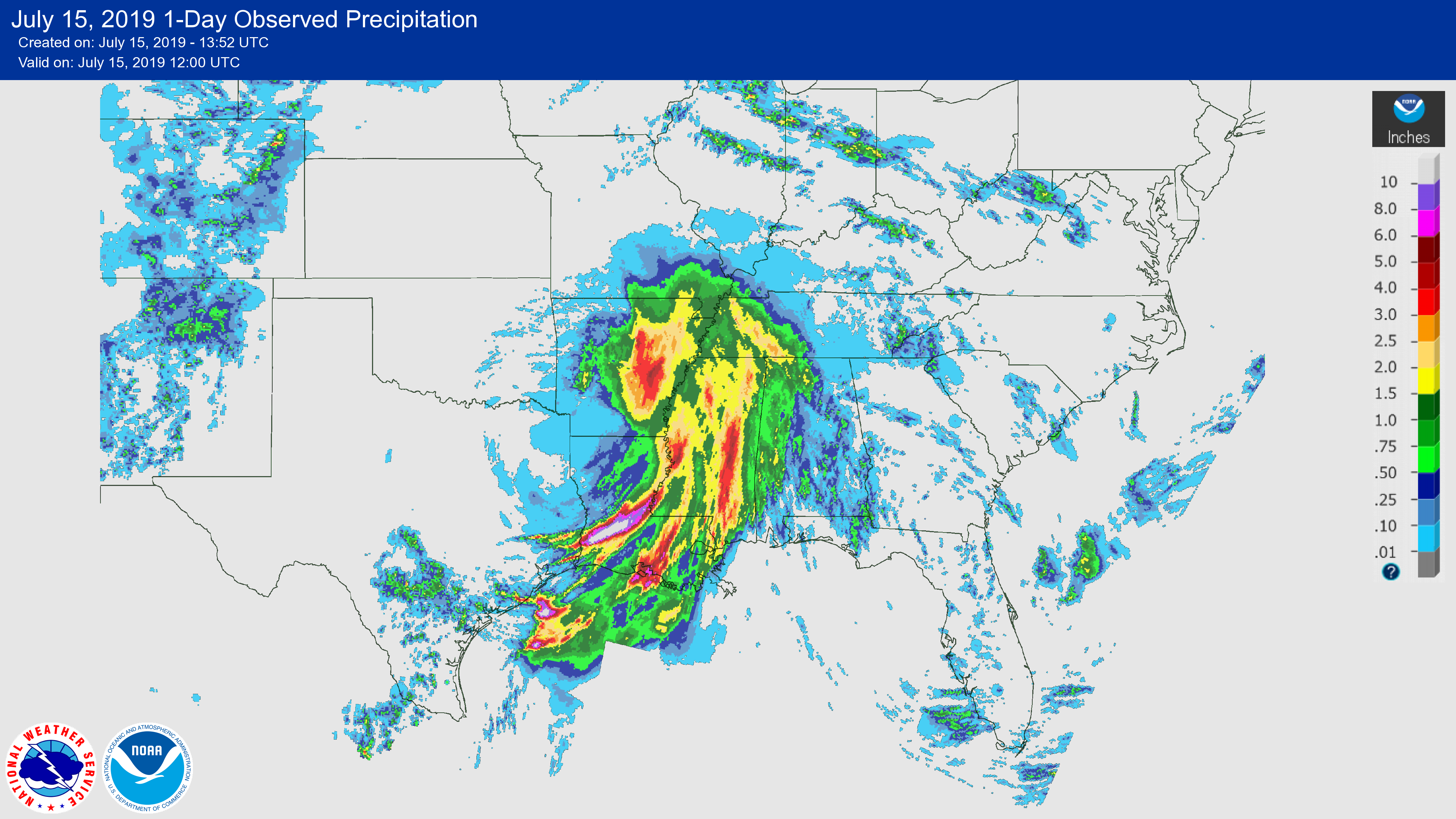
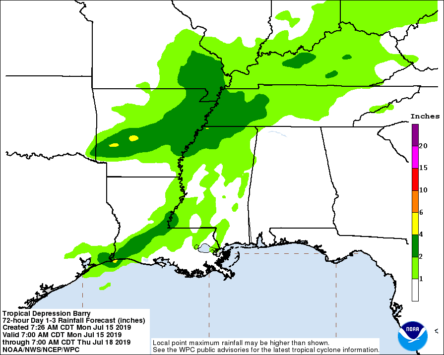
The rainfall map is very impressive. This is only for the last day, but still
some very hefty amounts. And it's also a prime example of how the eastern side of
those tropical systems tend to have the greater rainfall footprints.
http://ticker.mesonet.org/archive/20190715/barry-rainfall.png
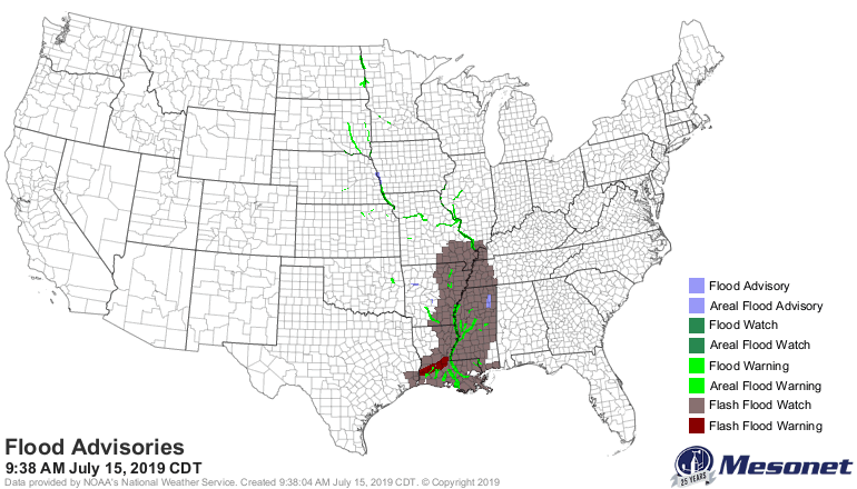
http://ticker.mesonet.org/archive/20190715/latest.flood.gif
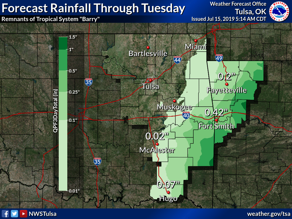
There is still the potential for 2-6 inches of rainfall from the system as it
moves off to the east and continues to unravel. Eastern Oklahoma could still
get just a bit, but not much it would appear.
http://ticker.mesonet.org/archive/20190715/barry-rainfall-potential.gif
http://ticker.mesonet.org/archive/20190715/nws-tulsa-Barry-rainfall.png
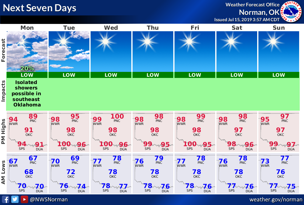
Now that's it. Excitement over. Back to the summer doldrums. Watch for the heat
index to once again rise to dangerous levels as we go through the week. And
it won't just feel like a fever on Saturday. You'll also have Tuesday Night
Fever, Wednesday Night Fever, etc.
http://ticker.mesonet.org/archive/20190715/nws-norman-weekly.planner.png
Gary McManus
State Climatologist
Oklahoma Mesonet
Oklahoma Climatological Survey
(405) 325-2253
gmcmanus@mesonet.org
==================================================
The OCS/Mesonet Ticker
https://ticker.mesonet.org/
To subscribe or unsubscribe from the Ticker
or for questions about the Ticker or its content
Phone or Email the Ticker Manager at OCS
Phone: 405-325-2253 Email: ticker@mesonet.org
---------------------------------------------------
-C- Copyright 2024 Oklahoma Climatological Survey
===================================================
|


 Tweet
Tweet