Ticker for July 3, 2017
MESONET TICKER ... MESONET TICKER ... MESONET TICKER ... MESONET TICKER ...
July 3, 2017 July 3, 2017 July 3, 2017 July 3, 2017
July to the rescue?
As you'll read below, June was dry, except where it wasn't. How's that for
precision (or is that accuracy??)? At any rate, up until the month's final week,
things were not looking good for the state. As of this morning, a significant
area of the state has received beneficial rainfall in the last 7 days.
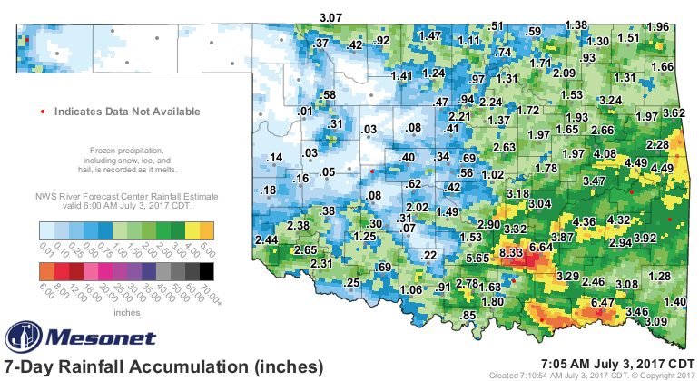
All except the northwestern quarter of the state, that is, extending over into
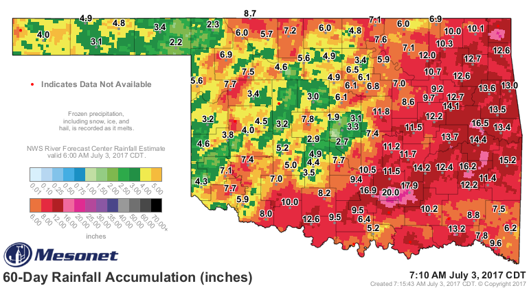
central Oklahoma and down into the southwest. The 60-day rainfall map looks a
*little* better with all those glorious reds, oranges and yellers, but deficits
still show up across much of Oklahoma, particularly in central sections.
Hope for that area of the state now lies with rainfall chances in the next
couple of days as more severe storms and possible flooding. Northwest OK might
get left out from the good stuff yet again, but at least central OK has some
decent prospects (that sounds disappointingly familiar).
And now for something completely different, here's a look back at WHY we need
all this rain. June in a nutshell.
---------------------------------------------------------------------------------
Drought Returns in June
July 3, 2017
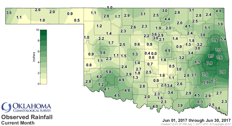
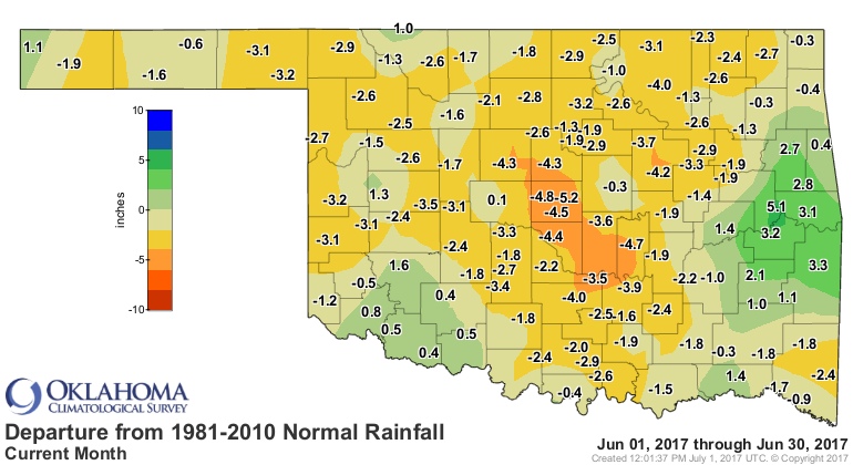
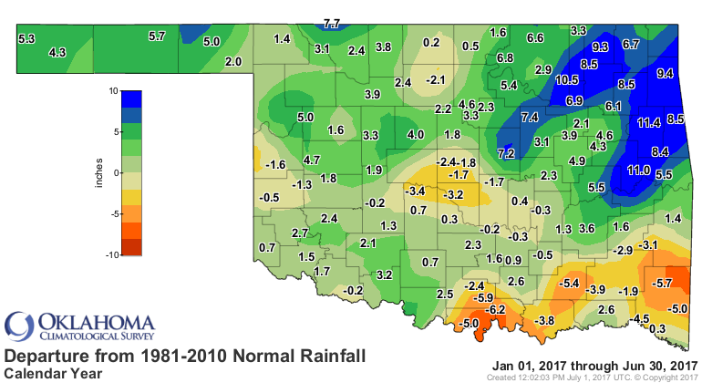
June, normally a pillar of Oklahoma?s spring rainy season, was very much a
disappointment in that regard. Unfortunately, that lack of significant moisture
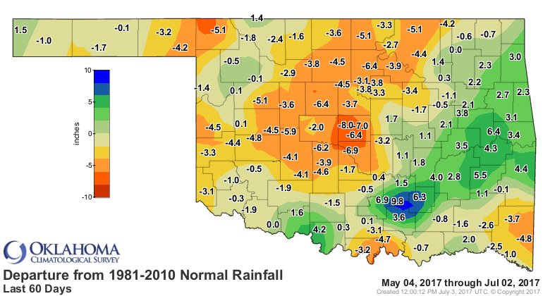
fueled a quick return to drought across parts of the state. Central Oklahoma
became particularly dry with deficits of more than 8 inches accumulating since
the beginning of May. According to preliminary data from the Oklahoma Mesonet,
the month finished with a statewide average of 2.97 inches, 1.55 inches below
normal to rank as the 43nd driest June since records began in 1895. Central
Oklahoma?s average of 1.94 inches fell nearly 3 inches below normal to rank as
that region?s 18th driest June.
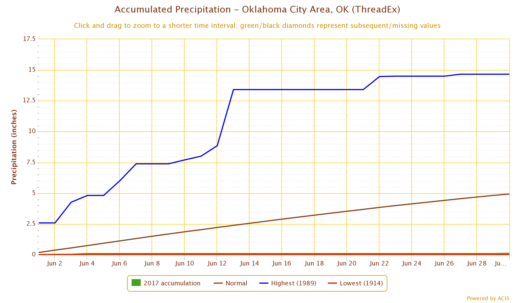
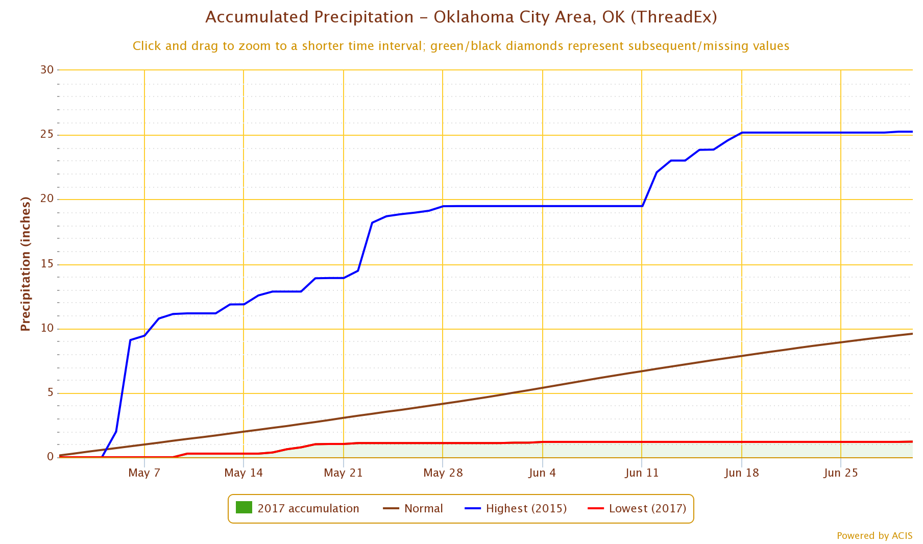
Oklahoma City experienced its second driest June and driest May-June period on
record with 0.11 inches and 1.21 inches, respectively. The Mesonet site at
Spencer recorded a hundredth of an inch during June, barely enough to wet the
rain gauge. While most of the state was dry, there were a few areas that
enjoyed a moisture surplus for the month. Parts of east central Oklahoma
finished 3-5 inches above normal, while isolated areas in the southwest and far
western Panhandle came out ahead as well. Webbers Falls led the state with 9.65
inches during June.

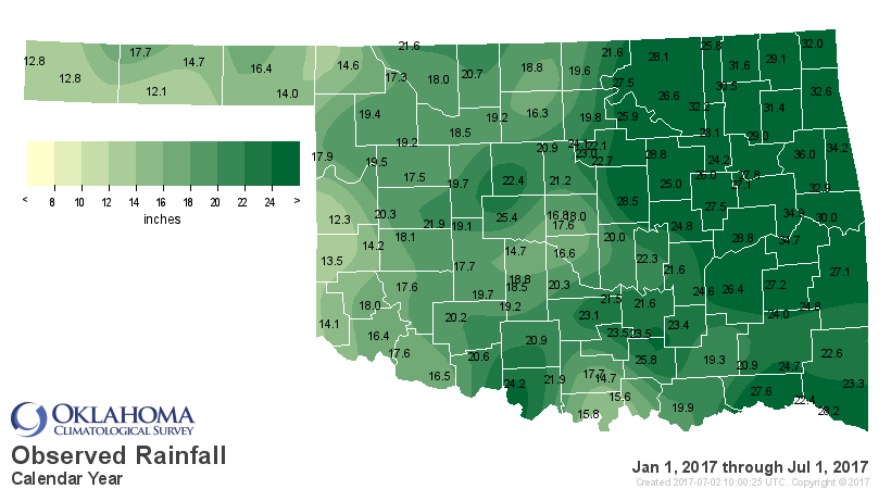
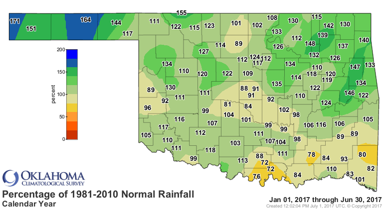
Despite the dry May and June, 2017 remained above normal through the first six
months with a statewide average of 20.91 inches, the 26th wettest such period
on record.
Despite the slant towards dryness during June, there was still plenty of severe
weather. The most intense storms were saved for the last week of the month.
Hail to the size of baseballs was reported across southwestern Oklahoma on the
30th. There were even a couple of possible tornado sightings in the far western
Panhandle on the 25th. The state?s tornado count for the year had climbed to 62
at the start of June according to preliminary data from the National Weather
Service, including 50 that touched down during May. The 1950-2016 annual
average is 56.
Mother Nature made up for the disappointing rain totals by offering extended
breaks from the summer heat. Highs were mostly in the 70s and 80s the weekend
of June 23-25, and some highs only reached the 60s early in the month. Summer
still peaked through at times, of course. The Mesonet recorded at least one
triple-digit temperature on 14 of the 30 days in June, and heat index values
soared as high as 112 degrees on a couple of occasions. The statewide average
temperature was 76.7 degrees, 0.2 degrees above normal to rank as the 52nd
coolest June on record.

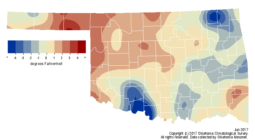
The month?s highest temperature was 106 degrees at Hooker on the 17th. The
lowest temperature was 46 degrees at Kenton on June 14. The year was still on
pace to finish as one of the warmest on record. The January-June statewide
average of 58.6 degrees was 2.9 degrees above normal, the fourth warmest such
period on record.
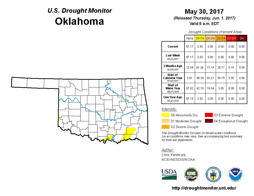
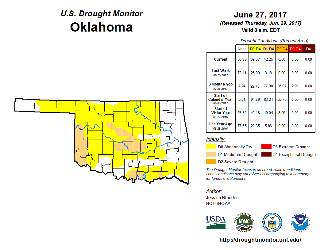
The bursts of summer heat, combined with strong winds and lack of rainfall,
created a ?flash drought? scenario ? a relatively rapid return to drought
compared to the normal long-term development of the hazard. Per the U.S.
Drought Monitor, the state went from no drought at the beginning of the month
to 13 percent on June?s final report. The amount of the state in abnormally dry
conditions, signaling areas where drought could develop if significant moisture
remained absent, exploded from 3 percent to 57 percent during the month.
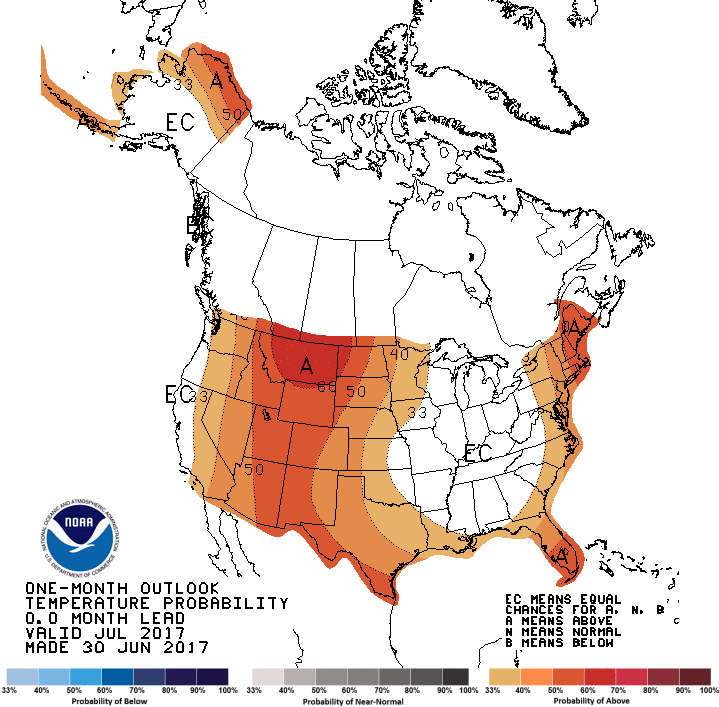
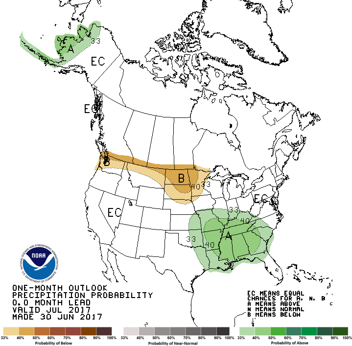
The July temperature outlook from the Climate Prediction Center (CPC) showed
increased odds of above normal temperature over the western two-thirds of the
state, but no clear indication for the eastern third. The odds are tilted for
above normal precipitation for the eastern half of the state.
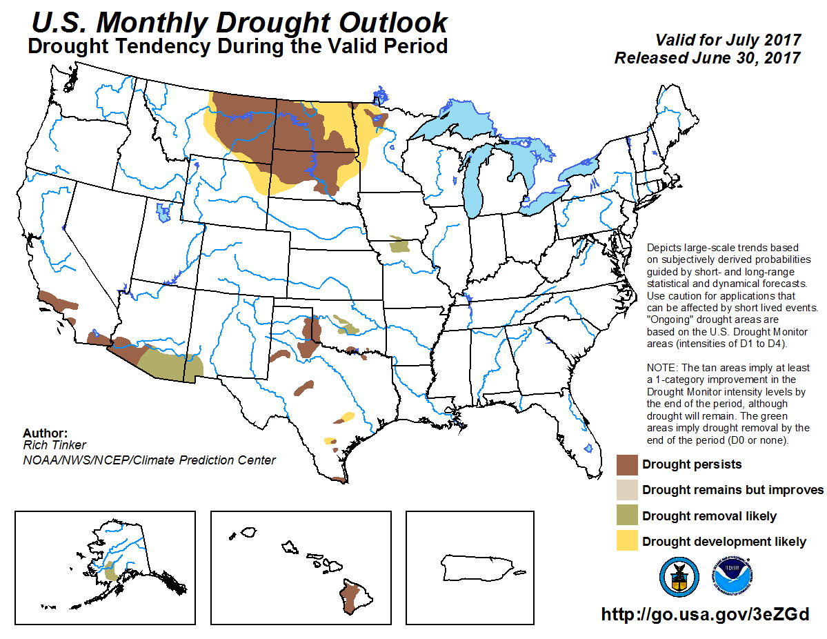
According to CPC?s drought outlook for July, drought will tend to persist or
intensify across western Oklahoma, but improve in central Oklahoma. No drought
development within Oklahoma is indicated on the July drought outlook.
Gary McManus
State Climatologist
Oklahoma Mesonet
Oklahoma Climatological Survey
(405) 325-2253
gmcmanus@mesonet.org
July 3 in Mesonet History
| Record | Value | Station | Year |
|---|---|---|---|
| Maximum Temperature | 106°F | KIN2 | 2011 |
| Minimum Temperature | 49°F | VINI | 2014 |
| Maximum Rainfall | 6.39″ | NOWA | 2016 |
Mesonet records begin in 1994.
Search by Date
If you're a bit off, don't worry, because just like horseshoes, “almost” counts on the Ticker website!