MESONET TICKER ... MESONET TICKER ... MESONET TICKER ... MESONET TICKER ...
June 27, 2022 June 27, 2022 June 27, 2022 June 27, 2022
The Hunt for Junetober
https://ticker.mesonet.org/archive/20220627/todays-forecast-highs.png
Sean Connery is a serial smacker. Ever notice how he eats in movies? Lots of noise,
lots of greasy lips but his mouth never seems to close. "The Hunt for Red October"
was a good example because he had to eat some sort of poached or steamed fish (and
we all know just how gross that can be). Up until the yesterday, you could have
poached or steamed a fish by just throwing it on the sidewalk.
BOOM! Now THAT'S a segue!
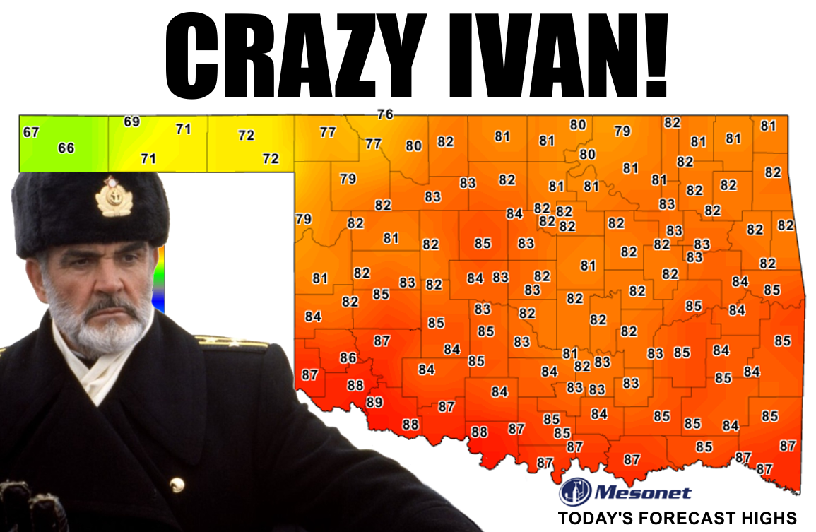
The consecutive days at or above 90 degrees map officially puts our heat wave at
16 days for most of the state, but 17 for most of those unlucky folks down south
that didn't get the front in time to stave off the true heat of the day. Yesterday's
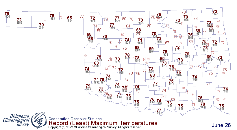
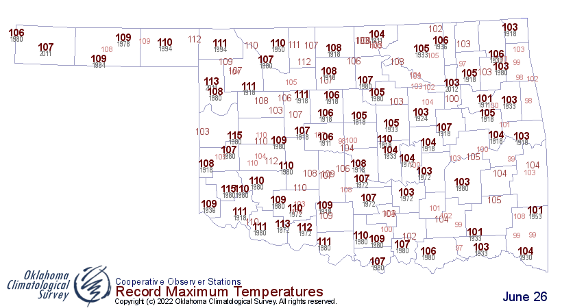
temperature difference across the state was so crazy we set (shattered, really)
records for LOW max temperatures in the western Panhandle at the same time as
approaching near HIGH max temperatures in SE OK.
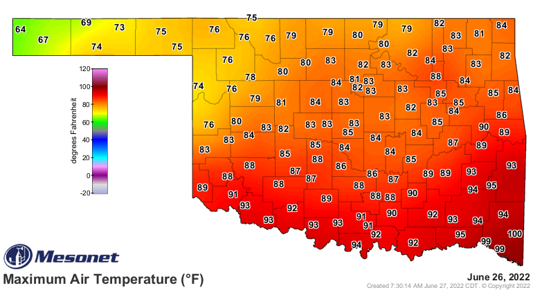
https://ticker.mesonet.org/archive/20220627/yesterdays-highs.png
https://ticker.mesonet.org/archive/20220627/june26-low-tmax-records-.png
https://ticker.mesonet.org/archive/20220627/june26-hi-tmax-records.png
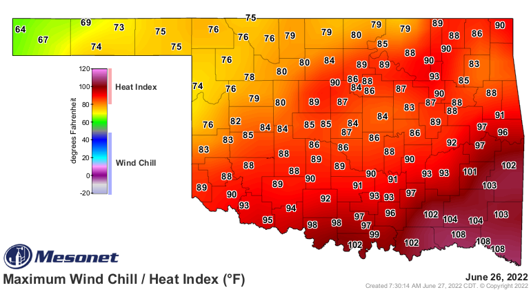
And of course it FELT much worse than that down in the SE.
https://ticker.mesonet.org/archive/20220627/yesterdays-high-heat.index.png
Everybody gets into the much cooler act today, with more record LOW max temps
in the western Panhandle, and much higher comfort level down south as you
can see from the records map vs. the forecast highs from the top map.
https://ticker.mesonet.org/archive/20220627/june27-low-tmax-records.png
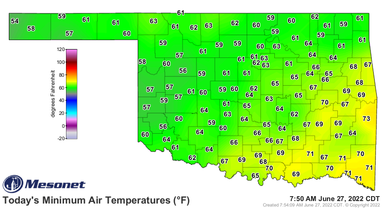
Heck, it even felt like fall this morning for some of us.
https://ticker.mesonet.org/archive/20220627/todays-min-temps.png
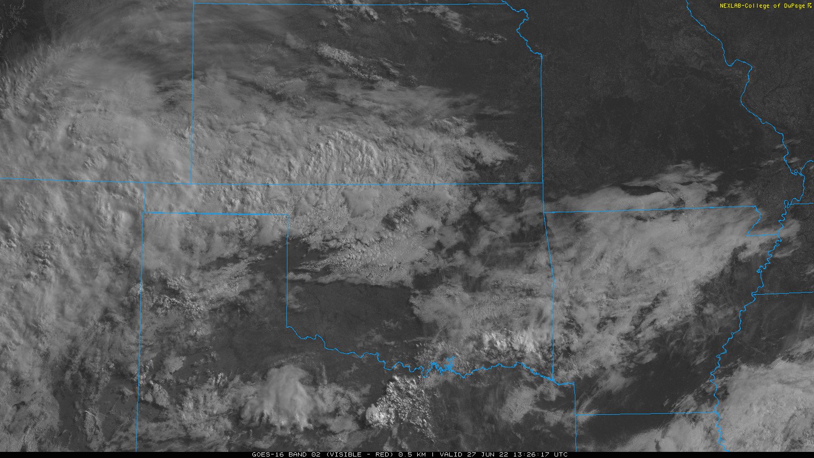
Helping those folks in the NW approach or shatter those low max temp records will
be plenty of cloudiness, and maybe a bit of rain.
https://ticker.mesonet.org/archive/20220627/S_Plains.02.jpg
Endless gray skies, drizzle, temperatures in the 50s and 60s...can fall be far
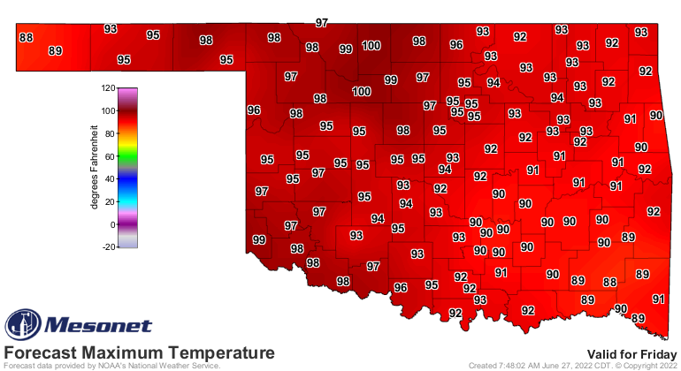
behind? Well, yes it can. We're back into the frying pan later this week.
https://ticker.mesonet.org/archive/20220627/friday-forecast-highs.png
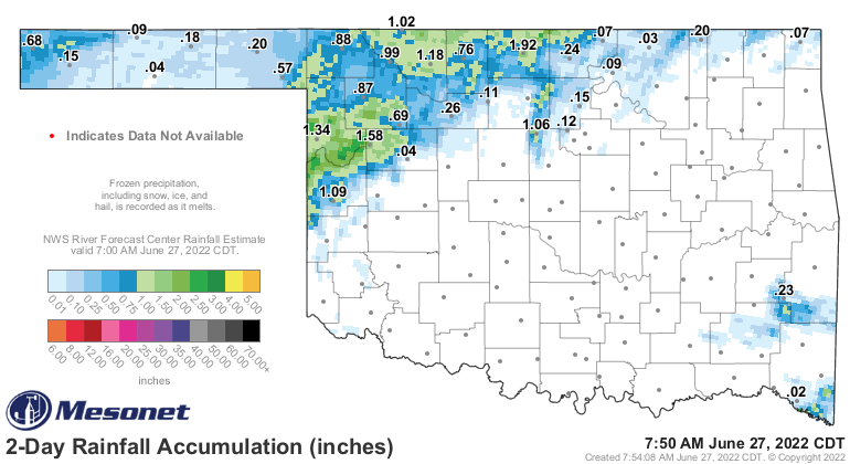
And speaking of rain, they got a good dousing up in the NW the last couple of
days as expected...maybe even better than expected.
https://ticker.mesonet.org/archive/20220627/48hour-rain-totals.png
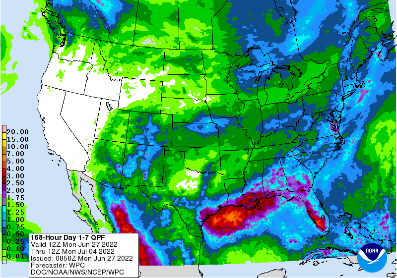
Don't expect much more without a front there to focus on.
https://ticker.mesonet.org/archive/20220627/7day-rain-forecast.gif
So we ended our nice little June heat wave...the hottest extended bout of heat
we've seen in the state since December 2021...errrrr, July 2020. And the hottest
extended June weather we've seen since the 2011-2012 versions.
https://ticker.mesonet.org/archive/20220627/june-high-temps.png
Now, give me a summer, Vasili.
One summer only.
Gary McManus
State Climatologist
Oklahoma Mesonet
Oklahoma Climatological Survey
gmcmanus@mesonet.org
==================================================
The OCS/Mesonet Ticker
https://ticker.mesonet.org/
To subscribe or unsubscribe from the Ticker
or for questions about the Ticker or its content
Phone or Email the Ticker Manager at OCS
Phone: 405-325-2253 Email: ticker@mesonet.org
---------------------------------------------------
-C- Copyright 2024 Oklahoma Climatological Survey
===================================================
|


 Tweet
Tweet