MESONET TICKER ... MESONET TICKER ... MESONET TICKER ... MESONET TICKER ...
May 21, 2020 May 21, 2020 May 21, 2020 May 21, 2020
Glub Glub
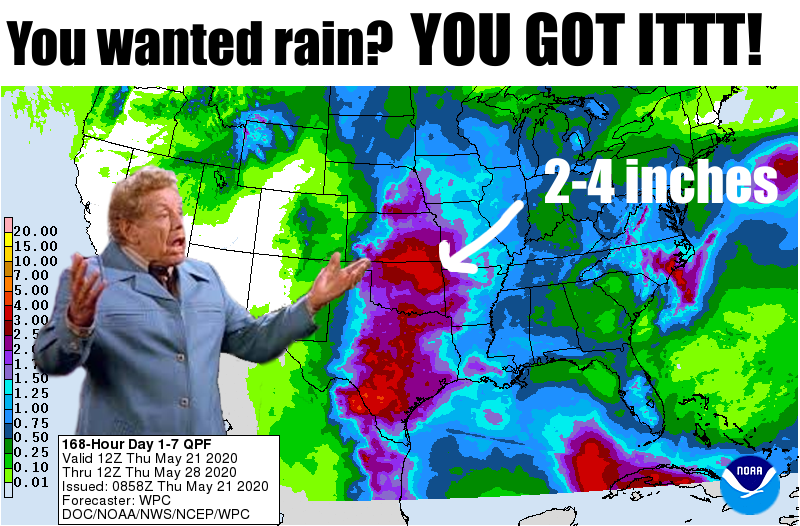
http://ticker.mesonet.org/archive/20200521/7day-rain-forecast.png
Wow, fresh off a long Monday and Tuesday of compiling data and asking for local
input across western Oklahoma to justify a major expansion of moderate drought,
along comes Mother Nature to make it all a moot point (NO, NOT MUTE!).
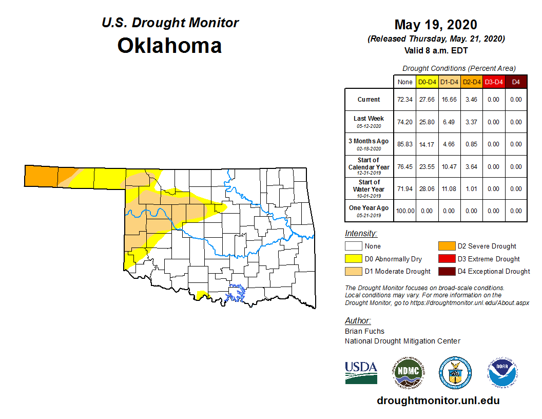
http://ticker.mesonet.org/archive/20200521/20200519_OK_trd.png
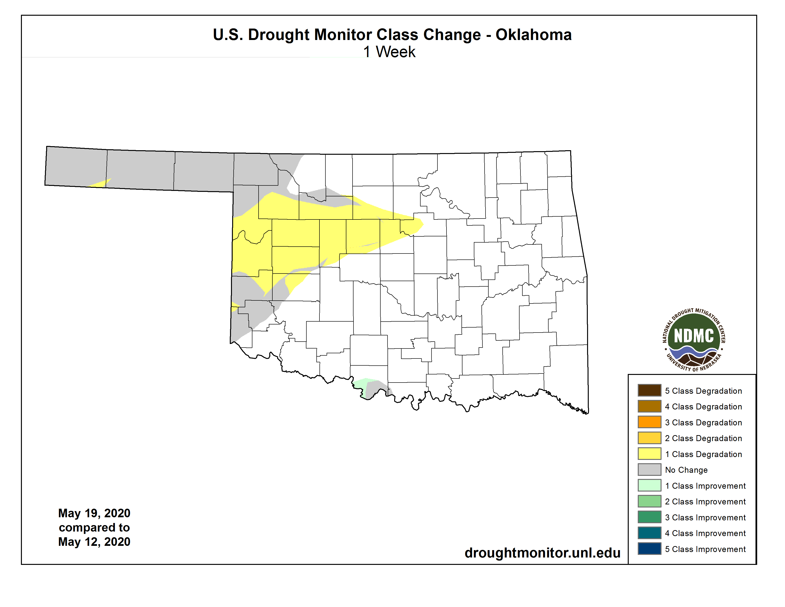
http://ticker.mesonet.org/archive/20200521/1week-change-DM.png
Heck no we're not complaining! In a week that saw out moderate drought coverage
jump 10 percentage points from 6.49% to 16.66%, we saw the handwriting on the
wall. We've done this script before, and it ain't pretty, probably a couple of
weeks away from seeing 33% of the state in drought.
Now this optimism comes with some caveats, because we've done THIS act before,
too.
1. The forecast has to come true. The rain looks good on paper thus far, but we'll
see.
2. We're talking mostly convection, which can leave one county with 3" and
another with a tenth. Shoot, that can happen from field to field when it
comes to Plains thunderstorms.
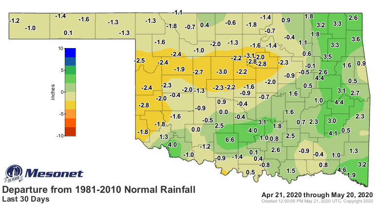
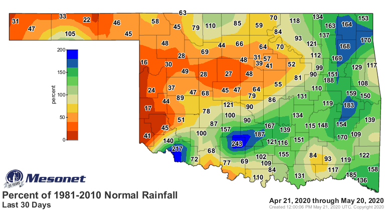
3. It has to be enough to overcome the deficits we're seeing over the last
30-90 days, and they are getting substantial.
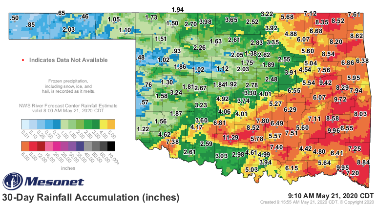
http://ticker.mesonet.org/archive/20200521/30day-totals.png
http://ticker.mesonet.org/archive/20200521/30days.norm_dep.png
http://ticker.mesonet.org/archive/20200521/30days.norm_pct.png
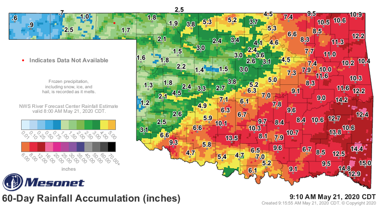
http://ticker.mesonet.org/archive/20200521/60day-totals.png
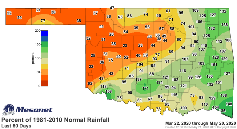
http://ticker.mesonet.org/archive/20200521/60days.norm_dep.png
http://ticker.mesonet.org/archive/20200521/60days.norm_pct.png
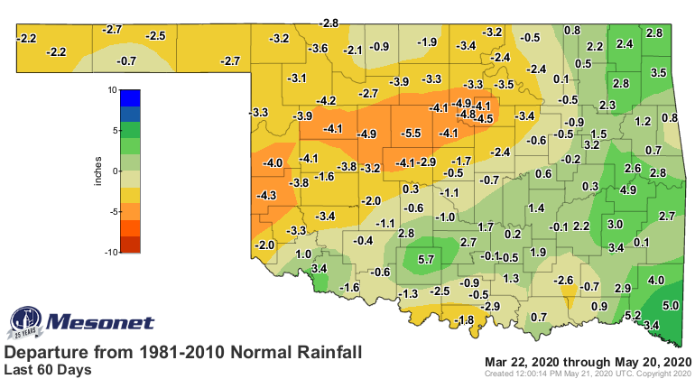
West central Oklahoma has suffered through its 7th driest last 60 days on record,
dating back to at least 1921, and much of western Oklahoma hasn't fared much
better than that.
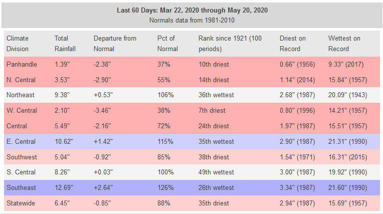
http://ticker.mesonet.org/archive/20200521/60day-rain-stats.png
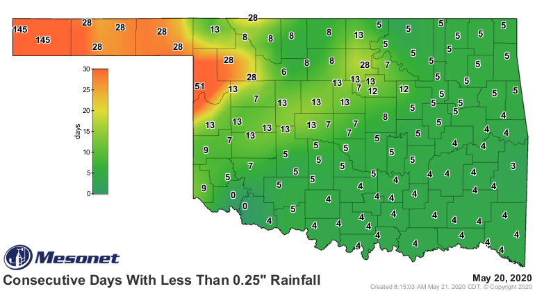
And a major concern still exists in the far western Panhandle, which isn't
forecast to get nearly enough to overcome what we've seen over the last 6
months or so.
http://ticker.mesonet.org/archive/20200521/mesonet.rainfall.quarterinch.png
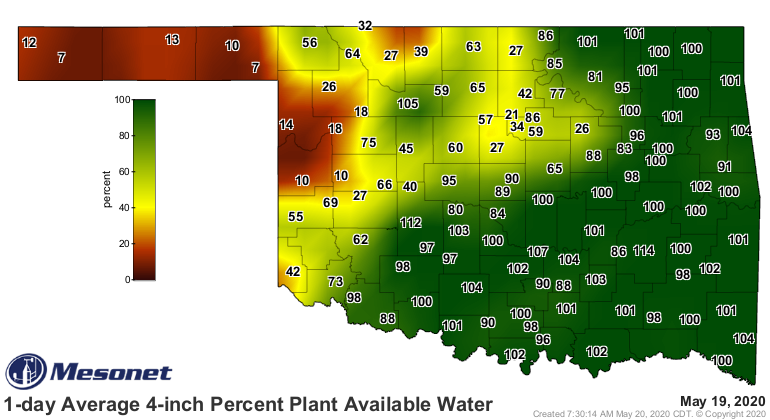
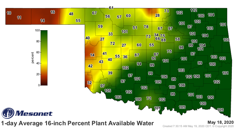
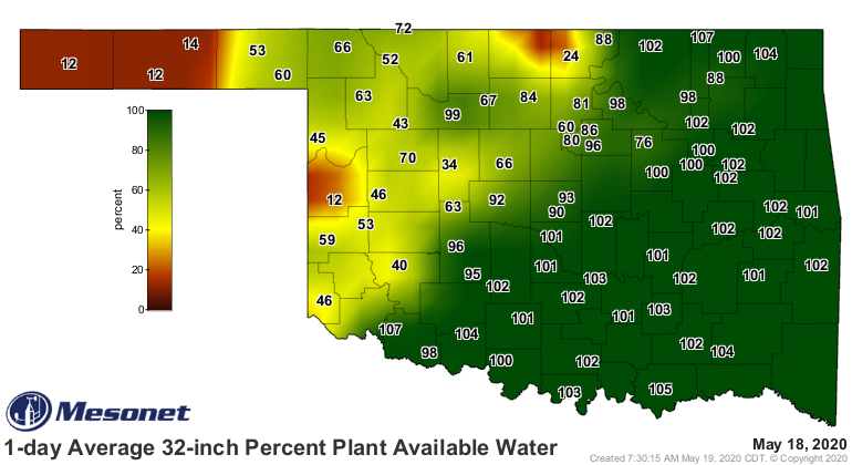
Over the last 30-90 days, we've seen a significant loss of soil moisture
available for plants to use, down to at least the 32-inch level.
http://ticker.mesonet.org/archive/20200521/mesonet.daily.current.PPAW10.grad.png
http://ticker.mesonet.org/archive/20200521/mesonet.daily.current.PPAW40.grad.png
http://ticker.mesonet.org/archive/20200521/mesonet.daily.current.PPAW80.grad.png
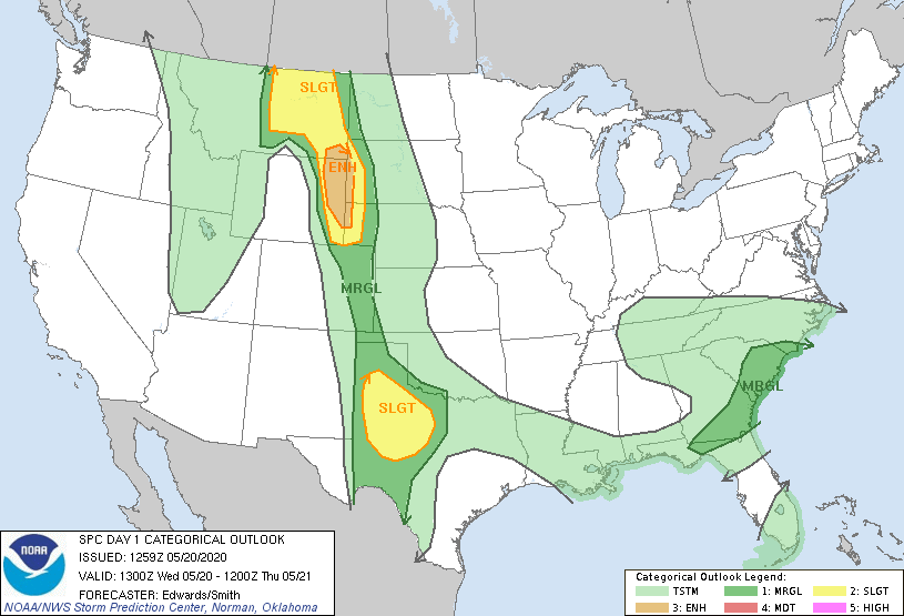
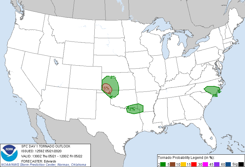
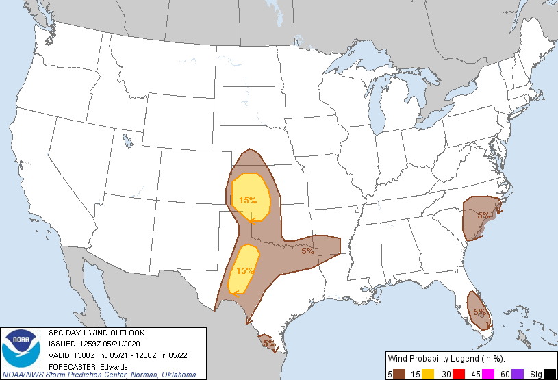
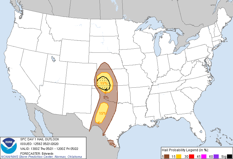
So the western half of the state, and an area bleeding over into north central
Oklahoma, needs rain. And of course, given that it's May, that can often come
with some unpleasantness. SPC has pegged far NW OK as a possible danger zone
today, with chances of large hail, high winds, and even a tornado or two. Not
too bad for May in Oklahoma, however.
http://ticker.mesonet.org/archive/20200521/day1otlk_1300.gif
http://ticker.mesonet.org/archive/20200521/day1probotlk_1300_torn.gif
http://ticker.mesonet.org/archive/20200521/day1probotlk_1300_wind.gif
http://ticker.mesonet.org/archive/20200521/day1probotlk_1300_hail.gif
Then we'll see marginal risks for severe weather over the next few days after
that, but again, nothing really MAY worthy. At least the way it looks at this
point. Basically a week of rain chances, off and on through the period.
Okay, let it rain or this will be a MUTE point, at least this week. We'll do
moot again next week.
Gary McManus
State Climatologist
Oklahoma Mesonet
Oklahoma Climatological Survey
(405) 325-2253
gmcmanus@mesonet.org
==================================================
The OCS/Mesonet Ticker
https://ticker.mesonet.org/
To subscribe or unsubscribe from the Ticker
or for questions about the Ticker or its content
Phone or Email the Ticker Manager at OCS
Phone: 405-325-2253 Email: ticker@mesonet.org
---------------------------------------------------
-C- Copyright 2024 Oklahoma Climatological Survey
===================================================
|


 Tweet
Tweet