Ticker for May 13, 2015
MESONET TICKER ... MESONET TICKER ... MESONET TICKER ... MESONET TICKER ...
May 13, 2015 May 13, 2015 May 13, 2015 May 13, 2015
Here it comes!

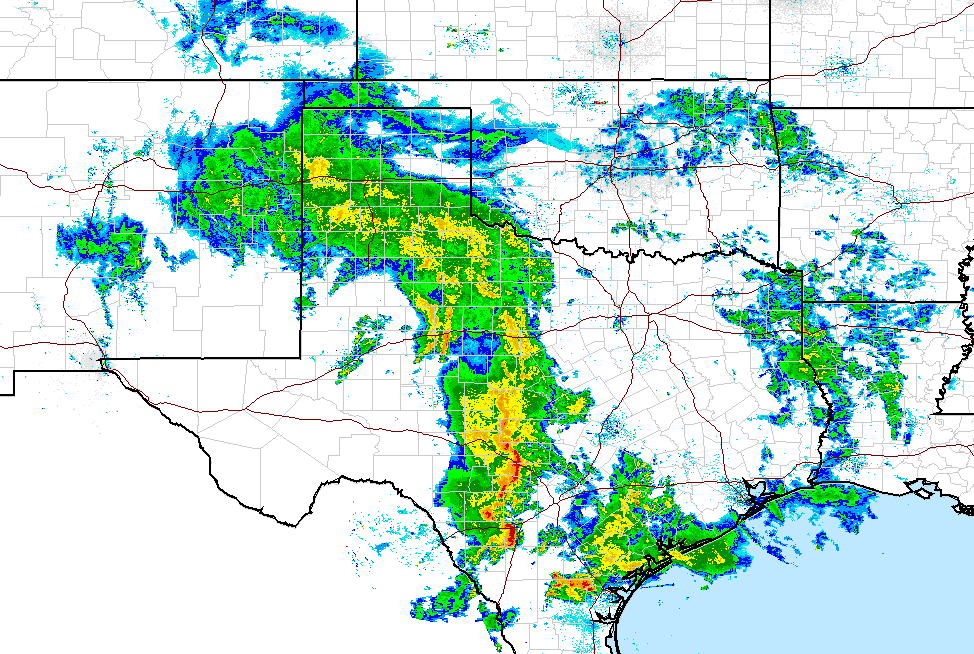
It ain't here yet, but it's definitely showing up on the radar. Texas is getting
theirs right now, we get ours later. I'm too lazy to try and remember if theirs
and ours get apostrophes, so I'm going with no.
Our friends (yes, we have friends...and we don't even have to pay them) at the
local NWS offices are still looking at some possibly heavy rainfall today and
tonight.
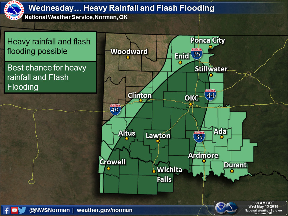

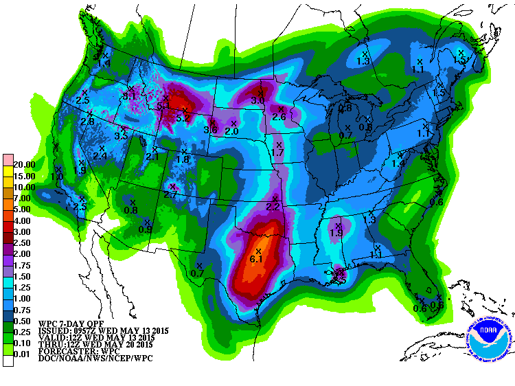
Forecast amounts are in the 1-2 inch range, especially across SW through C OK.
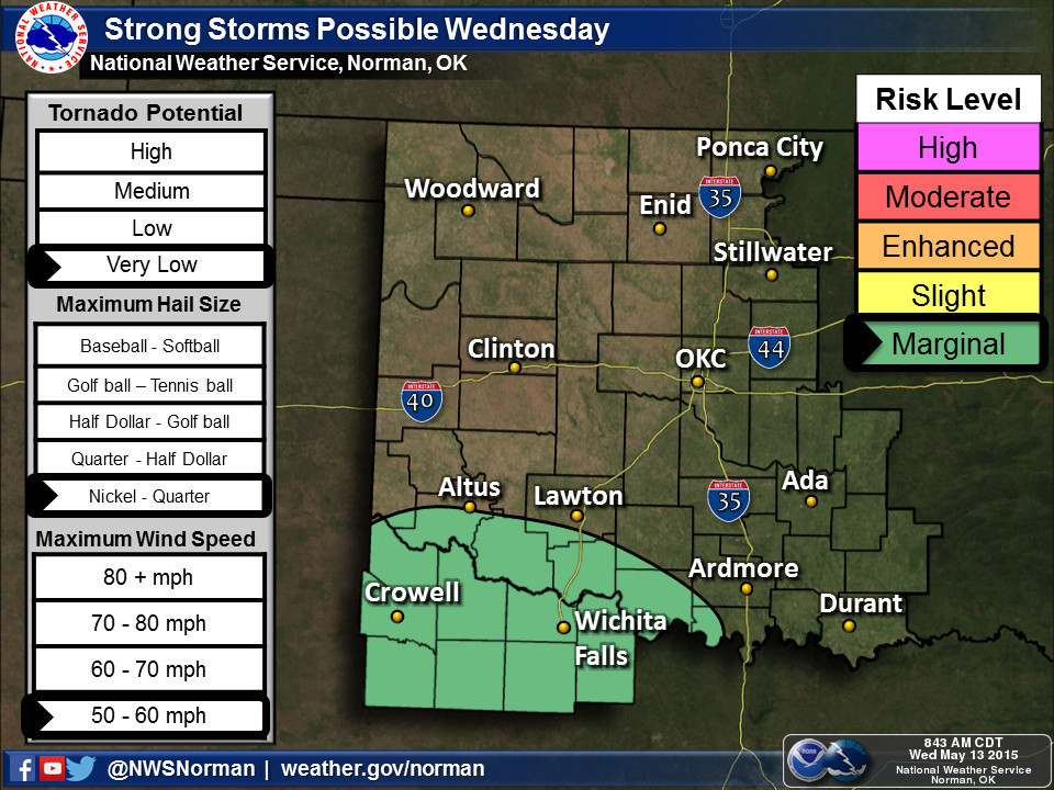
Chance of severe weather is low today, but it will pick back up again on Friday
after a brief lull on Thursday. Saturday looks like the big day again, but Friday
is no slouch. But as we've learned time and time again, these forecasts can and
will change between now and then...so stay aware of staying weather aware.
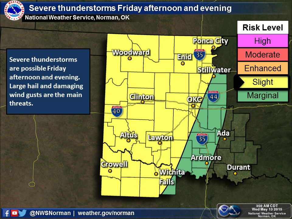
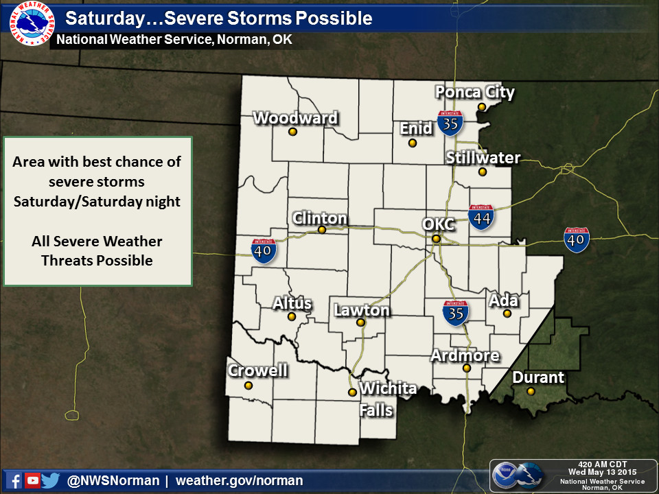
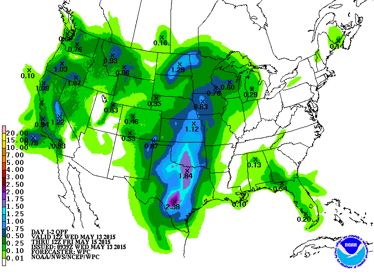
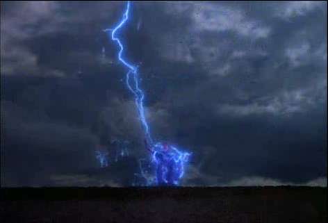
So whether we have lots of big hail, severe winds and even tornadoes, the
promise of more rain is in store through the weekend. South central OK could
see from 4-6 inches, with diminishing amounts to the north and west.
To be honest (now when have I ever lied to you??? Oh, I've been wrong, but never
lied!), what has saved us from having quite a few outbreaks of nastiness has
been the lack of heat (amongst other things), a key ingredient in storm
initiation and strength. The statewide average high temperature for May thus far
was 75.9 degrees, about 1.5 degrees below normal. The low temperature, owing
to all this moisture and cloudiness, has actually been about 1.2 degrees
above normal. The highest temperature recorded in May thus far has been 91
degrees in the Panhandle on the 3rd at both Beaver and Hooker. Other than
that, we've mostly been in the 70s and a few low 80s. That's a convection
limiter and killer in some cases.
One of the things we HAVEN'T lacked is moisture, so when these boundaries and
upper-level storms come through, they have plenty to work with to create rain.
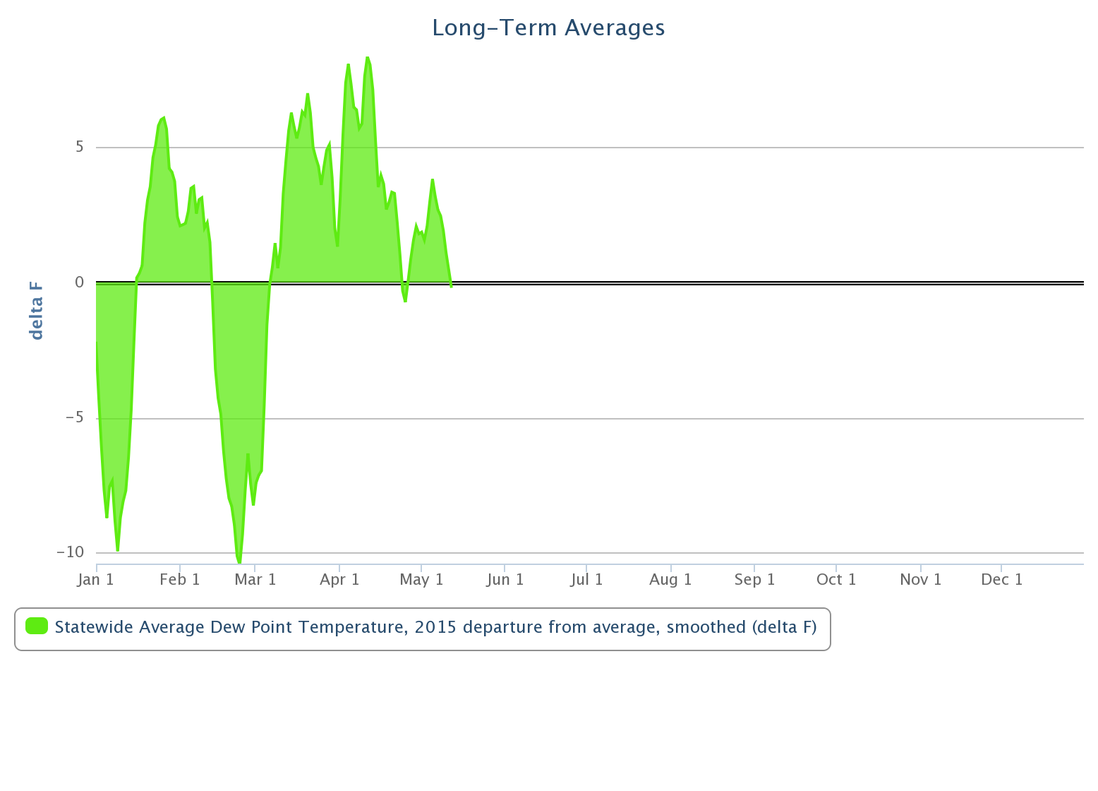
And lots of it. Check out the statewide departure from average dewpoints for
2015 thus far from the Oklahoma Mesonet. This is the departure from the 2000-
2014 data.
I don't know what's going to happen Saturday, other than me getting up early
to eat my Frankenberry cereal and watch Scooby Doo, The Superfriends, etc. Sorry,
flash forward 30 years. But as we've seen in the last week or two, morning storms
and lots of clouds could gum up the works and we'll just see rain. Or, it could
be a doozy of a May severe weather day. So stay alert, and for goodness sakes,
stay off the golf courses. Even if you could theoretically break the course
record.
Gary McManus
State Climatologist
Oklahoma Mesonet
Oklahoma Climatological Survey
(405) 325-2253
gmcmanus@mesonet.org
May 13 in Mesonet History
| Record | Value | Station | Year |
|---|---|---|---|
| Maximum Temperature | 99°F | GRA2 | 2022 |
| Minimum Temperature | 30°F | BOIS | 2000 |
| Maximum Rainfall | 4.41″ | JAYX | 2004 |
Mesonet records begin in 1994.
Search by Date
If you're a bit off, don't worry, because just like horseshoes, “almost” counts on the Ticker website!