MESONET TICKER ... MESONET TICKER ... MESONET TICKER ... MESONET TICKER ...
April 29, 2024 April 29, 2024 April 29, 2024 April 29, 2024
Wednesday
https://ticker.mesonet.org/archive/20240429/OK_swody3_PROB.png
Well that'll just about cover tornadoes for 2024 after the two dozen or so that
dropped on the state Saturday into early Sunday, injuring 50 or more and with at
least 4 confirmed fatalities. As bad as it looks, this map is an under-
representation of what actually hit the state! And that's gonna put us somewhere
over 30 tornadoes for the year, probably, which is already well above the
January-April average of 17 with May staring us in the face. We've seen above
normal tornado years 11 out of the last 14, including our all-time high of 149
back in 2019, so here's hoping we keep that number at 11!
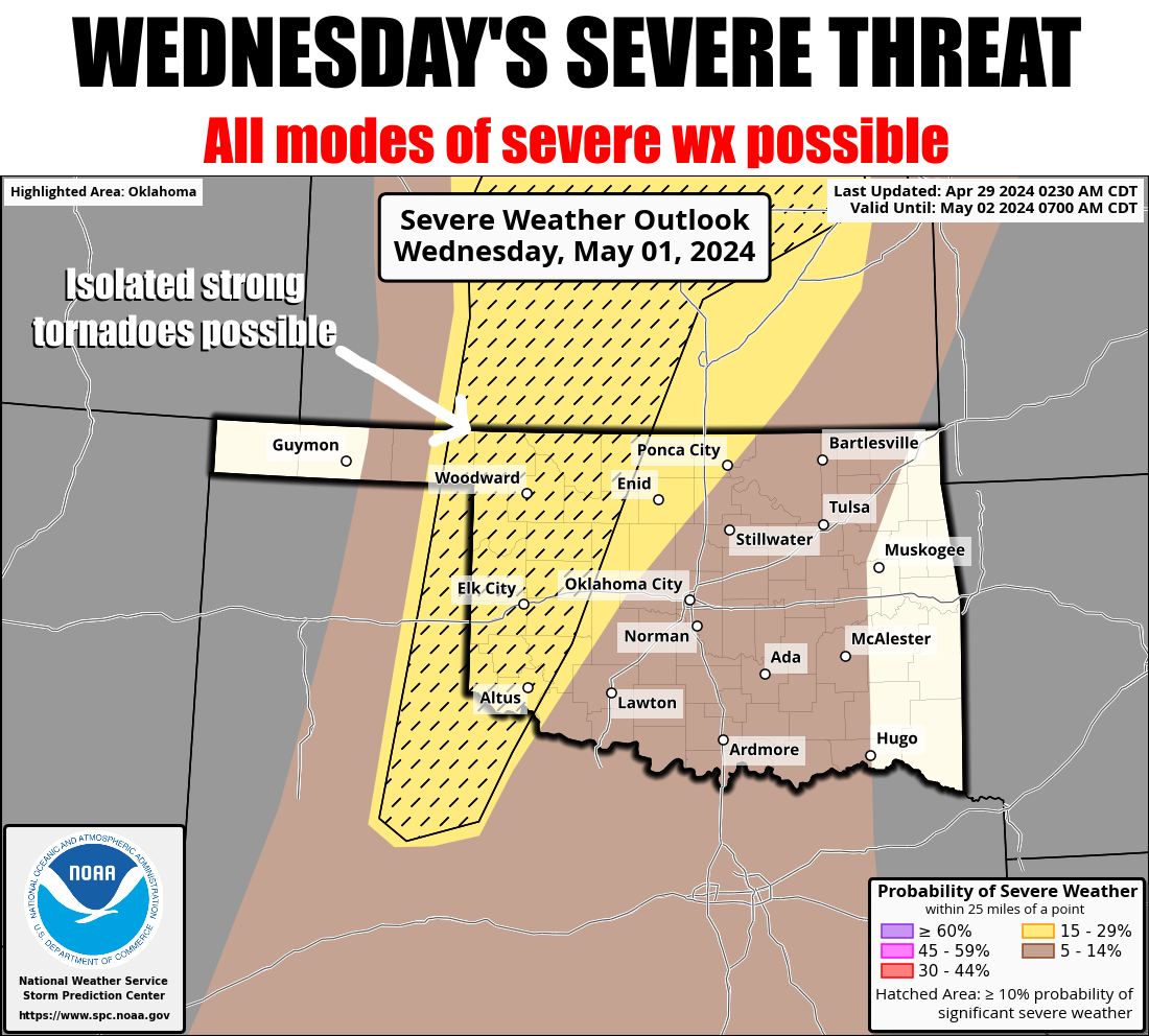
As you can see above, the chances for big storms steps up again starting on
Wednesday, although there will be other chances for severe weather today and
Tuesday...just not quite as hazardous as Wednesday. But then again, Wednesday
doesn't look nearly as hazardous as Saturday did.
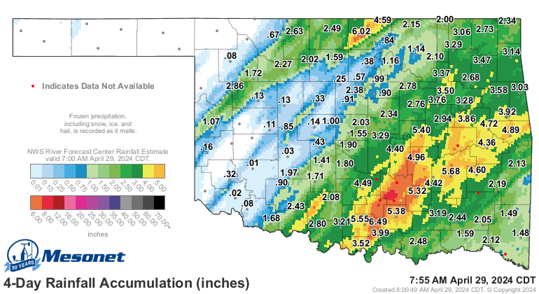
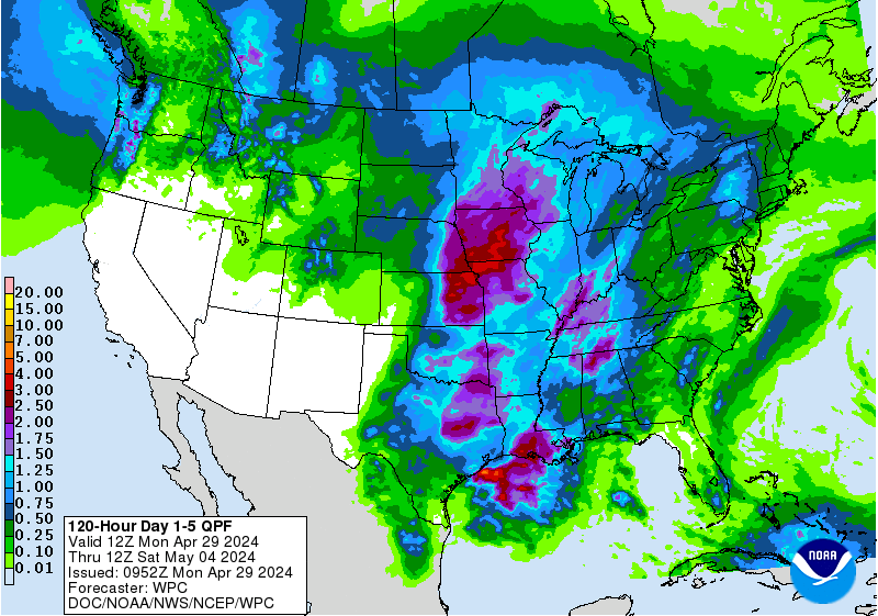
Hey, we'll take small victories where we can. Such as...what about all that rain?
It's an unfortunate aspect of moisture received in Oklahoma during spring that it
comes with all that bad stuff, but at least some folks saw their flash drought
halted in its tracks, and obviously, some had way too much.
https://ticker.mesonet.org/archive/20240429/4day-rain-totals.png
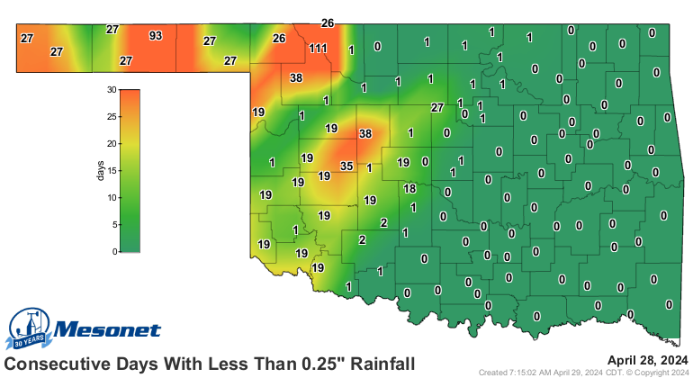
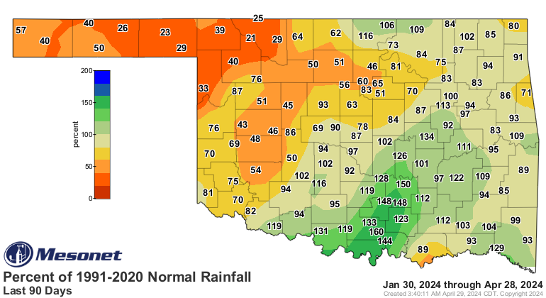
We still have significant deficits, however, at that 90-day time frame (as well
as 30 and 60), which is the span we've been basing much of our flash drought
areas on.
https://ticker.mesonet.org/archive/20240429/mesonet.rainfall.quarterinch.png
https://ticker.mesonet.org/archive/20240429/del90day_rain.current.png
https://ticker.mesonet.org/archive/20240429/pct90day_rain.current.png
With the stormy weather this week, a chance for more moisture arises (along
with some of that bad stuff, possibly).
https://ticker.mesonet.org/archive/20240429/5day-rain-forecast.gif
We'll take all we can get. Well, much like Texas Roadhouse's rolls and
cinnamon butter...within reason!
Mmmmmmm....Texas Roadhouse rollssssss with cinnamonnnnnnnn butterrrrrrr.
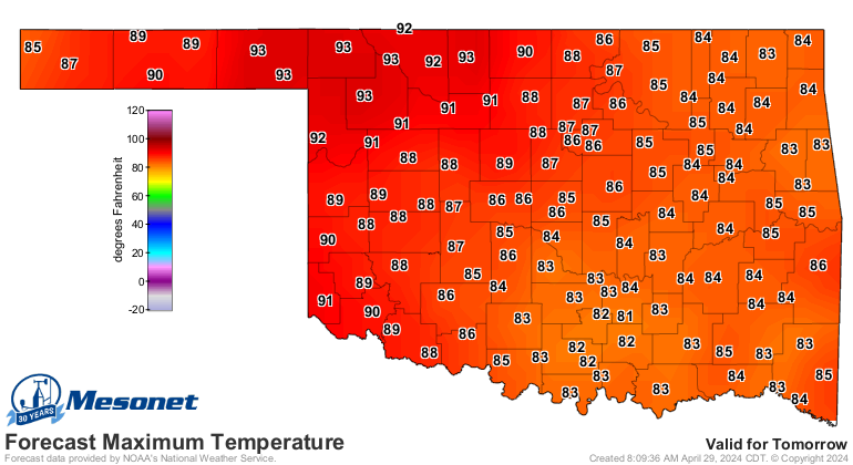
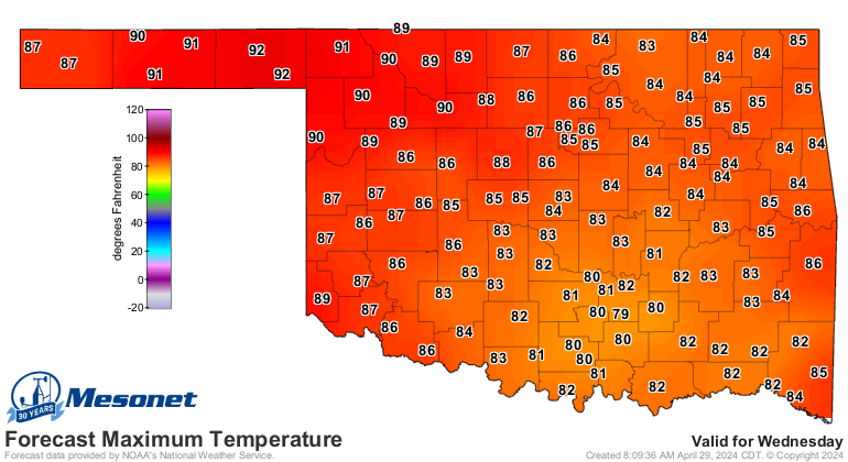
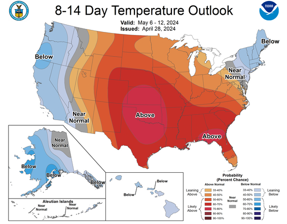
The heat returns tomorrow and Wednesday, which will both fuel storms AND flash
drought, and more heat is on the way down the road as well.
https://ticker.mesonet.org/archive/20240429/tuesday-highs.png
https://ticker.mesonet.org/archive/20240429/wednesday-highs.png
https://ticker.mesonet.org/archive/20240429/may6-12-temp-outlook.png
So another week to stay weather aware, especially Wednesday.
Gary McManus
State Climatologist
Oklahoma Mesonet
Oklahoma Climatological Survey
gmcmanus@mesonet.org
==================================================
The OCS/Mesonet Ticker
https://ticker.mesonet.org/
To subscribe or unsubscribe from the Ticker
or for questions about the Ticker or its content
Phone or Email the Ticker Manager at OCS
Phone: 405-325-2253 Email: ticker@mesonet.org
---------------------------------------------------
-C- Copyright 2024 Oklahoma Climatological Survey
===================================================
|


 Tweet
Tweet