Ticker for April 19, 2021
MESONET TICKER ... MESONET TICKER ... MESONET TICKER ... MESONET TICKER ...
April 19, 2021 April 19, 2021 April 19, 2021 April 19, 2021
Oh freeze this!
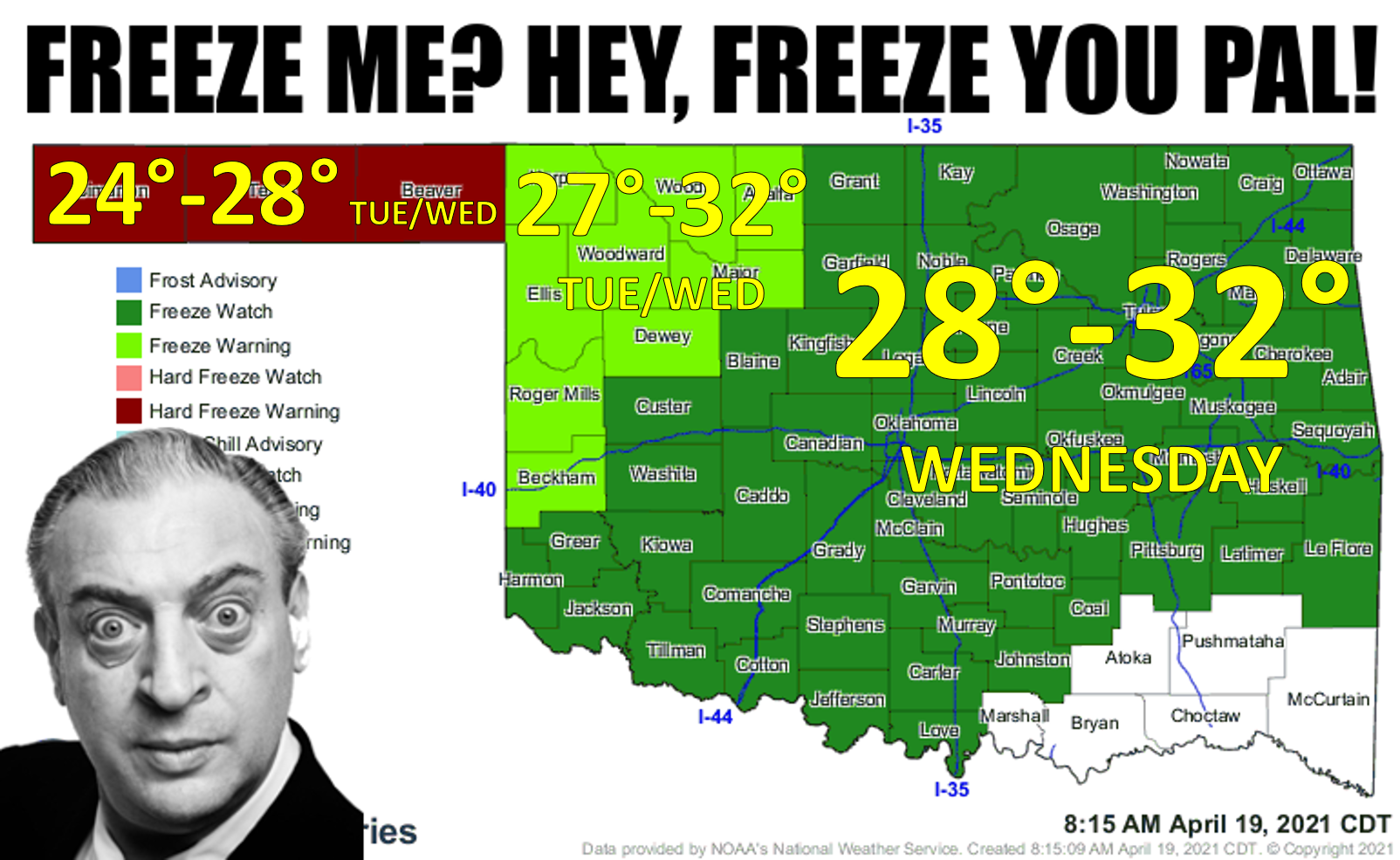
Yeah, that's gonna sting. Like I said last week, if Mother Nature keeps fooling
around with these much below normal temps, we're going to end up with a freeze.
Sure enough, here we are. We're looking at temperatures as low as 24 degrees
across the Panhandle Tuesday and Wednesday mornings, as low as 27 degrees in
the northwest both mornings, and as low as 28 degrees for much of the rest of the
state Wedesday morning (it looks so cold, I forgot to put that first "n" in
Wednesday!).
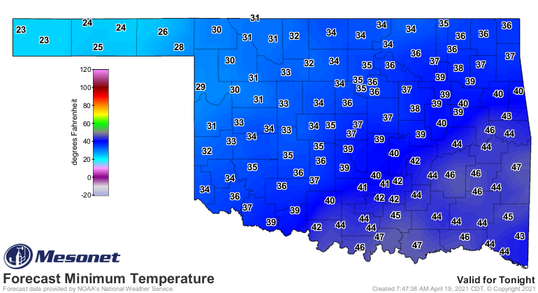
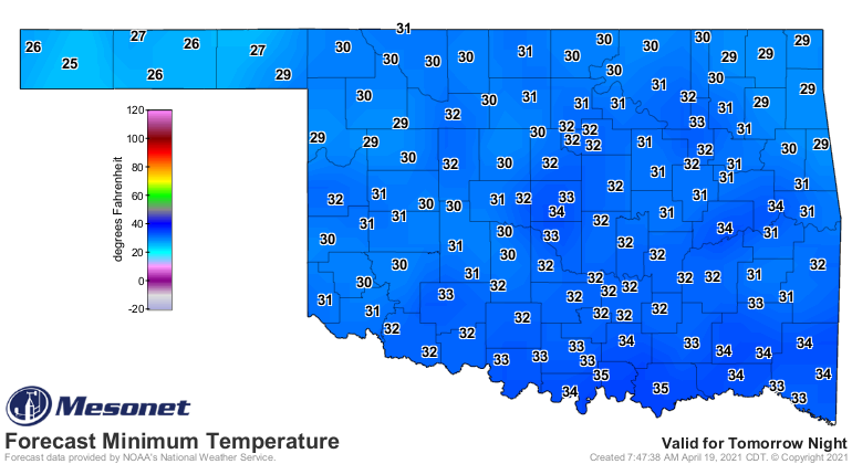
Now the secret is that the lows will probably end up a bit lower than that,
especially in those low-lying areas that are prone to freezing. One area to watch
is always far SW OK, which can bottom out for a few minutes to an hour about 4
degrees cooler than you expect. We see that a lot in the Mesonet data...a
site will be hovering right above freezing, then right at that time in the
morning when the air goes still and the skies are clear, BOOM (scared ya, didn't
I?) you're at 30 degrees for 15 minutes. You check the low temperature map
and you see you hit 30 and you get scared for all your tender plants. Well, 15
minutes below 32 degrees isn't going to do much damage. Except to Ticker writers.
In fact, 5 minutes below 60 degrees and we're pretty much done for the day.
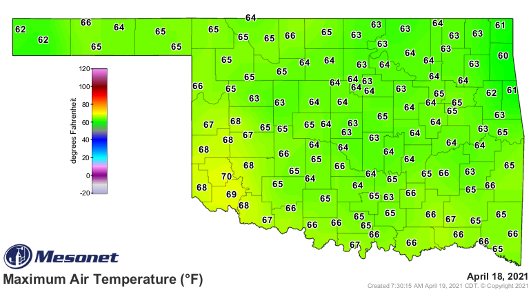
This all comes after a week of being cold already. We did have a nice day
yesterday, although it was still about 5-10 degrees below normal. It just FELT
nice because the sun was out. Amazing what that old bag of gas can do for ya.
But the cold is the big story, at least until Friday when we get a decent chance
of storms and warm weather again. There will be a chance of some snow in the
NW and then the north over the next couple of nights. So watch out for those
flakes (you know who you are). Snowflakes, too.
There will be a danger to those tender plants, animals, and state climatologists,
so be sure and bring them inside if you can. We are right at that point where
we shouldn't expect a freeze, but as is often the case with Oklahoma weather...
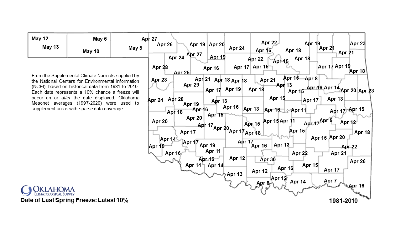
it likes to keep you guessing. For most of the state, we're almost past that
point where there's a 90% chance you WON'T see a freeze this late in the spring,
so that is out the window just a little bit.
Gary McManus
State Climatologist
Oklahoma Mesonet
Oklahoma Climatological Survey
(405) 325-2253
gmcmanus@mesonet.org
April 19 in Mesonet History
| Record | Value | Station | Year |
|---|---|---|---|
| Maximum Temperature | 95°F | HOLL | 2023 |
| Minimum Temperature | 21°F | BOIS | 2013 |
| Maximum Rainfall | 2.67″ | SLAP | 2004 |
Mesonet records begin in 1994.
Search by Date
If you're a bit off, don't worry, because just like horseshoes, “almost” counts on the Ticker website!