MESONET TICKER ... MESONET TICKER ... MESONET TICKER ... MESONET TICKER ...
April 14, 2015 April 14, 2015 April 14, 2015 April 14, 2015
What a difference 80 years makes
Fickleness, thy name is Ticker. Okay, I jest. I'm ready for 40 days and 40 nights
(although I'd prefer nights, and the gentle-type of rains that won't cause
flooding). Have I covered all my bases there? These are probably the best general
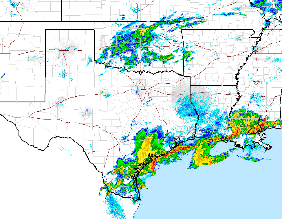
statewide rains we've seen in the state since last June and/or July, and it
couldn't have come at a better time, with drought beginning to intensify rapidly
with the warm season starting to ramp up. This batch of moisture is centered
over Oklahoma, too, although there are some heavier patches of rain down along
the Gulf Coast.
http://ticker.mesonet.org/archive/20150414/current-radar.png
And our rain chances don't end today, either. It would appear that we'll see
more good rains in a couple of days and again in a couple of days after that.
http://ticker.mesonet.org/archive/20150414/nws-norman-7dayforecast.jpg
http://ticker.mesonet.org/archive/20150414/nws-tulsa.png
The forecast amounts look quite lovely as well.
http://ticker.mesonet.org/archive/20150414/7day-rain-forecast.gif
Just how much has it rained this April thus far? Well, some parts of western
Oklahoma have received more in just the first 14 days of April than they did
from Jan. 1-May 20 of last year. In fact, there are six Mesonet stations that
did just that. Here are the maps for the two periods and a listing of the
winning stations.
http://ticker.mesonet.org/archive/20150414/jan1-may20-2014-totals.png
http://ticker.mesonet.org/archive/20150414/apr1-14-2015-totals.png
-***-
Site Apr. 1-14, 2015 Jan. 1-May 20, 2014 Difference
Cheyenne 4.37" 2.51" +1.86"
Erick 3.04" 2.00" +1.04"
Bessie 2.41" 1.78" +0.63"
Seiling 1.94" 1.60" +0.34"
Putnam 1.97" 1.85" +0.12"
Watonga 2.13" 2.09" +0.04"
-****-
In addition, there are 14 other sites that received within an inch Apr. 1-14
this year vs. the first 139 days of last year. I pick those dates from last year
because as you would (should!) remember, we had our 1st or 2nd driest first
5 month of the year in 2014 (cheating, not counting those last 10 days of May).
And this April, with a statewide average of 1.57", is already close to last
year's April total for the entire month (1.69"). I'm betting we'll eclipse that
either today or later this week.
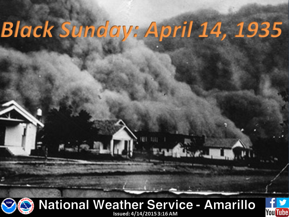
Certainly a much different experience than what we saw 80 years ago out in the
High Plains. On this date in 1935, the Grandaddy of all the dust storms during
the Dirty Thirties struck the Oklahoma and Texas Panhandles, as remembered by
the Amarillo NWS office.
http://ticker.mesonet.org/archive/20150414/nws-amarillo-Black-Sunday.jpg
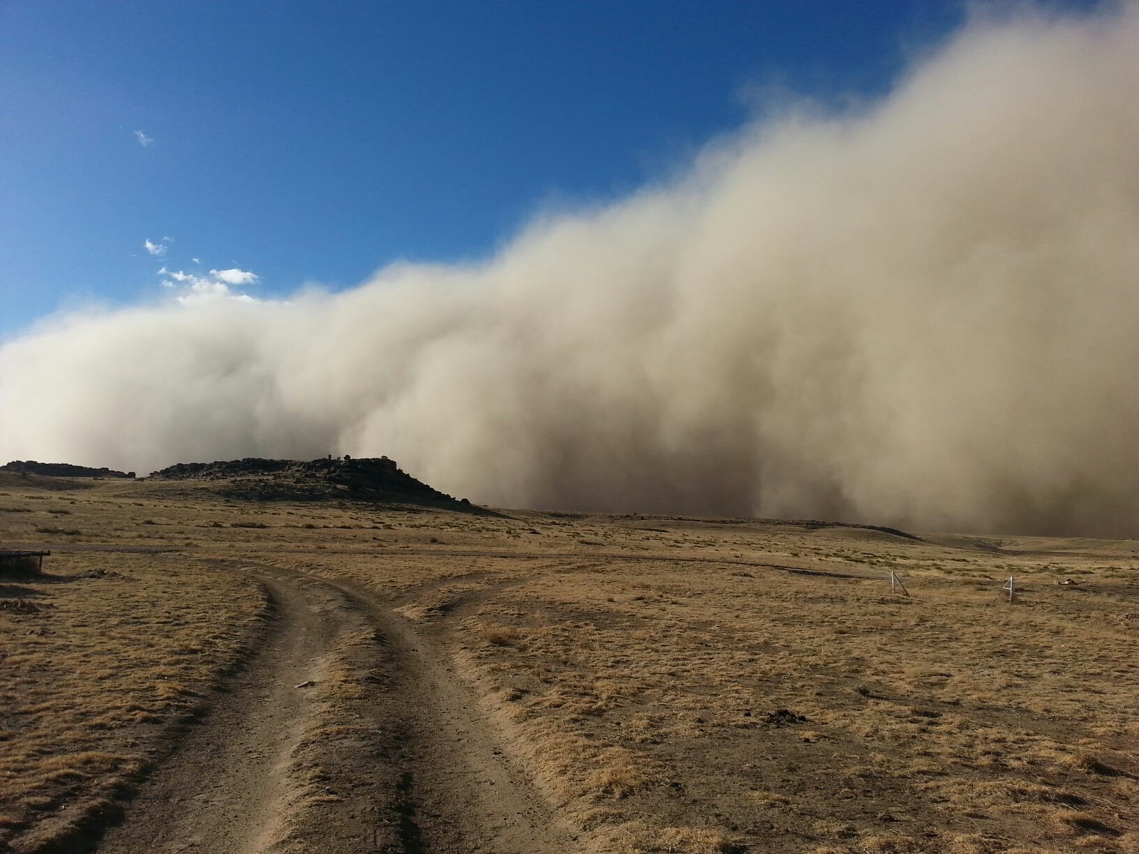
Heck, 80 years? What a difference about 15 months makes, as we remember the
big dusters that made frequent returns to Cimarron County last year such as
this one from January.
http://ticker.mesonet.org/archive/20140114/17.jpg
I hope we don't see many of those in the coming months, but if you look at the
rainfall maps, the Panhandle hasn't gotten enough to settle the dust just yet.
It's their turn, I think.
Gary McManus
State Climatologist
Oklahoma Mesonet
Oklahoma Climatological Survey
(405) 325-2253
gmcmanus@mesonet.org
==================================================
The OCS/Mesonet Ticker
https://ticker.mesonet.org/
To subscribe or unsubscribe from the Ticker
or for questions about the Ticker or its content
Phone or Email the Ticker Manager at OCS
Phone: 405-325-2253 Email: ticker@mesonet.org
---------------------------------------------------
-C- Copyright 2024 Oklahoma Climatological Survey
===================================================
|


 Tweet
Tweet