MESONET TICKER ... MESONET TICKER ... MESONET TICKER ... MESONET TICKER ...
March 30, 2016 March 30, 2016 March 30, 2016 March 30, 2016
Another
Oh great, it's another one of those "low but not zero" days with the true severe
risk predicated on the "if this happens, then this might happen, but if this
occurs, this is less likely" scenario. At any rate, the risk of severe weather
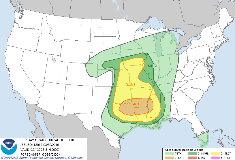
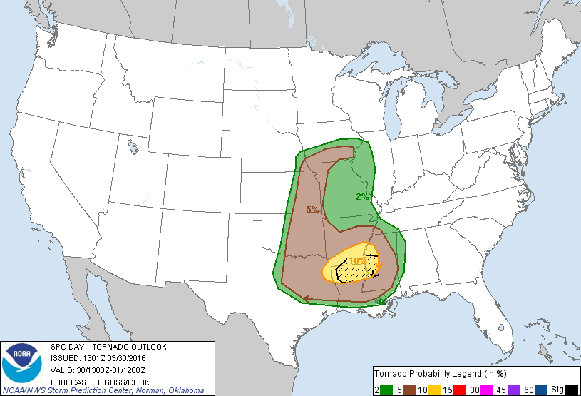
DOES exist in Oklahoma today with the Storm Prediction Center (SPC to their friends)
labeling most of the western 2/3rds of the state in the "slight" category, but
the far SE corner (a bit over into SC OK as well) in the "enhanced" category.
http://ticker.mesonet.org/archive/20160330/day1otlk_1300.gif
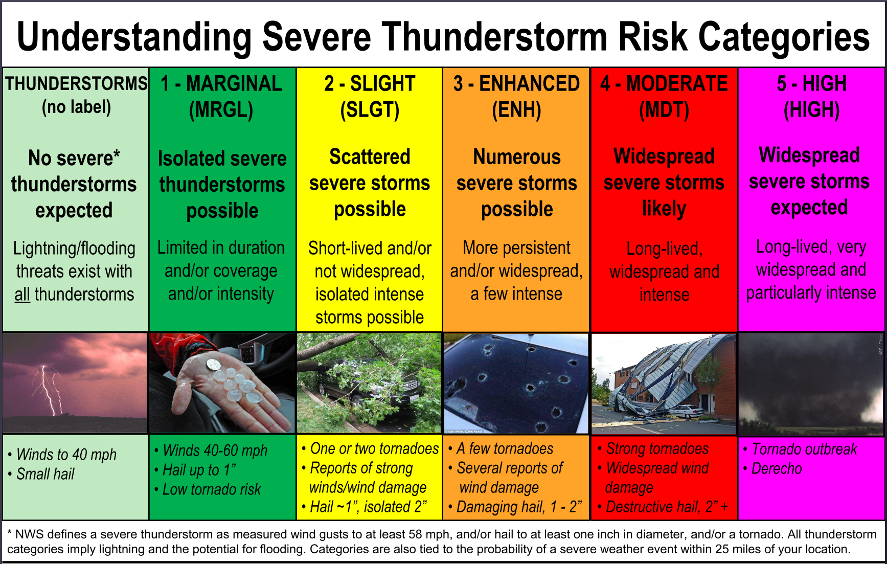
Sometimes folks see that "enhanced" category and get really skeered (Okies, help
the non-Okies), but it's nothing to panic about. Check out the explanation of the
risk categories from SPC for more information.
http://ticker.mesonet.org/archive/20160330/understanding_categories.png
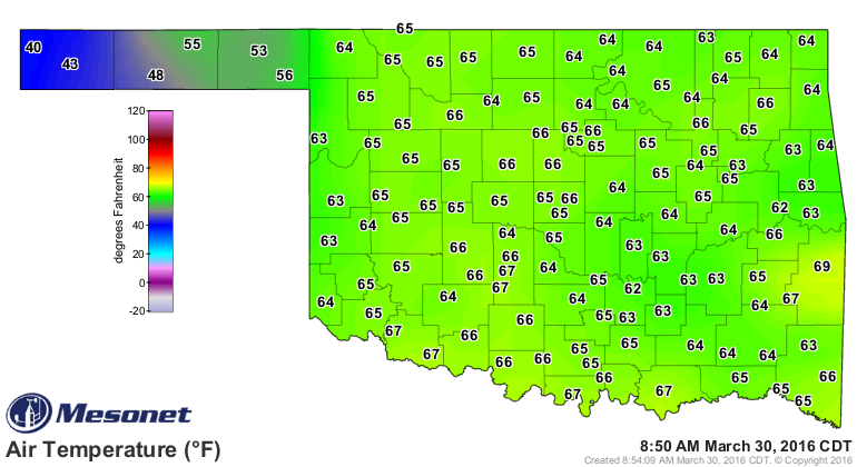
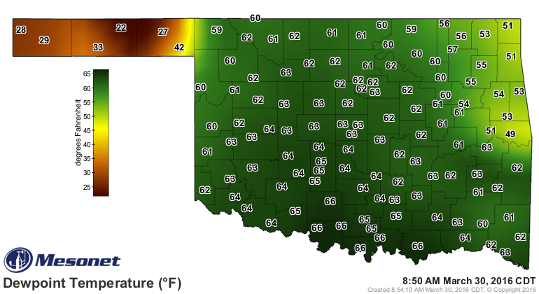
We have a cold front down from the Northern Plains through the Panhandles of
Oklahoma and that state to the south, and a dryline out ahead of that. Both of
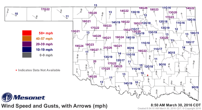
these are already showing up on the Mesonet on the air temps, winds and
dewpoint maps.
http://ticker.mesonet.org/archive/20160330/current-temps.png
http://ticker.mesonet.org/archive/20160330/current-dewpoints.png
http://ticker.mesonet.org/archive/20160330/current.gustarrows.gif
Those surface features along with the parent upper-level low pressure system
could provide the focus for thunderstorms later today, some of which could be
severe. At this time, the tornado threat remains low across Oklahoma, with
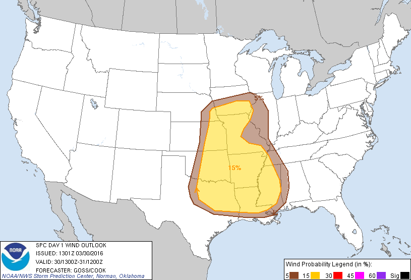
a more dangerous area to our SE. Wind will be possible of course, but that
threat also does not appear overwhelming at this time. It would appear that SPC
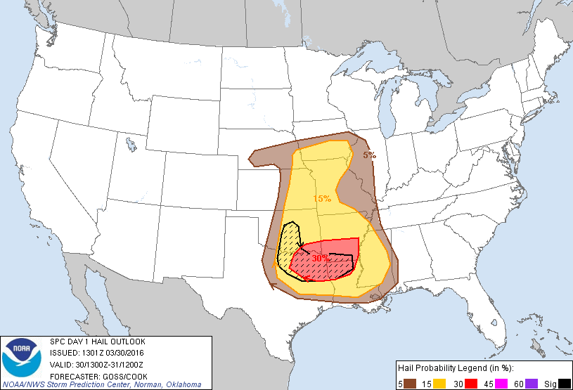
sees hail to be the surest bet across SE OK, but also a more limited threat
across the western 2/3rds of the state. And if severe hail does occur, it could
be a bit larger up into central OK (check for the hatched area on the hail
probability map below).
http://ticker.mesonet.org/archive/20160330/day1probotlk_1300_torn.gif
http://ticker.mesonet.org/archive/20160330/day1probotlk_1300_wind.gif
http://ticker.mesonet.org/archive/20160330/day1probotlk_1300_hail.gif
The clouds and the rain occurring now will help to inhibit convection, but if
we do get clearing along and behind the dryline, there will be a possibility of
a few isolated storms, a few of those storms could become supercells, and at that
point all modes of severe weather become possibly...yes, even a tornado or two,
but especially the aforementioned hail.
THIS IS A TYPICAL SPRING STORM SYSTEM SETUP FOR OKLAHOMA! It's easily handled by
remaining weather aware from your favorite-yet-trusted source. This does not
appear to be a major severe weather outbreak day AT THIS TIME. Part of the
"remaining weather aware" part comes with understanding it is an evolving
situation (either better or worse) and to keep checking back with your sources.
Now outside of the storm area, since we will have a dryline moving eastward
across the state and strong SW winds behind said dryline, along with dry air
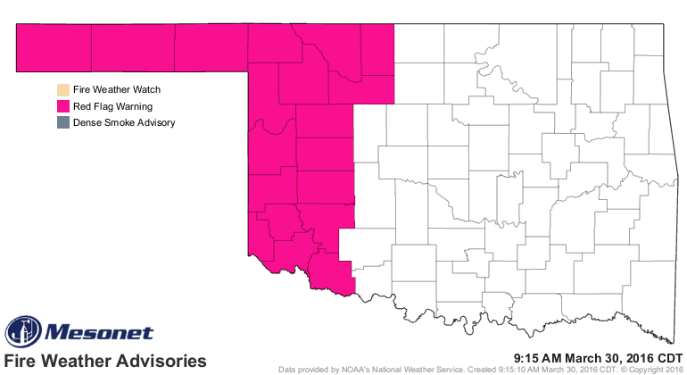
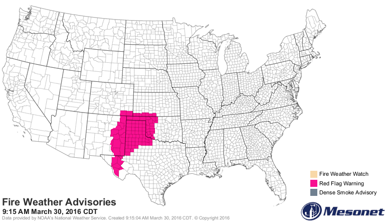
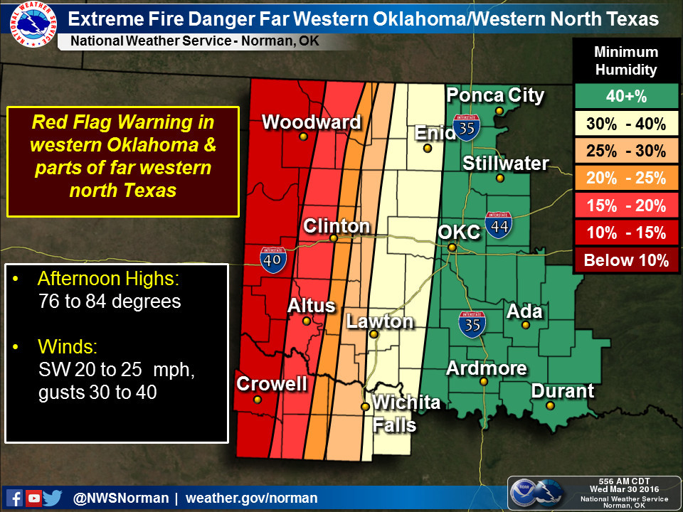
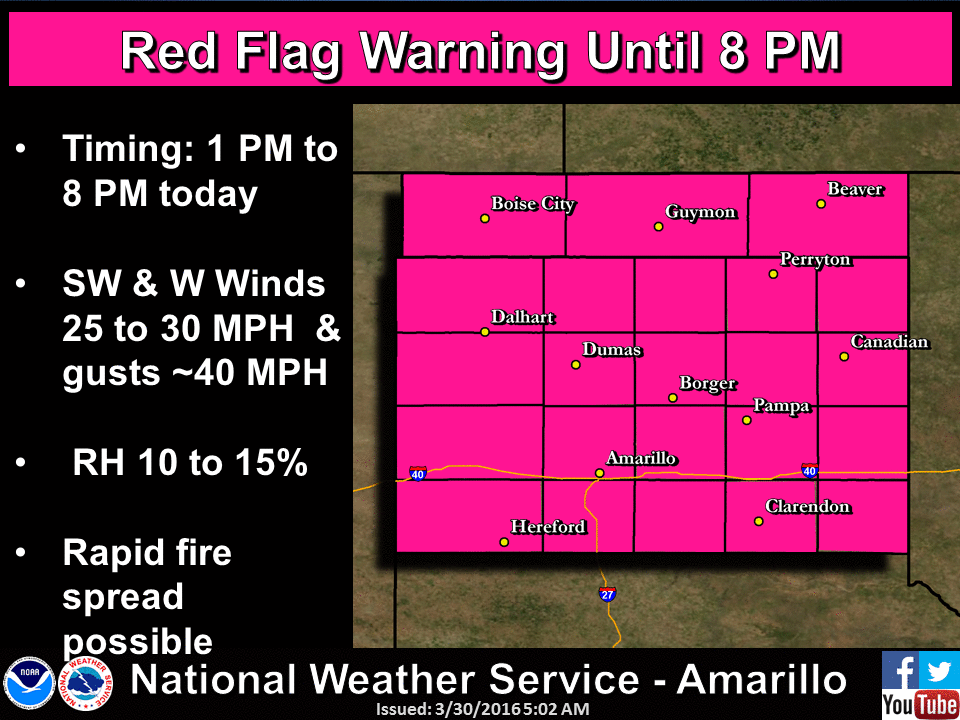
(it's called a dryline for a reason), that will once again result in high fire
danger across western Oklahoma. In fact, there is already a Red Flag Warning
across the western quarter of the state.
http://ticker.mesonet.org/archive/20160330/latest.oklahoma.fire.gif
http://ticker.mesonet.org/archive/20160330/latest.fire.gif
http://ticker.mesonet.org/archive/20160330/nws-norman-fire.jpg
http://ticker.mesonet.org/archive/20160330/nws-amarillo-fire.gif
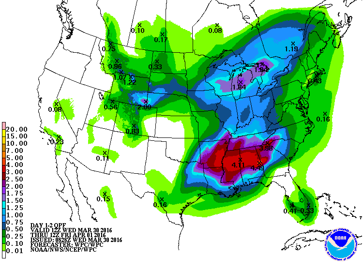
I guess the good news from today is there is a chance of rain. The bad news...it
ain't where they need it the most, up across NW OK.
http://ticker.mesonet.org/archive/20160330/2day-rainfall-forecast.gif
The bad news, at least for ag producers across much of the state, is that once
this storm has passed, that's it for awhile. Back to elevated fire danger days,
but lots of sunshine and springtime temps otherwise.
It's springtime in Oklahoma. Serenity now! Panic later.
Gary McManus
State Climatologist
Oklahoma Mesonet
Oklahoma Climatological Survey
(405) 325-2253
gmcmanus@mesonet.org
==================================================
The OCS/Mesonet Ticker
https://ticker.mesonet.org/
To subscribe or unsubscribe from the Ticker
or for questions about the Ticker or its content
Phone or Email the Ticker Manager at OCS
Phone: 405-325-2253 Email: ticker@mesonet.org
---------------------------------------------------
-C- Copyright 2024 Oklahoma Climatological Survey
===================================================
|


 Tweet
Tweet