MESONET TICKER ... MESONET TICKER ... MESONET TICKER ... MESONET TICKER ...
March 29, 2024 March 29, 2024 March 29, 2024 March 29, 2024
Monday Monday
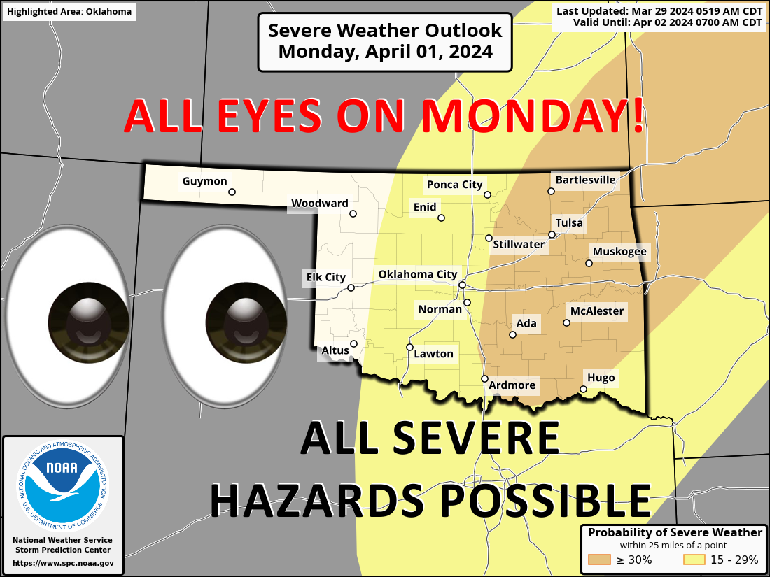
https://ticker.mesonet.org/archive/20240329/OK_swody4_PROB.png
Hey, just a quick note about Monday...it comes right after Sunday but right before
Tuesday. But we're not here to talk about calendar basics (and Frank Burnsly, I'm
a bit shocked you didn't know that about Monday), we're here to talk about the
weather and climate of Oklahoma. And other than some wind and a bit of rain, the
big news is possible severe weather on Monday. Looks like we'll see a classic
springtime setup for Oklahoma, with a front and dryline, moisture return from
the Gulf, and then it's shake, rattle and roll. Oxford comma notwithstanding.
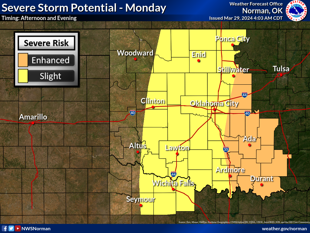
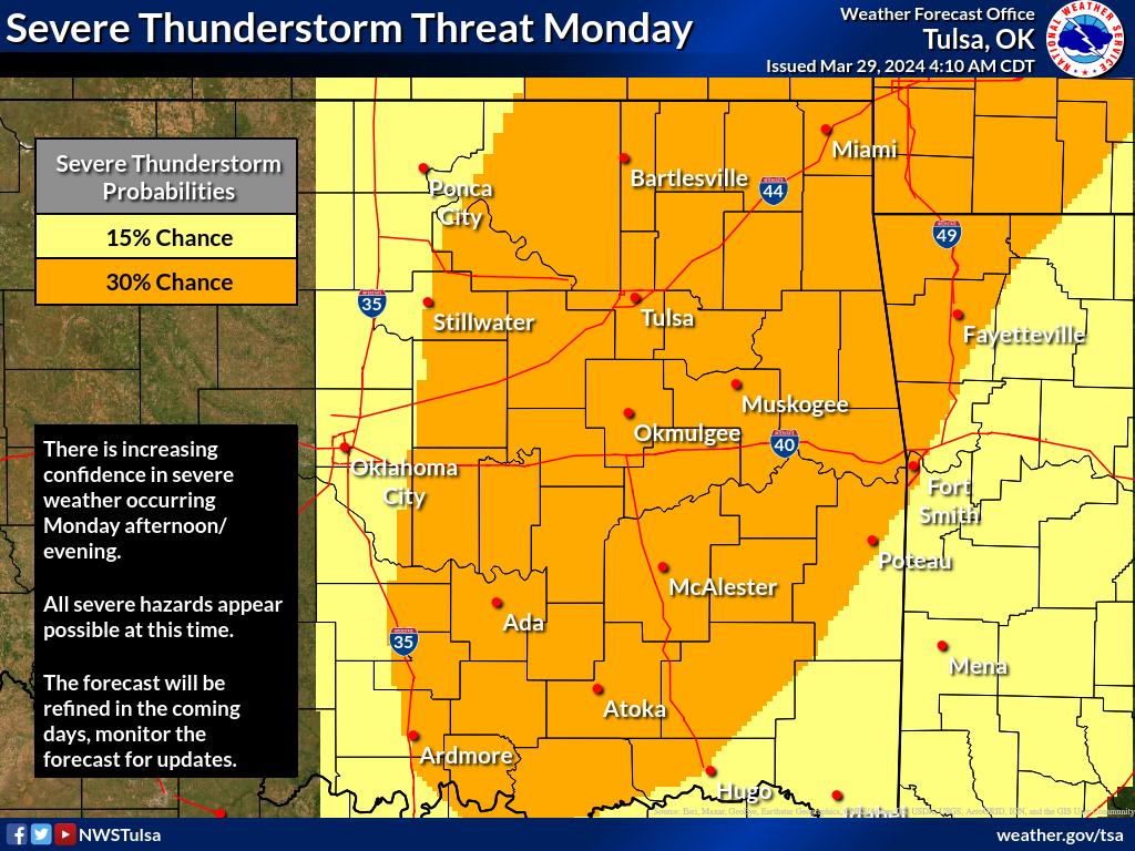
Here's what our local NWS offices say about Monday, at least graphically, and
what the Storm Prediction Center thinks, in text form.
https://ticker.mesonet.org/archive/20240329/nws-norman-monday.png
https://ticker.mesonet.org/archive/20240329/nws-tulsa-monday.png
"As the nose of the jet moves over the moist and unstable airmass
during the afternoon and evening, widespread severe weather is
expected to occur. Strong deep-layer shear and steep lapse rates
are forecast to be favorable for a large-hail threat with supercells
across parts of Texas, Oklahoma and Kansas eastward into the lower
Missouri Valley. Tornadoes and wind damage will also be possible,
especially as the low-level jet strengthens and an MCS organizes
across the region during the evening."
As with most forecasts 3-4 days out, it will change a bit here and there, shift
and whatnot. So stay tuned over the weekend to you favorite weather provider.
As for the wind, today it will be one notch below "fierce." I've spent my entire
life about 6 notches below fierce, so it's enough to bother me fiercely with
gusts of around 40 mph possible.
https://ticker.mesonet.org/archive/20240329/ndfd_24hgust.us_state_ok.png
Still looking for rain across western OK, where flash drought is taking shape,
but little is to be found.
https://ticker.mesonet.org/archive/20240329/5day-rain-forecast.gif
Other than that, spring is sprung. Enjoy those temperatures...even Tuesday's!
https://ticker.mesonet.org/archive/20240329/nws-norman-7day-temps.png
Our freezing weather is getting a bit more scarce. Check out this probability
map from our Canadian forecast friends showing the odds of those temps at or
below 32 degrees (Fahrenheit!) through April 12.
https://ticker.mesonet.org/archive/20240329/prob-freeze-weather.gif
Speaking of wind...who's having Taco Bell today???
Gary McManus
State Climatologist
Oklahoma Mesonet
Oklahoma Climatological Survey
gmcmanus@mesonet.org
==================================================
The OCS/Mesonet Ticker
https://ticker.mesonet.org/
To subscribe or unsubscribe from the Ticker
or for questions about the Ticker or its content
Phone or Email the Ticker Manager at OCS
Phone: 405-325-2253 Email: ticker@mesonet.org
---------------------------------------------------
-C- Copyright 2024 Oklahoma Climatological Survey
===================================================
|


 Tweet
Tweet